

|
|
WetlandUpdate February 2021World Wetlands Day 2021 and Ramsar 50th Anniversary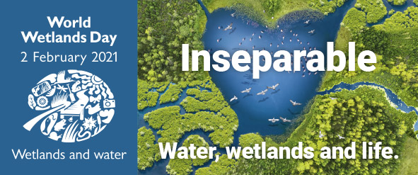
World Wetlands Day is celebrated each year on 2 February. This year’s theme is “Wetlands and Water”, with ‘Water, wetlands and life – inseparable’, highlighting the vital ecological role of wetlands.
This year’s celebrations are special, as they mark the 50th anniversary of the signing of the Convention on Wetlands of International Importance (Ramsar Convention) in Ramsar, Iran, on 2 February 1971. The Ramsar Convention Secretariat has developed a number of downloadable World Wetlands Day materials for 2021, including posters, a power point presentation, fact sheets and logos. These materials can be found on the World Wetlands Day 2021 website. Wetlands Australia is published each year in February and the 2021 edition, that focus on engagement, education or research activities undertaken at Australian Ramsar sites or local wetlands - including Queensland. The Ramsar Convention aims to halt the worldwide loss of wetlands and conserve those that remain. You can find out more about Ramsar in Queensland here. The Queensland and Australian Government will be celebrating the 50th anniversary of the Ramsar Convention by promoting the conservation and wise use of wetlands and raising awareness of their benefits. For more information see the WetlandInfo events page. South-East Gulf of Carpentaria: Leichhardt River to Gore Point (Wernadinga coast) Flyway Network Site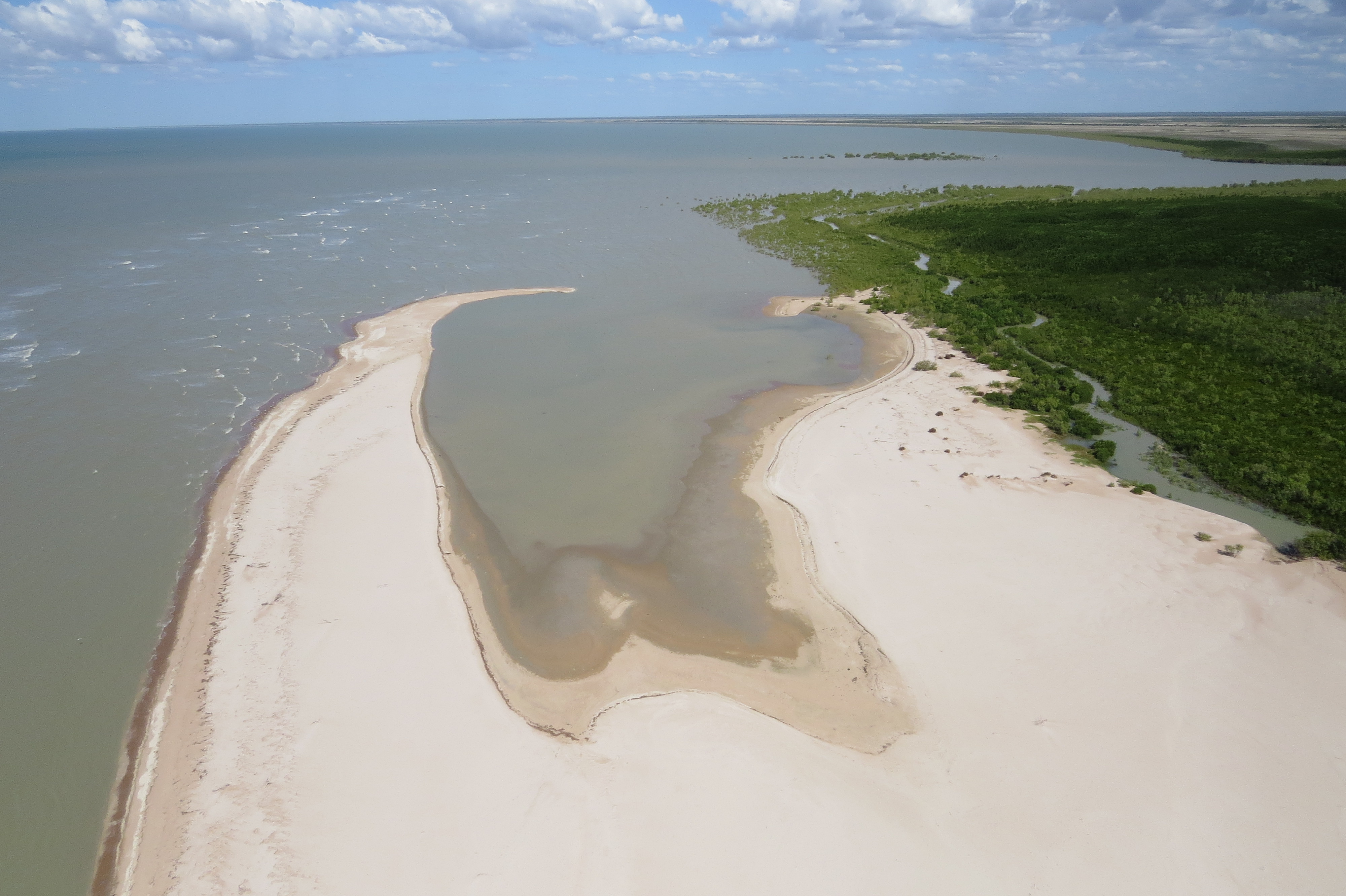 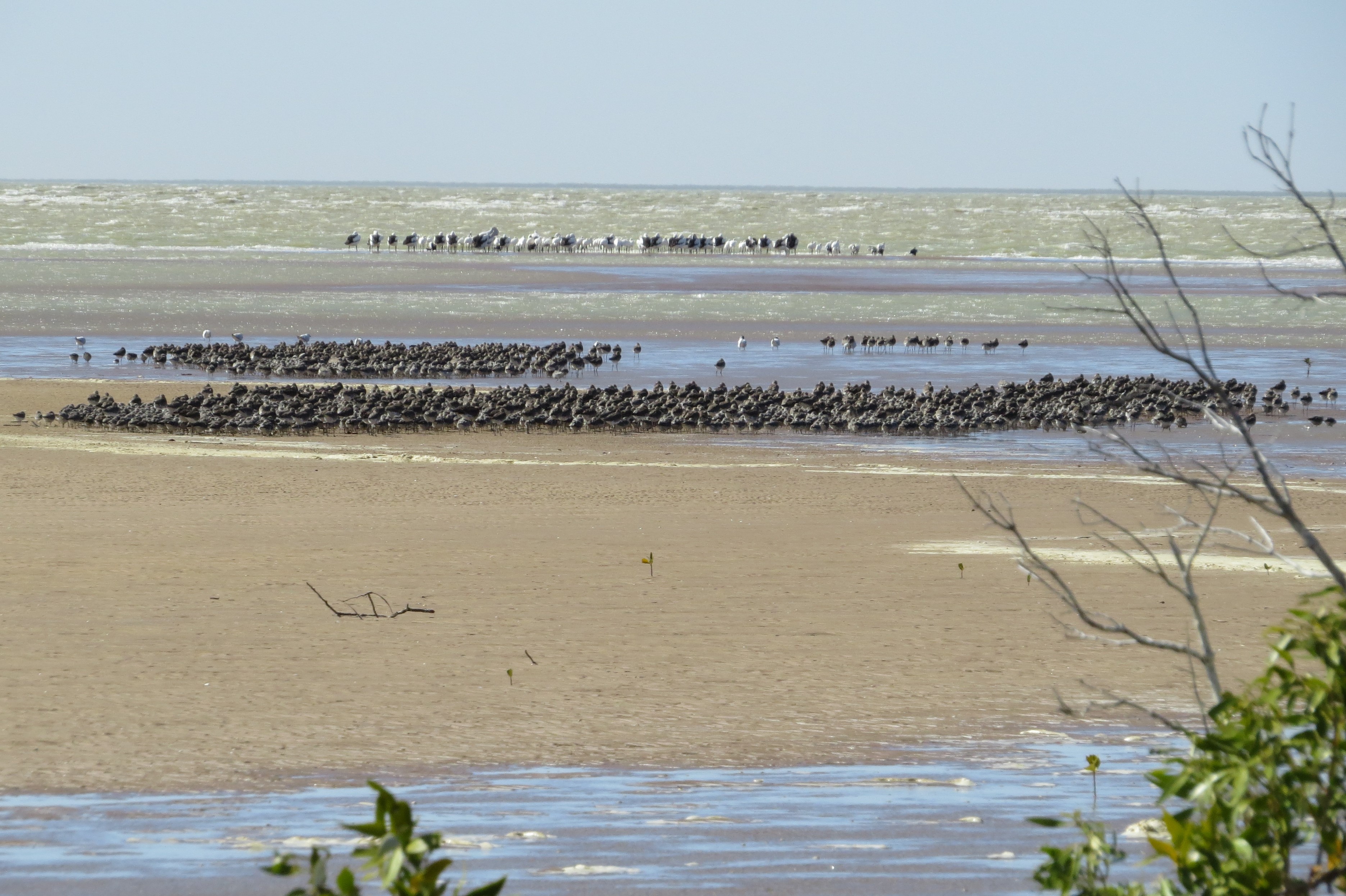 A property in the south-east Gulf of Carpentaria has been recognised as an important migratory shorebird site on the East Asian—Australasian Flyway, with formal recognition made on 16 December 2020. The Gkuthaarn and Kukatj People, represented by Carpentaria Land Council Aboriginal Corporation together with the leaseholder of the site, AJM Pastoral, proposed the site in the South-East Gulf of Carpentaria from Leichhardt River to Gore Point ‘Wernadinga Coast’ to be included in the Flyway Network. The site is located on the traditional country of the Kukatj People and incorporates approximately 7,080 hectares of wetland including land of the Wernadinga pastoral lease, intertidal areas and marine waters. It supports up to 13,000 migratory shorebirds of at least 22 species, including seven Australian threatened species, as well as internationally important numbers of species such as great knot, red knot and greater sand-plover. The site comprises an important section of the larger South-East Gulf of Carpentaria shorebird area and is the third network site recognised in the Gulf. Litter and Illegal Dumping Management Framework
Littering and illegal dumping occur in all regions and sectors of Queensland and affect all our communities. WetlandInfo hosts the Queensland Government's Litter and Illegal Dumping Management Framework (LIDMF), which aims to help land managers identify actions they can take to reduce and manage waste pollution. The LIDMF is a holistic biophysical management framework that examines the many sources of waste pollution, the pathways that move waste through the environment and the impacts of waste on human health, animals and the environment. Digital Earth Australia (DEA) Wetlands Insight Tool (QLD)
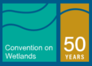
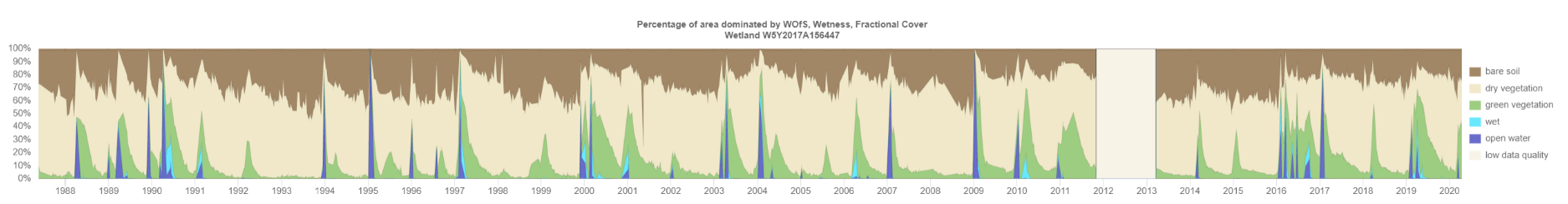
The Queensland Government has worked with the Australian Government (Geoscience Australia) to develop the DEA Wetlands Insight Tool (QLD). The Wetlands Insight data display on WetlandMaps (Beta) summarises how the amount of open water, wet, green vegetation, dry vegetation and bare soil varies over time within each wetland. This information provides wetland managers and scientists with a historical baseline of wetland dynamics based on Landsat data starting from 1987. Investigating Coombabah Lake and Creek, Gold Coast A project by the Department of Environment and Science with input from the City of the Gold Coast and other key partners is documenting the state of the wetland system. Information gained from tidal, sediment, vegetation and other studies will provide insight into how the system may change in response to increasing urbanisation and a changing climate. The information from this study will contribute to management solutions and climate adaptation measures to conserve the wetland system. UpdatesUpdated layers on WetlandMaps and WetlandSummary
The Assessment Toolbox
Wetland projects search toolAdditional projects have been added to the wetland projects search tool including a number from Natural Disaster Relief and Recovery Arrangements.
Additional links
WetlandUpdateThe WetlandUpdate is a regular bulletin sent to subscribers to provide you with the latest WetlandInfo resources and tools, as well as case studies, video information and new project fact sheets. WetlandInfo feedback and improvementsContact us via email for feedback, information or questions about wetlands. WetlandInfo feature species - Australian Pied Oystercatcher
Australian pied oystercatcher (Haematopus longirostris). Photo by Micha V. Jackson
Our World Wetland Day feature species is the Australian pied oystercatcher. This species is part of a group of birds called shorebirds. Shorebirds, also known as waders, gather in intertidal areas or on the fringes of freshwater wetlands. They generally have long legs in relation to their body size, no webbing on their feet and they don't swim. The shape and size of their bill gives a clue to their preferred diet and habitat. Inhabiting sandy beaches and mud flats, Oystercatchers are typically seen probing the sand or mud with their long bills in search of sandworms, molluscs or crabs, sometimes hammering at their shells. Or they may be seen roosting at high tide, sometimes with other species, such as gulls, cormorants, waterfowl or other shorebirds. Additional informationThis section is updated regularly, so stay tuned for more!Last updated: 1 February 2021 This page should be cited as: Department of Environment, Science and Innovation, Queensland (2021) WetlandUpdate February 2021, WetlandInfo website, accessed 18 March 2024. Available at: https://wetlandinfo.des.qld.gov.au/wetlands/resources/publications/latest-news/2021-02-02.html |
Site footer

 — Department of Environment, Science and Innovation