

|
|
Wetlands and disaster managementWetlands and floodplains play an important role in protecting our settlements from natural disasters in a range of ways. They act as nature’s sponges soaking up heavy rain, slowing down floodwaters, or breaking the force of waves. For more information on disaster management in Queensland, see: 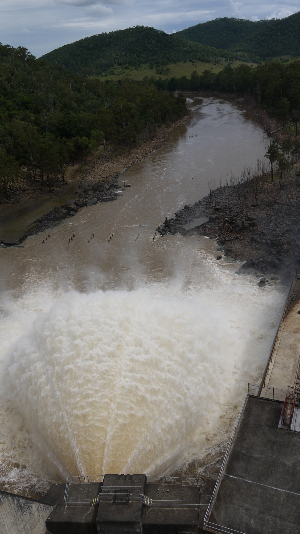 Quick facts
Disaster management in QueenslandThe Queensland Reconstruction Authority (QRA) is the lead agency responsible for disaster recovery and resilience policy in Queensland and manages and coordinates Queensland’s program of recovery and reconstruction funding within disaster-impacted communities, and delivers best practice administration of public reconstruction and resilience funds. For more information on the role of wetlands and floodplains in disaster management see:
Floodplains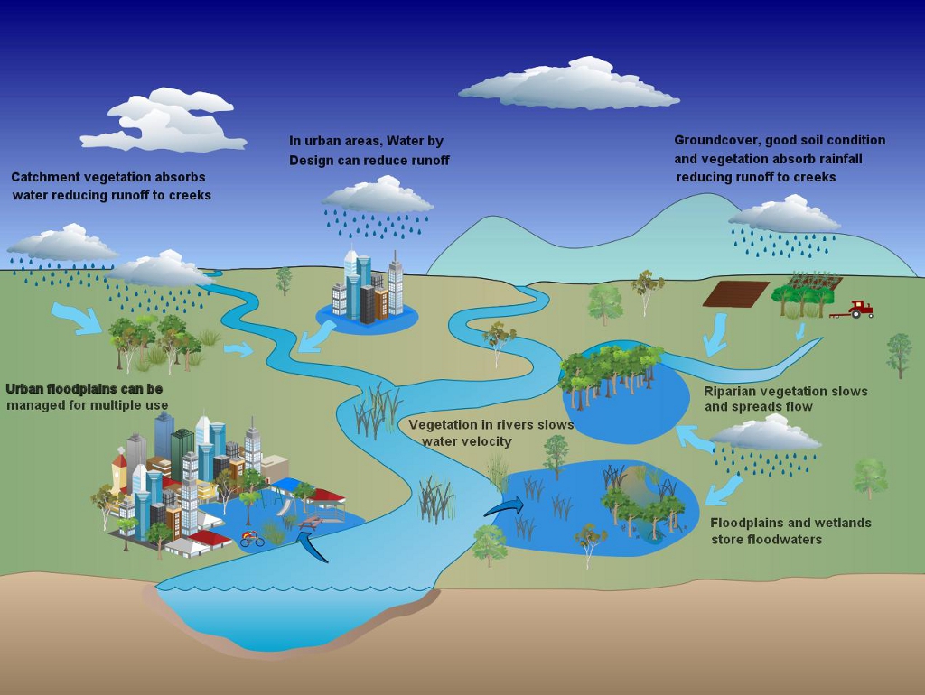
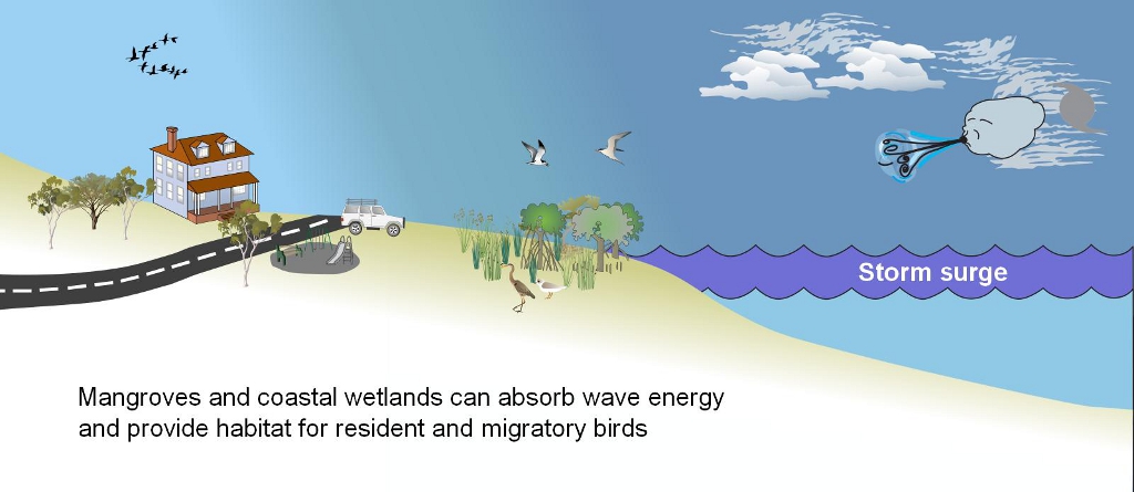
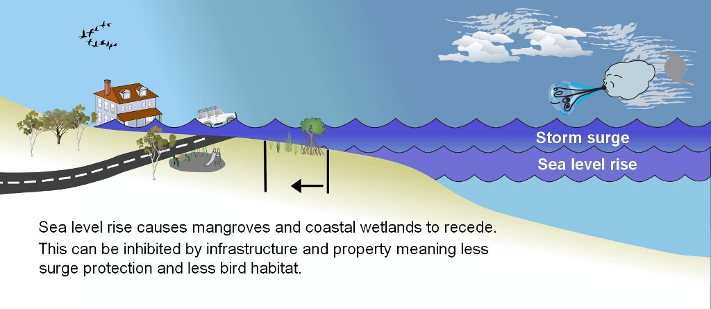
Floodplains have evolved as the areas beside and adjacent rivers or streams that flood during high rainfall events. They can be narrow, steep, wide or flat, and may extend several kilometres away from the waterway itself. They are naturally adapted to regular flooding, and effectively slow down and ‘hold’ water. When water is slowed down, it is usually less destructive to unprotected downstream habitats and settlements. Many studies have confirmed that floodplains play an important role in reducing the volume and mitigating the impact of flooding. Essentially floodplains and wetlands give a landscape an area for floodwaters to go, which can be a useful tool for keeping flooding clear of settlements. It is important that floodplains and wetlands are protected and valued as a flood management tool. Fringing vegetationThe plants that live in and alongside rivers and other wetlands can assist to slow down floodwaters and spread them through a catchment. Although this results in localised flooding, it lowers the concentration and velocity of the floodwater, which can reduce flood levels downstream. Vegetation helps prevent soil erosion from flood water, reduces environmental damage downstream, reduces potential damage to water treatment and other critical community infrastructure and retains productive agricultural soil.Find out more about riparian and other wetland vegetation types. Coastal EcosystemsIt is predicted that Australia’s many coastal cities will face increasing risks of flooding and storm damage as sea levels rise and cyclones become more intense[2]. Coastal wetlands like mangroves, reefs and saltmarshes stabilise the shoreline, slow down waves and reduce the impact of storm surge. Waves and storm surges lose energy as they enter these areas, resulting in reduced damage to coastal settlements. Clearing these natural defences can be risky and costly. When Hurricane Katrina struck the Mississippi Delta in 2005, a massive storm surge overtopped the engineered flood defences and inundated 80% of the city of New Orleans, killing hundreds and generating tens of billions of dollars of damage[4] It is important that we learn from these experiences. In the limited Australian records the highest water levels recorded in Australia were produced by Cyclone Mahina in 1899 in North Queensland. It reached a height of 43ft and killed around 400 people. The pearling fleet, which was at anchor nearby, was completely destroyed and many fish, sharks and dolphins were found 15m above sea level several kilometres inland. The wave extent was probably made worst by the steep coastal topography[1]. Flooding from late 2010 to January 2011, combined with Cyclone Yasi and much wetter than usual weather conditions since September 2010 is estimated to cost Queensland-wide around $6 billion[3]. Such costs of extreme events will reoccur as population and infrastructure increases and if coastal vegetation, wetlands and buffers are reduced or fully cleared along the coast. Various site-specific studies have found that functioning and intact coastal ecosystems can provide a cost-effective alternative or addition to structural defences. This is particularly the case where existing structural defences are expensive to maintain. Mangroves, however, can be relatively cheap to plant but very effective in taking the pressure off engineered defences like seawalls, reducing their maintenance costs[5].Coastal squeezeCoastal areas are unstable landforms, meaning, for example, the position of a beach may change dramatically due to sand being moved in a storm or a rise in sea level. To enable coastal species to survive these changes the coastline needs to be able to 'move' e.g. species need to be able to move inland during severe erosion events. A significant threat for coastal areas is a restriction (or squeeze) on the coastal zone. Coastal squeeze is often due to direct loss through the building of hard built structures that effectively 'fix' the coastline. Such structures may be unintentionally 'fixing' the shoreline, like coastal roads and towns, others are built to protect land and/or infrastructure from erosion and/or flooding.
Additional information A new type of river management is coming! A short animation film on river management by the Rhone Mediterranean Corsica water Agency. The European River Restoration Community of Practice in partnership with the Environment Agency and Agence de l'eau Rhone Méditarranée Corse Duration 3m 30s Additional links and information
References
Last updated: 12 January 2023 This page should be cited as: Department of Environment, Science and Innovation, Queensland (2023) Wetlands and disaster management, WetlandInfo website, accessed 18 March 2024. Available at: https://wetlandinfo.des.qld.gov.au/wetlands/management/disaster.html |
Site footer

 — Department of Environment, Science and Innovation