

|
|
Wetland hydrological modelsWetland models enable users to quantify and predict the performance of wetland systems. This is important to understand how best to use both natural and constructed treatment wetlands to improve water quality, and to support wetland rehabilitation[2].
Quick fact
Wetland hydrological models – Wetland catchment/subcatchment modelSelect from the tabs below
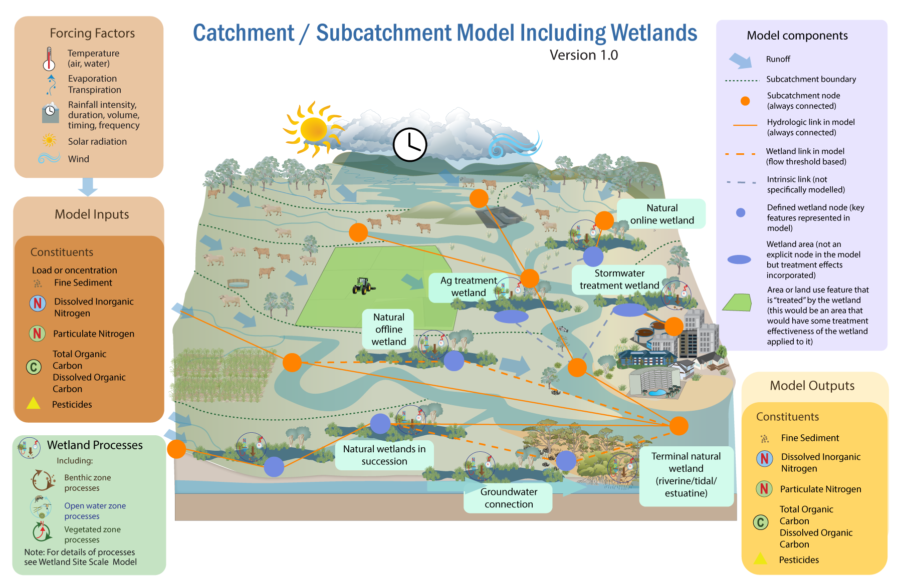 Modelling multiple wetlands within a catchment or subcatchment adds complexity, data requirements, and processing power. Incorporating detailed wetland models as a dedicated ‘module’ or ‘plug-in’ with a broader catchment model may be difficult, depending on the size of the catchment, the complexity of the models, the model framework and configuration, data requirements, and the time steps used in the models[2]. A catchment or subcatchment model can incorporate individual site scale wetlands as part of a node and link network often used to describe a catchment. These incorporate the same forcing factors, constituents and processes as the catchment model, but may be less detailed as noted above. References
Last updated: 31 May 2023 This page should be cited as: Department of Environment, Science and Innovation, Queensland (2023) Wetland hydrological models – Wetland catchment/subcatchment model, WetlandInfo website, accessed 18 March 2024. Available at: https://wetlandinfo.des.qld.gov.au/wetlands/facts-maps/modelling/wetlands-modelling/wetland-catchment-subcatchment-model.html |
Site footer

 — Department of Environment, Science and Innovation