

|
|
Groundwater dependent ecosystem and other mapping rule-setsMapping rule-sets are a combination of attribute rules that describe the GDE drivers and processes in a landscape based on local, expert knowledge. When applied to spatial data sets through GIS analysis these attributes delineate where ecosystems are, or are likely to be, dependent on groundwater.
Quick links
Queensland GDE mapping rule-setsQLD_RS_01—Spring ecosystemsActive springs (whether they have permanent or intermittent flow regime) can support surface expression groundwater dependent ecosystems. This mapping rule-set identifies known and potential GDEs associated with springs.
QLD_RS_02—Cave ecosystemsSubterranean cave systems are groundwater dependent ecosystems. This mapping rule-set identifies known and potential cave GDEs.
Comet, Dawson and Mackenzie River drainage sub-basins GDE mapping rule-setsSURAT_RS_01A—Quaternary alluvial aquifers overlying sandstone ranges with fresh, intermittent groundwater connectivity regimeAlluvial aquifers form from particles such as gravel, sand, silt and/or clay deposited by fluvial processes in river channels or on floodplains. These deposits store and transmit water to varying degrees through intergranular voids. This rule-set identifies potential GDEs associated with alluvial aquifers overlying sandstone ranges with fresh, intermittent connectivity regime.
SURAT_RS_01B—Quaternary alluvial aquifers near springs with fresh, permanent groundwater connectivity regimeAlluvial aquifers form from particles such as gravel, sand, silt and/or clay deposited by fluvial processes in river channels or on floodplains. These deposits store and transmit water to varying degrees through intergranular voids. Springs may transmit groundwater to overlying alluvial aquifers. This rule-set identifies potential GDEs associated with alluvial aquifers within one kilometre of an active, permanent spring from the Great Artesian Basin.
SURAT_RS_01C—Quaternary alluvial aquifers with fresh, intermittent groundwater connectivity regimeAlluvial aquifers form from particles such as gravel, sand, silt and/or clay deposited by fluvial processes in river channels or on floodplains. These deposits store and transmit water to varying degrees through intergranular voids. This rule-set identifies potential GDEs associated with fresh intermittently saturated alluvial aquifers.
SURAT_RS_01D—Quaternary alluvial aquifers with fluctuating, intermittent groundwater connectivity regime and neutral pHAlluvial aquifers form from particles such as gravel, sand, silt and/or clay deposited by fluvial processes in river channels or on floodplains. These deposits store and transmit water to varying degrees through intergranular voids. This rule-set identifies potential GDEs associated with fluctuating intermittently saturated alluvial aquifers.
SURAT_RS_01E—Quaternary alluvial aquifers with fluctuating, intermittent groundwater connectivity regime and unknown pHAlluvial aquifers form from particles such as gravel, sand, silt and/or clay deposited by fluvial processes in river channels or on floodplains. These deposits store and transmit water to varying degrees through intergranular voids. This rule-set identifies potential GDEs associated with fluctuating intermittently saturated alluvial aquifers.
SURAT_RS_01F—Quaternary alluvial aquifers supported by Precipice Sandstone with fresh, permanent groundwater connectivity regimeAlluvial aquifers form from particles such as gravel, sand, silt and/or clay deposited by fluvial processes in river channels or on floodplains. These deposits store and transmit water to varying degrees through intergranular voids. This rule-set identifies potential GDEs associated with fresh permanently saturated alluvial aquifers supported by groundwater from Precipice Sandstone.
SURAT_RS_02A—Permeable rock aquifers (basalts) greater than or equal to 100 ha in size with fresh, intermittent groundwater connectivity regimeBasalt weathers and oxidises relatively fast in comparison to other rock types. Basalt has highly variable porosity and may form aquifers which store and transmit groundwater through the vesicles, fractures and weathered zones of the basalt. Discharge of groundwater is common around the contact between basalt and less permeable underlying geologies including bands of rhyolite and mudstone. This mapping rule-set identifies potential GDEs associated with fresh, intermittently saturated basalt aquifers.
SURAT_RS_02B—Permeable rock aquifers (basalts) less than 100 ha in size with fresh, episodic groundwater connectivity regimeBasalt weathers and oxidises relatively fast in comparison to other rock types. Basalt has highly variable porosity and may form aquifers which store and transmit groundwater through the vesicles, fractures and weathered zones of the basalt. Discharge of groundwater is common around the contact between basalt and less permeable underlying geologies including bands of rhyolite and mudstone. This mapping rule-set identifies potential GDEs associated with fresh, episodically saturated basalt aquifers.
SURAT_RS_03A—Permeable consolidated sedimentary rock, aquifers with fresh, intermittent groundwater connectivity regimeSedimentary rocks are formed by the deposition of sediment which accumulates over time. Chemical, physical and/or biological processes compacts the sediment causing it to consolidate. The Great Artesian Basin is composed of sedimentary rock layers of varying thickness and porosity, forming a sequence of confined aquifers and aquitards. This mapping rule-set identifies potential GDEs associated with fresh, intermittently saturated sandstone aquifers.
SURAT_RS_03B—Permeable consolidated sedimentary rock aquifers with fresh, intermittent groundwater connectivity regime supporting surface expression GDEsSedimentary rocks are formed by the deposition of sediment which accumulates over time. Chemical, physical and/or biological processes compacts the sediment causing it to consolidate. The Great Artesian Basin is composed of sedimentary rock layers of varying thickness and porosity, forming a sequence of confined aquifers and aquitards. This mapping rule-set identifies specific potential GDEs associated with fresh, intermittently saturated sandstone aquifers.
SURAT_RS_04—Fractured rock aquifers (metamorphic rocks and metasediments) with fluctuating, intermittent groundwater connectivity regimeGroundwater is stored and transmitted in the fractures and weathered zones of otherwise relatively impermeable metamorphic rocks and metasediments. Groundwater may discharge from fractured metamorphic rock and metasediment aquifers typically along foot slopes and in channels.
SURAT_RS_05—Permeable old loamy or sandy plain aquifers with fresh, intermittent groundwater connectivity regimeTertiary to Quaternary loamy and sandy plains typically develop permeable sediment that readily stores and transmits groundwater. Discharge of groundwater typically occurs around the contact between these sediments and less permeable underlying rock. This rule-set identifies potential GDEs associated with fresh intermittently saturated sandy plain aquifers.
SURAT_RS_07—Fractured rock (igneous rocks) with fresh, intermittent groundwater connectivity regimeGroundwater is stored and transmitted in the fractures and weathered zones of otherwise relatively impermeable igneous rocks. Groundwater may discharge from fractured igneous rock aquifers typically along foot slopes and in channels.
SURAT_RS_08—Low porosity sedimentary and igneous rocks with fresh, intermittent groundwater connectivity regimeLow porosity rocks store and transmit some groundwater through the intergranular pores, fractures and/or weathered zones. Groundwater may discharge from low porosity rock typically along foot slopes and in channels.
Comet, Dawson and Mackenzie River drainage sub-basins other mapping rule-setsSURAT_RS_06—Exclusion zonesFor the Queensland GDE mapping program, exclusion zones are areas with low permeability surfaces. There is little or no infiltration in exclusion zones as water usually quickly runs off these areas. Consequently there is not enough groundwater in exclusion zones to support GDEs. Lake Eyre Basin and surrounding drainage sub-basins GDE mapping rule-setsLEB_RS_01A—Quaternary alluvial aquifers with fresh, seasonal groundwater connectivity regimeAlluvial aquifers form from particles such as gravel, sand, silt and/or clay deposited by fluvial processes in river channels or on floodplains. These deposits store and transmit water to varying degrees through inter-granular voids. This rule-set identifies potential GDEs associated with fresh seasonally saturated alluvial aquifers.
LEB_RS_01B—Quaternary alluvial aquifers overlying sandstone ranges with fresh, intermittent groundwater connectivity regimeAlluvial aquifers overlying sandstone ranges form from particles such as gravel, sand, silt and/or clay deposited by fluvial processes in river channels or on floodplains. These deposits store and transmit water to varying degrees through inter-granular voids. This rule-set identifies potential GDEs associated with fresh intermittently saturated alluvial aquifers overlying sandstone ranges.
LEB_RS_01C—Quaternary alluvial aquifers near springs with fresh, permanent groundwater connectivity regimeAlluvial aquifers form from particles such as gravel, sand, silt and/or clay deposited by fluvial processes in river channels or on floodplains. These deposits store and transmit water to varying degrees through inter-granular voids. Springs may transmit groundwater to nearby alluvial aquifers. This rule-set identifies potential GDEs associated with fresh permanently saturated alluvial aquifers near springs.
LEB_RS_01D—Quaternary alluvial aquifers with fresh, intermittent groundwater connectivity regimeAlluvial aquifers form from particles such as gravel, sand, silt and/or clay deposited by fluvial processes in river channels or on floodplains. These deposits store and transmit water to varying degrees through inter-granular voids. This rule-set identifies potential GDEs associated with fresh intermittently saturated alluvial aquifers.
LEB_RS_01E—Quaternary alluvial aquifers with fresh, episodic groundwater connectivity regimeAlluvial aquifers form from particles such as gravel, sand, silt and/or clay deposited by fluvial processes in river channels or on floodplains. These deposits store and transmit water to varying degrees through inter-granular voids. This rule-set identifies potential GDEs associated with fresh episodically saturated alluvial aquifers.
LEB_RS_01F—Quaternary alluvial aquifers with brackish, episodic groundwater connectivity regimeAlluvial aquifers form from particles such as gravel, sand, silt and/or clay deposited by fluvial processes in river channels or on floodplains. These deposits store and transmit water to varying degrees through inter-granular voids. This rule-set identifies potential GDEs associated with brackish episodically saturated alluvial aquifers.
LEB_RS_01G—Quaternary alluvial aquifers with saline, episodic groundwater connectivity regimeAlluvial aquifers form from particles such as gravel, sand, silt and/or clay deposited by fluvial processes in river channels or on floodplains. These deposits store and transmit water to varying degrees through inter-granular voids. This rule-set identifies potential GDEs associated with saline episodically saturated alluvial aquifers.
LEB_RS_01H—Quaternary alluvial aquifers with fresh, ephemeral groundwater connectivity regimeAlluvial aquifers form from particles such as gravel, sand, silt and/or clay deposited by fluvial processes in river channels or on floodplains. These deposits store and transmit water to varying degrees through inter-granular voids. This rule-set identifies potential GDEs associated with fresh ephemerally saturated alluvial aquifers.
LEB_RS_01I—Closed alluvial systems with fresh, intermittent groundwater connectivity regimeAlluvial aquifers form from particles such as gravel, sand, silt and/or clay deposited by fluvial processes in river channels or on floodplains. These deposits store and transmit water to varying degrees through inter-granular voids. This rule-set identifies potential GDEs associated with fresh intermittently saturated alluvial aquifers in closed depressions.
LEB_RS_01J—Closed alluvial systems with fluctuating, near permanent groundwater connectivity regimeAlluvial aquifers form from particles such as gravel, sand, silt and/or clay deposited by fluvial processes in river channels or on floodplains. These deposits store and transmit water to varying degrees through inter-granular voids. This rule-set identifies potential GDEs associated with fluctuating near permanently saturated alluvial aquifers in closed depressions.
LEB_RS_01K—Closed alluvial systems with hypersaline, near permanent groundwater connectivity regimeAlluvial aquifers form from particles such as gravel, sand, silt and/or clay deposited by fluvial processes in river channels or on floodplains. These deposits store and transmit water to varying degrees through inter-granular voids. This rule-set identifies potential GDEs associated with hypersaline near permanently saturated alluvial aquifers in closed depressions.
LEB_RS_01L—Closed alluvial systems with fresh, ephemeral groundwater connectivity regimeAlluvial aquifers form from particles such as gravel, sand, silt and/or clay deposited by fluvial processes in river channels or on floodplains. These deposits store and transmit water to varying degrees through inter-granular voids. This rule-set identifies potential GDEs associated with fresh ephemerally saturated alluvial aquifers in closed depressions.
LEB_RS_01M—Quaternary alluvial aquifers with brackish, ephemeral groundwater connectivity regimeAlluvial aquifers form from particles such as gravel, sand, silt and/or clay deposited by fluvial processes in river channels or on floodplains. These deposits store and transmit water to varying degrees through inter-granular voids. This rule-set identifies potential GDEs associated with brackish, ephemerally saturated alluvial aquifers.
LEB_RS_01N—Closed alluvial systems with brackish, intermittent groundwater connectivity regimeAlluvial aquifers form from particles such as gravel, sand, silt and/or clay deposited by fluvial processes in river channels or on floodplains. These deposits store and transmit water to varying degrees through inter-granular voids. This rule-set identifies potential GDEs associated with brackish intermittently saturated alluvial aquifers in closed depressions.
LEB_RS_01O—Closed alluvial systems with fluctuating, intermittent groundwater connectivity regimeAlluvial aquifers form from particles such as gravel, sand, silt and/or clay deposited by fluvial processes in river channels or on floodplains. These deposits store and transmit water to varying degrees through inter-granular voids. This rule-set identifies potential GDEs associated with fluctuating intermittently saturated alluvial aquifers in closed depressions.
LEB_RS_01P—Quaternary alluvial aquifers with fluctuating, intermittent groundwater connectivity regimeAlluvial aquifers form from particles such as gravel, sand, silt and/or clay deposited by fluvial processes in river channels or on floodplains. These deposits store and transmit water to varying degrees through inter-granular voids. This rule-set identifies potential GDEs associated with fluctuating intermittently saturated alluvial aquifers.
LEB_RS_01Q—Quaternary alluvial aquifers with brackish, intermittent groundwater connectivity regimeAlluvial aquifers form from particles such as gravel, sand, silt and/or clay deposited by fluvial processes in river channels or on floodplains. These deposits store and transmit water to varying degrees through inter-granular voids. This rule-set identifies potential GDEs associated with brackish intermittently saturated alluvial aquifers.
LEB_RS_01R—Quaternary alluvial aquifers with saline, ephemeral groundwater connectivity regimeAlluvial aquifers form from particles such as gravel, sand, silt and/or clay deposited by fluvial processes in river channels or on floodplains. These deposits store and transmit water to varying degrees through inter-granular voids. This rule-set identifies potential GDEs associated with saline ephemerally saturated alluvial aquifers.
LEB_RS_01S—Quaternary alluvial aquifers overlying sandstone ranges with fluctuating, intermittent groundwater connectivity regimeAlluvial aquifers overlying sandstone ranges form from particles such as gravel, sand, silt and/or clay deposited by fluvial processes in river channels or on floodplains. These deposits store and transmit water to varying degrees through inter-granular voids. This rule-set identifies potential GDEs associated with fluctuating intermittently saturated alluvial aquifers overlying sandstone ranges.
LEB_RS_01T—Quaternary alluvial aquifers overlying sandstone ranges with fresh, episodic groundwater connectivity regimeAlluvial aquifers overlying sandstone ranges form from particles such as gravel, sand, silt and/or clay deposited by fluvial processes in river channels or on floodplains. These deposits store and transmit water to varying degrees through inter-granular voids. This rule-set identifies potential GDEs associated with fresh episodically saturated alluvial aquifers overlying sandstone ranges.
LEB_RS_01U—Quaternary alluvial aquifers overlying sandstone ranges with brackish, intermittent groundwater connectivity regimeAlluvial aquifers overlying sandstone ranges form from particles such as gravel, sand, silt and/or clay deposited by fluvial processes in river channels or on floodplains. These deposits store and transmit water to varying degrees through inter-granular voids. This rule-set identifies potential GDEs associated with brackish intermittently saturated alluvial aquifers overlying sandstone ranges.
LEB_RS_02A—Permeable sandy plain aquifers with fresh, seasonal groundwater connectivity regimeTertiary to Quaternary loamy and sandy plains typically develop permeable sediment that readily stores and transmits groundwater. Discharge of groundwater typically occurs around the contact between these sediments and less permeable underlying rock. This rule-set identifies potential GDEs associated with fresh seasonally saturated sandy plain aquifers.
LEB_RS_02C—Permeable sandy plain aquifers with saline, intermittent groundwater connectivity regimeTertiary to Quaternary loamy and sandy plains typically develop permeable sediment that readily stores and transmits groundwater. Discharge of groundwater typically occurs around the contact between these sediments and less permeable underlying rock. This rule-set identifies potential GDEs associated with saline intermittently saturated sandy plain aquifers.
LEB_RS_02D—Permeable sandy plain aquifers with saline, ephemeral groundwater connectivity regimeTertiary to Quaternary loamy and sandy plains typically develop permeable sediment that readily stores and transmits groundwater. Discharge of groundwater typically occurs around the contact between these sediments and less permeable underlying rock. This rule-set identifies potential GDEs associated with saline ephemerally saturated sandy plain aquifers.
LEB_RS_02E—Permeable sandy plain aquifers with brackish, ephemeral groundwater connectivity regimeTertiary to Quaternary loamy and sandy plains typically develop permeable sediment that readily stores and transmits groundwater. Discharge of groundwater typically occurs around the contact between these sediments and less permeable underlying rock. This rule-set identifies potential GDEs associated with brackish ephemerally saturated sandy plain aquifers.
LEB_RS_02F—Permeable sandy plain aquifers with fresh, ephemeral groundwater connectivity regimeTertiary to Quaternary loamy and sandy plains typically develop permeable sediment that readily stores and transmits groundwater. Discharge of groundwater typically occurs around the contact between these sediments and less permeable underlying rock. This rule-set identifies potential GDEs associated with fresh ephemerally saturated sandy plain aquifers.
LEB_RS_02G—Permeable sandy plain aquifers with brackish, intermittent groundwater connectivity regimeTertiary to Quaternary loamy and sandy plains typically develop permeable sediment that readily stores and transmits groundwater. Discharge of groundwater typically occurs around the contact between these sediments and less permeable underlying rock. This rule-set identifies potential GDEs associated with brackish intermittently saturated sandy plain aquifers.
LEB_RS_02H—Permeable sandy plain aquifers with fresh, intermittent groundwater connectivity regimeTertiary to Quaternary loamy and sandy plains typically develop permeable sediment that readily stores and transmits groundwater. Discharge of groundwater typically occurs around the contact between these sediments and less permeable underlying rock. This rule-set identifies potential GDEs associated with fresh intermittently saturated sandy plain aquifers.
LEB_RS_02I—Permeable sandy plain aquifers with fluctuating, intermittent groundwater connectivity regimeTertiary to Quaternary loamy and sandy plains typically develop permeable sediment that readily stores and transmits groundwater. Discharge of groundwater typically occurs around the contact between these sediments and less permeable underlying rock. This rule-set identifies potential GDEs associated with fluctuating intermittently saturated sandy plain aquifers.
LEB_RS_02J—Permeable sandy plain aquifers with saline, episodic groundwater connectivity regimeTertiary to Quaternary loamy and sandy plains typically develop permeable sediment that readily stores and transmits groundwater. Discharge of groundwater typically occurs around the contact between these sediments and less permeable underlying rock. This rule-set identifies potential GDEs associated with saline episodically saturated sandy plain aquifers.
LEB_RS_02K—Permeable sandy plain aquifers with brackish, episodic groundwater connectivity regimeTertiary to Quaternary loamy and sandy plains typically develop permeable sediment that readily stores and transmits groundwater. Discharge of groundwater typically occurs around the contact between these sediments and less permeable underlying rock. This rule-set identifies potential GDEs associated with brackish episodically saturated sandy plain aquifers.
LEB_RS_02L—Permeable sandy plain aquifers with fresh, episodic groundwater connectivity regimeTertiary to Quaternary loamy and sandy plains typically develop permeable sediment that readily stores and transmits groundwater. Discharge of groundwater typically occurs around the contact between these sediments and less permeable underlying rock. This rule-set identifies potential GDEs associated with fresh episodically saturated sandy plain aquifers.
LEB_RS_03A—Sandstone aquifers with fresh, permanent groundwater connectivity regime associated with discharge springsSedimentary rocks are formed by the deposition of sediment which accumulates over time. Chemical, physical and/or biological processes compacts the sediment causing it to consolidate. The Great Artesian Basin is composed of sedimentary rock layers of varying thickness and porosity, forming a sequence of confined aquifers and aquitards. This mapping rule-set identifies potential GDEs associated with fresh, permanently saturated sandstone aquifers associated with discharge springs.
LEB_RS_03B—Sandstone aquifers with fresh, permanent groundwater connectivity regime associated with recharge springsSedimentary rocks are formed by the deposition of sediment which accumulates over time. Chemical, physical and/or biological processes compacts the sediment causing it to consolidate. The Great Artesian Basin is composed of sedimentary rock layers of varying thickness and porosity, forming a sequence of confined aquifers and aquitards. This mapping rule-set identifies potential GDEs associated with fresh, permanently saturated sandstone aquifers associated with recharge springs.
LEB_RS_03C—Aquifers associated with springs that form saline scaldsSedimentary rocks are formed by the deposition of sediment which accumulates over time. Chemical, physical and/or biological processes compacts the sediment causing it to consolidate. The Great Artesian Basin is composed of sedimentary rock layers of varying thickness and porosity, forming a sequence of confined aquifers and aquitards. The evaporation of groundwater discharge by springs can form saline scalds in the landscape. This mapping rule-set identifies potential GDEs associated with permanently saturated sandstone aquifers associated with springs that have formed saline scales.
LEB_RS_04A—Melaleuca tamariscina situated on old loamy and sandy plainsMelaleuca tamariscina has a very stong associated with groundwater discharge in the Lake Eyre Basin landscape. This mapping rule-set identifies potential GDEs associated with old loamy and sandy plains.
LEB_RS_04B— Melaleuca tamariscina situated on ironstone jump-upsMelaleuca tamariscina has a very strong associated with groundwater discharge in the Lake Eyre Basin landscape. This mapping rule-set identifies potential GDEs associated with ironstone jump-ups.
LEB_RS_04C— Melaleuca tamariscina situated on sandstone rangesMelaleuca tamariscina has a very strong associated with groundwater discharge in the Lake Eyre Basin landscape. This mapping rule-set identifies potential GDEs associated with sandstone ranges.
LEB_RS_06A—Permeable rock aquifers (basalts) with fresh, seasonal groundwater connectivity regimeBasalt weathers and oxidises relatively fast in comparison to other rock types. Basalt is permeable and may form aquifers which store and transmit groundwater through the vesicles, fractures and weathered zones of the basalt. Discharge of groundwater is common around the contact between basalt and less permeable underlying geologies including bands of rhyolite and mudstone. This mapping rule-set identifies potential GDEs associated with fresh, seasonally saturated basalt aquifers.
LEB_RS_06B—Permeable rock aquifers (basalts) with fresh, intermittent groundwater connectivity regimeBasalt weathers and oxidises relatively fast in comparison to other rock types. Basalt is permeable and may form aquifers which store and transmit groundwater through the vesicles, fractures and weathered zones of the basalt. Discharge of groundwater is common around the contact between basalt and less permeable underlying geologies including bands of rhyolite and mudstone. This mapping rule-set identifies potential GDEs associated with fresh, intermittently saturated basalt aquifers.
LEB_RS_07A—Permeable rock aquifers (sandstones) with fresh, seasonal groundwater connectivity regimeFine to medium grained sedimentary rocks may store and transmit groundwater through fractures and weathered zones of what is otherwise a relatively low porosity rock. Groundwater may discharge typically along foot slopes and channels. This mapping rule-set identifies potential GDEs associated with fresh, seasonally saturated sandstone aquifers.
LEB_RS_07B—Permeable rock aquifers (sandstones) with fluctuating, intermittent groundwater connectivity regimeFine to medium grained sedimentary rocks may store and transmit groundwater through fractures and weathered zones of what is otherwise a relatively low porosity rock. Groundwater may discharge typically along foot slopes and channels. This mapping rule-set identifies potential GDEs associated with fluctuating, intermittently saturated sandstone aquifers.
LEB_RS_07C—Permeable rock aquifers (sandstones) with fluctuating, episodic groundwater connectivity regimeFine to medium grained sedimentary rocks may store and transmit groundwater through fractures and weathered zones of what is otherwise a relatively low porosity rock. Groundwater may discharge typically along foot slopes and channels. This mapping rule-set identifies potential GDEs associated with fluctuating, episodically saturated sandstone aquifers.
LEB_RS_08B—Inland sand dunefield aquifers with fresh, near permanent groundwater connectivity regimeInland sand dunefields are composed largely of unconsolidated sand. These inland sand dunefields may store and transmit water to varying degrees through inter-granular voids. This mapping rule-set identifies potential GDEs associated with fresh near permanently saturated sand aquifers.
LEB_RS_08C—Inland sand dunefield aquifers with fresh, episodic groundwater connectivity regimeInland sand dunefields are composed largely of unconsolidated sand. These inland sand dunefields may store and transmit water to varying degrees through inter-granular voids. This mapping rule-set identifies potential GDEs associated with fresh episodically saturated sand aquifers.
LEB_RS_09A—Alluvial aquifers with brackish, episodic groundwater connectivity regime associated with catchment constrictionsCatchment constrictions are a narrowing in the width and/or depth of the catchment resulting in the formation of a catchment throat which acts as a ‘bottle-neck’. Often groundwater upslope of a catchment constriction is shallower due to the restriction of groundwater flow through the constriction point. There may also be a widening of the floodplain upslope of a catchment constriction due to the restriction of sediment flow through the constriction point. This mapping rule-set identifies potential GDEs associated with brackish alluvial aquifers influenced by a catchment constriction.
LEB_RS_09B—Alluvial aquifers with saline, ephemeral groundwater connectivity regime associated with catchment constrictionsCatchment constrictions are a narrowing in the width and/or depth of the catchment resulting in the formation of a catchment throat which acts as a ‘bottle-neck’. Often groundwater upslope of a catchment constriction is shallower due to the restriction of groundwater flow through the constriction point. There may also be a widening of the floodplain upslope of a catchment constriction due to the restriction of sediment flow through the constriction point. This mapping rule-set identifies potential GDEs associated with saline alluvial aquifers influenced by a catchment constriction.
LEB_RS_12—Permeable rock aquifers (metamorphic rocks)Groundwater is stored and transmitted in the fractures and weathered zones of otherwise relatively impermeable metamorphic rocks. Groundwater may discharge from fractured metamorphic rock aquifers typically along foot slopes and in channels.
LEB_RS_13—Permeable rock aquifers (igneous rocks)Groundwater is stored and transmitted in the fractures and weathered zones of otherwise relatively impermeable igneous rocks. Groundwater may discharge from fractured igneous rock aquifers typically along foot slopes and in channels.
LEB_RS_14—Coastal sand masses (beach ridges)Coastal sand masses often have one or more aquifers where groundwater has formed a freshwater lens in the intergranular voids of the unconsolidated sand. Groundwater may occur above low-permeability strata within the sand mass, for example coffee rock.
Lake Eyre Basin and surrounding drainage sub-basins other mapping rule-setsLEB_RS_10—Exclusion zonesFor the Queensland GDE mapping program, exclusion zones are areas with low permeability surfaces. There is little or no infiltration in exclusion zones as water usually quickly runs off these areas. Consequently there is not enough groundwater in exclusion zones to support GDEs. LEB_RS_11—Recharge zonesFor the Queensland GDE mapping program, recharge zones are areas of permeable rocks where water infiltrates the surface and is transported away from the local area. In recharge zones groundwater is usually occurs at a substantial depth. Recharge zones do not support GDEs locally, but may support GDEs where discharge occurs some distance away. South East Queensland GDE mapping rule-setsSEQ_RS_01—High rainfall permeable rocks (basalts) with near-permanent flowBasalt weathers and oxidises relatively quickly in comparison to other rock types. Basalt is permeable and may form aquifers which store and transmit groundwater through the vesicles, fractures and weathered zones of the basalt. Discharge of groundwater is common around the contact between basalt and less permeable underlying geologies including bands of rhyolite and mudstone. Basalt uplands and associated basalt colluvium with high rainfall (>800mm average annual rainfall) occurring along the McPherson Range, Great Dividing Range and Maleny Plateau are included in this mapping rule-set. Channels on or extending up to 1km from basalt and basalt colluvium with high rainfall are potential surface GDEs with near-permanent flow. Lacustrine and palustrine wetlands and riverine water bodies fringing streams on basalt, basalt colluvium or within 50m of the contact between basalt and other less permeable underlying rocks in high rainfall areas, are potential surface GDEs. Treed regional ecosystems and riverine wetlands fringing streams on basalt, basalt colluvium or within 50m of the contact zone between basalt and other less permeable underlying rocks in high rainfall areas, are potential terrestrial GDEs. SEQ_RS_02—High rainfall permeable rocks (basalts) with permanent flowBasalt weathers and oxidises relatively quickly in comparison to other rock types. Basalt is permeable and may form aquifers which store and transmit groundwater through the vesicles, fractures and weathered zones of the basalt. This mapping rule-set is restricted to basalt uplands with high rainfall (generally >1600mm average annual rainfall) such as the Springbrook and Lamington Plateaus. Channels on high rainfall basalt are potential surface GDEs with permanent flow. Lacustrine and palustrine wetlands and riverine water bodies fringing streams on basalt, in high rainfall areas, are potential surface GDEs. Treed regional ecosystems and riverine wetlands fringing streams on basalt in high rainfall areas, are potential terrestrial GDEs. SEQ_RS_03—Low rainfall &/or low capacity permeable rocks (basalts)Basalt weathers and oxidises relatively quickly in comparison to other rock types. Basalt is permeable and may form aquifers which store and transmit groundwater through the vesicles, fractures and weathered zones of the basalt. Discharge of groundwater is common around the contact between basalt and less permeable underlying geologies including bands of rhyolite and mudstone. Basalt and associated basalt colluvium occurring as either isolated caps or in areas with low rainfall (<800mm average annual rainfall) are included in this mapping rule-set and have a reduced groundwater storing capacity compared to basalt captured in rule-set SEQ_RS_01. The Great Dividing Range north of Woodbine, Jinbroken Range and western slopes of Mt Tamborine are included in this mapping rule-set. Channels on or extending up to 100m from basalt and basalt colluvium with low rainfall &/or low capacity are potential surface GDEs with intermittent flow. Lacustrine and palustrine wetlands and riverine water bodies fringing streams on low rainfall and/or low capacity basalt, associated colluvium, or within 50m of the contact between the basalt and other less permeable underlying rocks, are potential surface GDEs. Treed regional ecosystems and riverine wetlands fringing streams on low rainfall and/or low capacity basalt, associated colluvium, or within 50m of the contact zone between the basalt and other less permeable underlying rocks, are potential terrestrial GDEs. Mesic regional ecosystems on low rainfall and/or low capacity basalt are also potential terrestrial GDEs. SEQ_RS_04—Petrie Formation along the shoreline of Moreton Bay (Redland basalt)Basalt weathers and oxidises relatively quickly in comparison to other rock types. Basalt is permeable and may form aquifers which store and transmit groundwater through the vesicles, fractures and weathered zones. Weathered basalt of the Petrie Formation (Petrie basalt) occurring on the edges of Moreton Bay is captured by this mapping rule-set. Channels on Petrie basalt are potential surface GDEs. Lacustrine and palustrine wetlands and riverine water bodies on Petrie basalt are potential surface GDEs. Treed regional ecosystems and riverine wetlands on Petrie basalt are potential terrestrial GDEs. SEQ_RS_05—Deeply weathered rises and crestsDeeply weathered rises and crests typically develop well-structured and well-drained permeable soils that readily store and transmit groundwater. Discharge of groundwater is common around the contact between deeply weathered soils and less permeable underlying geologies. The Sunnybank soil type situated to the south of Brisbane is included in this rule-set. Channels on or extending up to 100m from deeply weathered rises and crests are potential surface GDEs with intermittent flow. Lacustrine and palustrine wetlands and riverine water bodies on deeply weathered rises and crests or within 50m of the contact between the deeply weathered rises and crests and other less permeable underlying rocks, are potential surface GDEs. Treed regional ecosystems and riverine wetlands fringing streams on deeply weathered rises and crests or within 50m of the contact zone between the deeply weathered rises and crests and other less permeable underlying rocks are potential terrestrial GDEs. SEQ_RS_06—Low porosity sedimentary rocks with intermittent flowFine to medium grained sedimentary rocks generally with a clay matrix, may store and transmit groundwater through fractures and weathered zones of what is otherwise a relatively low porosity rock. Lenses of medium grained sedimentary rock with greater porosity may occur in localised areas within the surrounding low porosity sedimentary rock. Groundwater may discharge typically along foot slopes and drainage lines. In South East Queensland this mapping rule-set includes much of the Esk and Bryden Formations’, the Tarong Beds, Colleges Conglomerate, some Gatton Sandstone and minor areas of Walloon Coal measures. Channels, excluding uppermost tributaries that conduct surface water only, on low porosity sedimentary rocks are potential surface GDEs with intermittent flow. The area fringing these channels represents the lower part of the landscape where groundwater is likely to discharge to the surface or be within rooting depth of treed regional ecosystems. Lacustrine and palustrine wetlands and riverine water bodies fringing channels, excluding uppermost tributaries, on low porosity sedimentary rocks are potential surface GDEs with intermittent flow. Treed regional ecosystems and riverine wetlands fringing channels on low porosity sedimentary rocks are potential terrestrial GDEs with intermittent flow. SEQ_RS_06a—Sedimentary rocks with saline flowFine to medium grained sedimentary rocks generally with a clay matrix, may store and transmit groundwater through fractures and weathered zones of what is otherwise a relatively low porosity rock. Lenses of medium grained sedimentary rock with greater porosity may occur in localised areas within the surrounding low porosity sedimentary rock. Groundwater may discharge typically along foot slopes and drainage lines. In South East Queensland this mapping rule-set includes the Koukandowie Formation, occurrences of Gatton Sandstone south of Lockyer Creek and minor areas of Walloon Coal measures where groundwater discharge from these rocks is generally saline. Channels, excluding uppermost tributaries that conduct surface water only, on sedimentary rocks with saline flow are potential surface GDEs. The area fringing these channels represents the lower part of the landscape where groundwater is likely to discharge to the surface or be within rooting depth of treed regional ecosystems. Lacustrine and palustrine wetlands and riverine water bodies fringing these channels on sedimentary rocks with saline flow are potential surface GDEs. Treed regional ecosystems and riverine wetlands fringing these channels on sedimentary rocks with saline flow are potential terrestrial GDEs. SEQ_RS_07—Medium porosity sedimentary rocks with intermittent flowMedium porosity sedimentary rocks may be fine to coarse grained, generally with a sandy matrix and may store and transmit groundwater through inter-granular pore space, fractures and weathered zones. Groundwater may discharge typically along foot slopes and drainage lines. In South East Queensland this mapping rule-set includes parts of the Woogaroo Subgroup, and minor areas of Ripley Road Sandstone and Raceview Formation occurring in the Ripley Valley area. Channels on medium porosity sedimentary rocks are potential surface GDEs with intermittent flow. The area fringing these channels represents the lower part of the landscape where groundwater is likely to discharge to the surface or be within rooting depth of treed regional ecosystems. Lacustrine and palustrine wetlands and riverine water bodies fringing channels on medium porosity sedimentary rocks are potential surface GDEs. Treed regional ecosystems and riverine wetlands fringing channels on medium porosity sedimentary rocks are potential terrestrial GDEs. SEQ_RS_08—Edge of Clarence-Moreton basin sedimentary rocksPorous sandstones of the Woogaroo Subgroup make up the earliest sedimentary rocks of the Clarence–Moreton Basin and tend to outcrop around its edge. These sandstones may store and transmit groundwater through inter-granular pore space, fractures and weathered zones. Groundwater may discharge typically along foot slopes and drainage lines on a near-permanent basis. In addition to parts of the Woogaroo Subgroup, occurrences of Gatton Sandstone north of Lockyer Creek are included in this mapping rule-set. Channels on the edge of Clarence-Moreton Basin sedimentary rocks are potential surface GDEs with near-permanent flow. The area fringing these channels represents the lower part of the landscape where groundwater is likely to discharge to the surface or be within rooting depth of treed regional ecosystems. Lacustrine and palustrine wetlands and riverine water bodies fringing channels on edge of Clarence–Moreton Basin sedimentary rocks are potential surface GDEs. Treed regional ecosystems and riverine wetlands fringing channels on edge of Clarence–Moreton Basin sedimentary rocks are potential terrestrial GDEs. SEQ_RS_09—Sedimentary rocks with near-permanent flowFine to medium grained sedimentary rocks may store and transmit groundwater through inter-granular pore space, fractures and weathered zones. Groundwater may discharge typically along foot slopes and drainage lines. In South East Queensland this mapping rule-set includes much of the Esk and Bryden Formations’, the Tarong Beds, Colleges Conglomerate, some Gatton Sandstone and minor areas of Walloon Coal measures. Channels, excluding uppermost tributaries that conduct surface water only, on low porosity sedimentary rocks are potential surface GDEs with intermittent flow. Lacustrine and palustrine wetlands and riverine water bodies fringing channels, excluding uppermost tributaries, on low porosity sedimentary rocks are potential surface GDEs with intermittent flow. Treed regional ecosystems and riverine wetlands fringing channels on low porosity sedimentary rocks are potential terrestrial GDEs with near-permanent flow. SEQ_RS_10—Silkstone FormationThe Silkstone Formation is mostly comprised of limestone and basalt, both of which may store and transmit groundwater through inter-granular pore space, fractures and weathered zones. Groundwater may discharge typically along foot slopes and drainage lines. In South East Queensland this mapping rule-set is restricted to the Silkstone Formation and the small occurrence of Flinders Dolomite south of Peak Crossing. Channels on Silkstone Formation are potential surface GDEs with intermittent flow. The area fringing these channels represents the lower part of the landscape where groundwater is likely to discharge to the surface or be within rooting depth of treed regional ecosystems. Lacustrine and palustrine wetlands and riverine water bodies fringing channels on Silkstone Formation are potential surface GDEs. Treed regional ecosystems and riverine wetlands fringing channels on Silkstone Formation are potential terrestrial GDEs. SEQ_RS_11—Sedimentary rocks associated with Leslie Harrison DamThe sedimentary rocks associated with Leslie Harrison Dam are fine to coarse grained, generally with a sandy matrix and may store and transmit groundwater through inter-granular pore space, fractures and weathered zones. Groundwater may discharge typically along foot slopes and drainage lines, however the presence of wet heath vegetation indicates discharge occurs higher in the landscape as well. The groundwater table is often within the rooting zone of treed regional ecosystems. This mapping rule-set includes parts of the Woogaroo Subgroup, and minor areas of Tingalpa Formation adjacent to the dam. Channels on sedimentary rocks associated with Leslie Harrison Dam are potential surface GDEs. Lacustrine and palustrine wetlands and riverine water bodies on sedimentary rocks associated with Leslie Harrison Dam are potential surface GDEs. Treed regional ecosystems and riverine wetlands on sedimentary rocks associated with Leslie Harrison Dam are potential terrestrial GDEs. SEQ_RS_12—Sedimentary rocks associated with Fassifern scrubBrigalow (Acacia harpophylla) and vine-forest species typify the Fassifern scrub. These species have a relatively high water demand which is likely to be met in part by groundwater from underlying sedimentary rocks. The Walloon Coal Measures are the dominant rock unit underlying the Fassifern scrub and are usually comprised of fine to coarse grained sedimentary rocks which may store and transmit groundwater through inter-granular pore space, fractures and weathered zones. Groundwater is generally within the rooting depth of Fassifern scrub ecosystems and is also known to surface in the Roadvale area. Channels on sedimentary rocks associated with Fassifern scrub are potential surface GDEs. Lacustrine and palustrine wetlands and riverine water bodies on sedimentary rocks associated with Fassifern scrub are potential surface GDEs. Mesic regional ecosystems and riverine wetlands on sedimentary rocks that form the Fassifern scrub are potential terrestrial GDEs. SEQ_RS_13—Sandstone overlying impervious rocksQuartzose sandstone is permeable and may form aquifers which store and transmit groundwater through inter-granular pore space, fractures and weathered zones. Discharge of groundwater is common along drainage lines, foot slopes and around the contact between quartzose sandstone and less permeable underlying rocks. Quartzose sandstone crests overlying rhyolitic tuff in the Parklands Regional Park area are included in this mapping rule-set. Channels on or extending up to 100m from quartzose sandstone are potential surface GDEs. The area fringing these channels represents the lower part of the landscape where groundwater is likely to discharge to the surface or be within rooting depth of treed regional ecosystems. Lacustrine and palustrine wetlands and riverine water bodies fringing streams on quartzose sandstone, or within 50m of the contact between the quartzose sandstone and other less permeable underlying rocks, are potential surface GDEs. Treed regional ecosystems and riverine wetlands fringing streams on quartzose sandstone or within 50m of the contact between quartzose sandstone and other less permeable underlying rocks are potential terrestrial GDEs. SEQ_RS_14—Low porosity fractured sedimentary rocksFine to medium grained sedimentary rocks generally with a clay matrix may store and transmit groundwater through fractures and weathered zones within the rock. Groundwater may discharge typically along foot slopes and drainage lines. In South East Queensland this mapping rule-set is applied to occurrences of the Marburg Subgroup in the upper Brisbane River catchment only. Upper tributaries usually carry surface runoff and it is the higher order (>3rd) channels on low porosity sedimentary rocks that are potential surface GDEs. Mesic regional ecosystems, for example vine forests on low porosity sedimentary rocks are likely to meet their water requirements in-part from groundwater and therefore are potential terrestrial GDEs. SEQ_RS_15—Fractured metamorphic rocksMetamorphic rocks are generally hard and impervious and tend to only transmit groundwater through fractures and some bedding plains within the rock. Groundwater typically may discharge along drainage lines coinciding with fractures and bedding plains. In South East Queensland this mapping rule-set is applied to both metamorphosed sedimentary and metamorphosed volcanic rocks including the Neranleigh-Fernvale beds, Bunya Phyllite, Maronghi Creek beds, Pinecliffe Formation, Sugarloaf Metamorphics, Jimna Phyllite, Kurwongbah beds and Rocksberg Greenstone. Upper tributaries usually carry surface runoff and it is the higher order (>3rd) channels on low porosity sedimentary rocks that are potential surface GDEs. Mesic regional ecosystems for example vine forests, on low porosity sedimentary rocks are likely to meet their water requirements in-part with groundwater and therefore are potential terrestrial GDEs. SEQ_RS_16—Fractured igneous rocks with near-permanent flowGroundwater is stored and transmitted in the fractures and weathered zones of otherwise relatively impermeable igneous rocks. Groundwater may discharge from fractured igneous rock aquifers typically along foot slopes and drainage lines. In South East Queensland this mapping rule-set includes areas of Bellthorpe Andesite, Cedarton Volcanics and Neurum Tonalite. Channels, excluding uppermost tributaries that conduct surface water only, on fractured igneous rocks are potential surface GDEs with near-permanent flow. The area fringing these channels represents the lower part of the landscape where groundwater is likely to discharge to the surface or be within rooting depth of treed regional ecosystems. Lacustrine and palustrine wetlands and riverine water bodies fringing channels, excluding uppermost tributaries, on fractured igneous rocks are potential surface GDEs. Treed regional ecosystems and riverine wetlands fringing channels, excluding uppermost tributaries, on fractured igneous rocks are potential terrestrial GDEs. SEQ_RS_17—Fractured igneous rocks with intermittent flowGroundwater is stored and transmitted in the fractures and weathered zones of otherwise relatively impermeable igneous rocks. Groundwater may discharge from fractured igneous rock aquifers typically along foot slopes and drainage lines. In South East Queensland this mapping rule-set includes areas of Neara and Mount Byron Volcanics, Eskdale Granodiorite, Taromeo Igneous Complex, Neurum Tonalite, Northbrook beds and Crows Nest Granite. Channels, excluding uppermost tributaries that conduct surface water only, on fractured igneous rocks are potential surface GDEs with intermittent flow. The area fringing these channels represents the lower part of the landscape where groundwater is likely to discharge to the surface or be within rooting depth of treed regional ecosystems. Lacustrine and palustrine wetlands and riverine water bodies fringing channels, excluding uppermost tributaries, on fractured igneous rocks are potential surface GDEs. Treed regional ecosystems and riverine wetlands fringing channels, excluding uppermost tributaries, on fractured igneous rocks are potential terrestrial GDEs. SEQ_RS_18—ColluviumColluvial aquifers form from unconsolidated sediments deposited at the base of a hillslope by rainwash, sheetwash, slow continuous downslope creep or a variable combination of these processes. These deposits store and transmit water to varying degrees through inter-granular voids. This rule-set identifies potential GDEs associated with a large deposit of colluvium situated at the base of Mt French. Other smaller deposits of colluvium are captured in other GDE mapping rule-sets. Potential surface GDEs on colluvial aquifers include lacustrine wetlands, palustrine wetlands, riverine water bodies and channels (represented by drainage lines). Potential terrestrial GDEs on colluvial aquifers include riverine wetlands and regional ecosystems containing deep rooted tree species. SEQ_RS_19—Tertiary-Quaternary high-level alluviumTertiary–Quaternary high-level alluvium (TQa), is a poorly consolidated or unconsolidated alluvial deposit in an ancestral valley which has been dissected by more recent channel activity. This process results in inverted relief whereby older alluvial deposits are higher in the landscape than younger alluvial deposits. In South East Queensland this rule-set is only applied to an uplifted area of TQa at Moggill. This area once supported pineapple farming but is now largely urbanised. Other occurrences of TQa which function like a high alluvial terrace are captured in other alluvial GDE mapping rule-sets. Channels on or extending up to 100m from Tertiary–Quaternary high-level alluvium are potential surface GDEs. Lacustrine and palustrine wetlands and riverine water bodies located within 50 meters of the contact between the Tertiary–Quaternary high-level alluvium and other less permeable underlying rocks, are potential surface GDEs. Riverine wetlands and regional ecosystems containing deep rooted tree species, located within 50 meters of the geological contact between Tertiary–Quaternary high-level alluvium and other less permeable underlying rocks, are potential terrestrial GDEs. SEQ_RS_20—Alluvial aquifers with permanent natural flowAlluvial aquifers form from particles such as gravel, sand, silt and/or clay deposited by fluvial processes in river channels or on floodplains. These deposits store and transmit water to varying degrees through inter-granular voids. This rule-set identifies potential GDEs associated with naturally permanently saturated alluvial aquifers. The distribution of these aquifers is restricted to areas with either high rainfall or a strong connection with an underlying aquifer. Potential surface GDEs on alluvial aquifers include lacustrine wetlands, palustrine wetlands, riverine water bodies and channels (represented by drainage lines). Potential terrestrial GDEs on alluvial aquifers include riverine wetlands and regional ecosystems containing deep rooted tree species. SEQ_RS_21—Alluvial aquifers with near-permanent flowAlluvial aquifers form from particles such as gravel, sand, silt and/or clay deposited by fluvial processes in river channels or on floodplains. These deposits store and transmit water to varying degrees through inter-granular voids. This rule-set identifies potential GDEs associated with near-permanently saturated alluvial aquifers. The distribution of these aquifers is widespread throughout South East Queensland. Potential surface GDEs on alluvial aquifers include lacustrine wetlands, palustrine wetlands, riverine water bodies and channels (represented by drainage lines). Potential terrestrial GDEs on alluvial aquifers include regional ecosystems containing deep rooted tree species. SEQ_RS_22—Alluvial aquifers with intermittent flowAlluvial aquifers form from particles such as gravel, sand, silt and/or clay deposited by fluvial processes in river channels or on floodplains. These deposits store and transmit water to varying degrees through inter-granular voids. This rule-set identifies potential GDEs associated with intermittently saturated alluvial aquifers. Such aquifers are common in the lower rainfall parts of South East Queensland. Potential surface GDEs on alluvial aquifers include lacustrine wetlands, palustrine wetlands, riverine water bodies and channels (represented by drainage lines). Potential terrestrial GDEs on alluvial aquifers include riverine wetlands and regional ecosystems containing deep rooted tree species. SEQ_RS_23—Alluvial aquifers with saline, near-permanent flowAlluvial aquifers form from particles such as gravel, sand, silt and/or clay deposited by fluvial processes in river channels or on floodplains. These deposits store and transmit water to varying degrees through inter-granular voids. This rule-set identifies potential GDEs associated with saline, near-permanently saturated alluvial aquifers. These aquifers occur where saline discharge from adjacent sedimentary rock aquifers infiltrates the alluvial aquifer. Deep Gully in the Lockyer Creek catchment and upper Yarraman Creek are examples of alluvial aquifers with saline, near-permanent flow. Potential surface GDEs on alluvial aquifers include lacustrine wetlands, palustrine wetlands, riverine water bodies and channels (represented by drainage lines). Potential terrestrial GDEs on alluvial aquifers include riverine wetlands and regional ecosystems containing deep rooted tree species. SEQ_RS_24—Alluvial aquifers with saline, intermittent flowAlluvial aquifers form from particles such as gravel, sand, silt and/or clay deposited by fluvial processes in river channels or on floodplains. These deposits store and transmit water to varying degrees through inter-granular voids. This rule-set identifies potential GDEs associated with saline, intermittently saturated alluvial aquifers. These aquifers occur where saline groundwater from adjacent sedimentary rock aquifers infiltrates the alluvial aquifer. Many creeks within the Lockyer Valley draining sandstone catchments such as Plain, Woolshed and Ma-Ma Creeks are examples of alluvial aquifers with saline, intermittent flow. Other examples include Black Snake Creek in the Brisbane River catchment and upper Purga Creek in the Bremer River catchment. Potential surface GDEs on alluvial aquifers with saline, intermittent flow include lacustrine wetlands, palustrine wetlands, riverine water bodies and channels (represented by drainage lines). Potential terrestrial GDEs on alluvial aquifers with saline, intermittent flow include riverine wetlands and regional ecosystems containing deep rooted tree species. SEQ_RS_25—Alluvial aquifers with brackish, intermittent flowAlluvial aquifers form from particles such as gravel, sand, silt and/or clay deposited by fluvial processes in river channels or on floodplains. These deposits store and transmit water to varying degrees through inter-granular voids. This rule-set identifies potential GDEs associated with brackish, intermittently saturated alluvial aquifers. These aquifers occur where saline groundwater from adjacent sedimentary rocks infiltrates and mixes with fresh groundwater in the alluvial aquifer. Alluvial aquifers with brackish, intermittent flow occur in the Wivenhoe Pocket area and along a section of Purga Creek upstream of Peak Crossing. Potential surface GDEs on alluvial aquifers with brackish, intermittent flow include lacustrine wetlands, palustrine wetlands, riverine water bodies and channels (represented by drainage lines). Potential terrestrial GDEs on alluvial aquifers with brackish, intermittent flow include riverine wetlands and regional ecosystems containing deep rooted tree species. SEQ_RS_26—Alluvial aquifers with intermittent flow and fluctuating salinityAlluvial aquifers form from particles such as gravel, sand, silt and/or clay deposited by fluvial processes in river channels or on floodplains. These deposits store and transmit water to varying degrees through inter-granular voids. This rule-set identifies potential GDEs associated with intermittently saturated alluvial aquifers and fluctuating salinity. Aquifers discharging either fresh or saline baseflow upstream may influence salinity downstream in larger alluvial aquifers. The amount and timing of salinity delivered to the downstream alluvial aquifer can cause salinity levels to fluctuate. Often a cycle occurs whereby salinity may build up over time in an aquifer and then be discharged as a major saline baseflow event by fresh water recharge from a rainfall event. In South East Queensland this mapping rule-set includes Lockyer Creek and lower Cressbrook Creek. Potential surface GDEs on alluvial aquifers with intermittent flow and fluctuating groundwater salinity include lacustrine wetlands, palustrine wetlands, riverine water bodies and channels (represented by drainage lines). Potential terrestrial GDEs on with intermittent flow and fluctuating groundwater salinity include riverine wetlands and regional ecosystems containing deep rooted tree species. SEQ_RS_27—Modified alluvial aquifers with near-permanent flowAlluvial aquifers form from particles such as gravel, sand, silt and/or clay deposited by fluvial processes in river channels or on floodplains. These deposits store and transmit water to varying degrees through inter-granular voids. Urban development may create an abundance of hard surfaces that can modify infiltration rates into alluvial aquifers. Hard surfaces generally increase runoff and reduce recharge of the alluvial aquifer. Concrete channels may prevent baseflow infiltrating underlying alluvial aquifers and may transport baseflow more frequently and over greater distances than would have naturally occurred. This rule-set identifies potential GDEs associated with alluvial aquifers along lower Kedron Brook and lower Oxley Creek that have modified infiltration from hard surfaces. Potential surface GDEs on modified alluvial aquifers with near-permanent flow include lacustrine wetlands, palustrine wetlands, riverine water bodies and channels (represented by drainage lines). Potential terrestrial GDEs on modified alluvial aquifers with near-permanent flow include riverine wetlands and regional ecosystems containing deep rooted tree species. SEQ_RS_28—Alluvial aquifers with permanent regulated flow from damsAlluvial aquifers form from particles such as gravel, sand, silt and/or clay deposited by fluvial processes in river channels or on floodplains. These deposits store and transmit water to varying degrees through inter-granular voids. This rule-set identifies potential GDEs associated with alluvial aquifers with permanent regulated flow from dams. The distribution of these aquifers is restricted to below Moogerah, Hinze, Little Nerang and Pine River dams. Potential surface GDEs on alluvial aquifers with permanent regulated flow from dams include lacustrine wetlands, palustrine wetlands, riverine water bodies and channels (represented by drainage lines). Potential terrestrial GDEs on alluvial aquifers with permanent regulated flow from dams include riverine wetlands and regional ecosystems containing deep rooted tree species. SEQ_RS_29—Alluvial aquifers with permanent regulated flow and fluctuating salinityAlluvial aquifers form from particles such as gravel, sand, silt and/or clay deposited by fluvial processes in river channels or on floodplains. These deposits store and transmit water to varying degrees through inter-granular voids. This rule-set identifies potential GDEs associated with permanently saturated alluvial aquifers with fluctuating salinity. In South East Queensland such aquifers occur in the regulated section of the Brisbane River downstream of Wivenhoe Dam to the estuary near Colleges Crossing. Aquifers discharging either fresh or saline baseflow upstream may influence salinity downstream in larger alluvial aquifers. The amount and timing of salinity delivered to the downstream alluvial aquifer can cause salinity levels to fluctuate. Salinity may build up over time in the aquifer and then be flushed by freshwater released from Wivenhoe Dam. Potential surface GDEs on alluvial aquifers with permanent regulated flow and fluctuating salinity include lacustrine wetlands, palustrine wetlands, riverine water bodies and channels (represented by drainage lines). Potential terrestrial GDEs on aquifers with permanent regulated flow and fluctuating salinity include riverine wetlands and regional ecosystems containing deep rooted tree species. SEQ_RS_30—Alluvial aquifers with sustained flow from many in-stream damsAlluvial aquifers form from particles such as gravel, sand, silt and/or clay deposited by fluvial processes in river channels or on floodplains. These deposits store and transmit water to varying degrees through inter-granular voids. Historical construction of many in-stream dams throughout the southern half of Redland catchments results in water infiltrating from the dams back into the surrounding alluvial aquifer. This sustainment of water results in an increase from near-permanent to permanent saturation within the alluvial aquifer. Potential surface GDEs on alluvial aquifers with sustained flow from many in-stream dams include lacustrine wetlands, palustrine wetlands, riverine water bodies and channels (represented by drainage lines). Potential terrestrial GDEs on alluvial aquifers with sustained flow from many in-stream dams include riverine wetlands and regional ecosystems containing deep rooted tree species. SEQ_RS_31—Alluvial aquifers with sustained flow from in-stream damsAlluvial aquifers form from particles such as gravel, sand, silt and/or clay deposited by fluvial processes in river channels or on floodplains. These deposits store and transmit water to varying degrees through inter-granular voids. Historical construction of in-stream dams throughout the northern half of Redland catchments results in water infiltrating from the dams back into the surrounding alluvial aquifer. This sustainment of water results in an increase in saturation within the alluvial aquifer. Potential surface GDEs on alluvial aquifers with sustained flow from in-stream dams include lacustrine wetlands, palustrine wetlands, riverine water bodies and channels (represented by drainage lines). Potential terrestrial GDEs on alluvial aquifers with sustained flow from in-stream dams include riverine wetlands and regional ecosystems containing deep rooted tree species. SEQ_RS_32—Alluvial aquifers with regulated, intermittent flow from damsAlluvial aquifers form from particles such as gravel, sand, silt and/or clay deposited by fluvial processes in river channels or on floodplains. These deposits store and transmit water to varying degrees through inter-granular voids. Large dams may withhold the amount of baseflow available to recharge downstream alluvial aquifers. In South East Queensland the alluvial aquifers below Perseverence Creek Dam, Cressbrook Dam, Lake Manchester and Enoggera Reservoir have been identified as having reduced groundwater flows due to regulation by the dams. Potential surface GDEs on alluvial aquifers with regulated, intermittent flow from dams include lacustrine wetlands, palustrine wetlands, riverine water bodies and channels (represented by drainage lines). Potential terrestrial GDEs on alluvial aquifers with regulated, intermittent flow from dams include riverine wetlands and regional ecosystems containing deep rooted tree species. SEQ_RS_33—Alluvial aquifers supplemented with effluentAlluvial aquifers form from particles such as gravel, sand, silt and/or clay deposited by fluvial processes in river channels or on floodplains. These deposits store and transmit water to varying degrees through inter-granular voids. Discharge from sewage treatment plants may locally supplement the recharge of alluvial aquifers. This GDE mapping rule-set captures the section of alluvial aquifer likely to be supplemented by the Kilcoy sewage treatment plant. Potential surface GDEs on alluvial aquifers supplemented with effluent include lacustrine wetlands, palustrine wetlands, riverine water bodies and channels (represented by drainage lines). Potential terrestrial GDEs on alluvial aquifers supplemented with effluent include riverine wetlands and regional ecosystems containing deep rooted tree species. SEQ_RS_34—Saline alluvial aquifers supplemented with effluentAlluvial aquifers form from particles such as gravel, sand, silt and/or clay deposited by fluvial processes in river channels or on floodplains. These deposits store and transmit water to varying degrees through inter-granular voids. Discharge from sewage treatment plants may locally supplement the recharge of alluvial aquifers. This GDE mapping rule-set captures the section of alluvial aquifer with saline groundwater that is likely to be supplemented by the Marburg sewage treatment plant. Potential surface GDEs on alluvial aquifers supplemented with effluent include lacustrine wetlands, palustrine wetlands, riverine water bodies and channels (represented by drainage lines). Potential terrestrial GDEs on alluvial aquifers supplemented with effluent include riverine wetlands and regional ecosystems containing deep rooted tree species. SEQ_RS_35—Catchment constrictionsCatchment constrictions are a narrowing in the width and/or depth of the catchment resulting in the formation of a catchment throat which acts as a ‘bottle-neck’. Often groundwater upslope of a catchment constriction is shallower due to the restriction of groundwater flow through the constriction point. There may also be a widening of the floodplain upslope of a catchment constriction due to the restriction of sediment flow through the constriction point. Potential surface GDEs on aquifers influenced by catchment constrictions include lacustrine wetlands, palustrine wetlands, riverine water bodies and channels (represented by drainage lines). Potential terrestrial GDEs on aquifers influenced by catchment constrictions include riverine wetlands and regional ecosystems containing deep rooted tree species. SEQ_RS_35a—Saline catchment constrictionsCatchment constrictions are a narrowing in the width and/or depth of the catchment resulting in the formation of a catchment throat which acts as a ‘bottle-neck’. Often groundwater upslope of a catchment constriction is shallower due to the restriction of groundwater flow through the constriction point. There may also be a widening of the floodplain upslope of a catchment constriction due to the restriction of sediment flow through the constriction point. This mapping rule-set captures alluvial aquifers influenced by a catchment constriction and also receives saline discharge from upstream. Potential surface GDEs on aquifers influenced by catchment constrictions and salinity include lacustrine wetlands, palustrine wetlands, riverine water bodies and channels (represented by drainage lines). Potential terrestrial GDEs on aquifers influenced by catchment constrictions and salinity include riverine wetlands and regional ecosystems containing deep rooted tree species. SEQ_RS_36—Near-permanent low-lying coastal swampsAquifers associated with low-lying coastal swamps form from particles such as gravel, sand, silt and/or clay deposited by fluvial processes in river channels, floodplains, estuarine, delta and other near-shore environments. These deposits store and transmit water to varying degrees through inter-granular voids and are nearly permanently saturated. Acid sulphate soils are commonly associated with this mapping rule-set. Potential surface GDEs on near-permanently saturated aquifers associated with low-lying coastal swamps include lacustrine wetlands, palustrine wetlands, riverine water bodies and channels (represented by drainage lines). Potential terrestrial GDEs on near-permanently saturated aquifers associated with low-lying coastal swamps include riverine wetlands and regional ecosystems containing deep rooted tree species. SEQ_RS_37—Permanent low-lying coastal swampsAquifers associated with low-lying coastal swamps form from particles such as gravel, sand, silt and/or clay deposited by fluvial processes in river channels, floodplains, estuarine, delta and other near-shore environments. These deposits store and transmit water to varying degrees through inter-granular voids and are permanently saturated. Acid sulphate soils are commonly associated with this mapping rule-set. Potential surface GDEs on permanently saturated aquifers associated with low-lying coastal swamps include lacustrine wetlands, palustrine wetlands, riverine water bodies and channels (represented by drainage lines). Potential terrestrial GDEs on permanently saturated aquifers associated with low-lying coastal swamps include riverine wetlands and regional ecosystems containing deep rooted tree species. SEQ_RS_38—Coastal sand masses (beach ridges)Coastal sand masses often have one or more aquifers where groundwater has formed a freshwater lens in the intergranular voids of the unconsolidated sand. Groundwater may occur above low-permeability strata within the sand mass, for example coffee rock. Beach ridges, low elevation dunes and coastal sand plains on the mainland and South Stradbroke Island are included in this mapping rule-set. Potential surface GDEs on coastal sand masses include lacustrine wetlands, palustrine wetlands, riverine water bodies and channels (represented by drainage lines). Potential terrestrial GDEs on coastal sand masses include regional ecosystems containing deep rooted tree species. SEQ_RS_39—Coastal sand masses (high dunes)The coastal sand masses of Moreton and North Stradbroke Islands range from present day beaches to older high dunes. Sand islands often have one or more sand mass aquifers where groundwater has formed a freshwater lens in the intergranular voids of the unconsolidated sand. Perched aquifers may occur above low-permeability strata within the sand mass but GDEs relying on perched aquifers are mapped separately in rule sets SEQ_RS_39c and SEQ_RS_39d. Potential surface GDEs on coastal sand masses include lacustrine wetlands, palustrine wetlands, riverine water bodies and channels (represented by drainage lines). Potential terrestrial GDEs on coastal sand masses include regional ecosystems containing deep rooted tree species occurring below 50 meters elevation. Above 50 meters elevation groundwater is usually too deep for terrestrial vegetation to access. SEQ_RS_39b—Permanent window lakes on coastal sand massesSand islands often have one or more sand mass aquifers where groundwater has formed a freshwater lens in the intergranular voids of the unconsolidated sand. Window lakes occur when the land surface dips below the water table. This GDE mapping rule set captures permanent window lakes within coastal sand masses. Blue Lake and two nearby vegetated swamps and internal channels are known permanent surface GDEs on coastal sand masses. SEQ_RS_39c—Permanent perched lakes on coastal sand massesSand mass aquifers occur where groundwater has formed a freshwater lens in the intergranular voids of unconsolidated sand. Perched aquifers occur where the water is held at an elevation in the sand mass above the regional water table by an impervious layer usually made up of organic material and sand. Perched aquifers can be likened to perching a saucer above a much larger body of water. Perched lakes occur where the land surface dips below the perched water table. This GDE mapping rule set identifies permanent perched lakes within coastal sand masses. Brown Lake and Swallow Lagoon plus any internal channels are known permanent perched surface GDEs on coastal sand masses. SEQ_RS_39d—Near-permanent perched lakes on coastal sand massesSand mass aquifers occur where groundwater has formed a freshwater lens in the intergranular voids of unconsolidated sand. Perched aquifers occur where the water is held at an elevation in the sand mass above the regional water table by an impervious layer usually made up of organic material and sand. Perched aquifers can be likened to perching a saucer above a much larger body of water. Perched lakes occur where the land surface dips below the perched water table. This GDE mapping rule set identifies near-permanent perched lakes within coastal sand masses. Tortise, Shag and Black Snake Lagoons, Lake Kounpee and Kounpee Swamp plus any internal channels are known near-permanent perched surface GDEs on coastal sand masses. SEQ_RS_40—Brackish canal estatesIn South East Queensland man made canals have been constructed in unconsolidated sedimentary aquifers. These aquifers form from particles such as gravel, sand, silt and/or clay deposited by fluvial processes in river channels, estuarine, delta and other near-shore environments, or from wind and wave deposition of sand. These deposits store and transmit water to varying degrees through inter-granular voids. This mapping rule-set identifies man made canals with locks or weirs that largely prevent the inflow of marine water. Some marine water may infiltrate the unconsolidated sedimentary aquifer and at certain sites marine water is actively pumped into the canals, generally creating a brackish environment. The canals are usually dug deeper than the water table within the aqufer allowing groundwater to discharge from the aquifer into the canal. SEQ_RS_41—Estuarine canal estatesIn South East Queensland man made canal estates have been constructed in unconsolidated sedimentary aquifers. These aquifers form from particles such as gravel, sand, silt and/or clay deposited by fluvial processes in river channels, estuarine, delta and other near-shore environments, or from wind and wave deposition of sand. These deposits store and transmit water to varying degrees through inter-granular voids. This mapping rule-set identifies man-made canal estates that are subject to tidal flows due to a direct connection with the marine environment. Marine water commonly infiltrates the unconsolidated sedimentary aquifer creating a salty water table. Usually a layer of freshwater develops ontop of the salty water table. Canals dug into the aquifer may experience fresh groundwater discharge from the surrounding aquifer into the canal at low tide, then at high tide salty water may recharge back into the surrounding aquifer. This environment represents a man-made surface GDE. Eastern Murray–Darling Basin GDE mapping rule-setseMDB_RS_01A (Ecosystems intermittently connected to aquifers with fresh salinity and neutral pH in unconsolidated Quaternary alluvia)Alluvial aquifers form from particles such as gravel, sand, silt and/or clay deposited by fluvial processes in river channels or on floodplains. These deposits store and transmit water to varying degrees through intergranular voids. This rule-set identifies potential GDEs intermittently connected to alluvial aquifers with fresh salinity and neutral pH.
eMDB_RS_01B (Ecosystems intermittently connected to aquifers with fresh salinity and alkaline pH in unconsolidated Quaternary alluvia)Alluvial aquifers form from particles such as gravel, sand, silt and/or clay deposited by fluvial processes in river channels or on floodplains. These deposits store and transmit water to varying degrees through intergranular voids. This rule-set identifies potential GDEs intermittently connected to alluvial aquifers with fresh salinity and alkaline pH.
eMDB_RS_01C (Ecosystems intermittently connected to aquifers with brackish salinity and neutral pH in unconsolidated Quaternary alluvia)Alluvial aquifers form from particles such as gravel, sand, silt and/or clay deposited by fluvial processes in river channels or on floodplains. These deposits store and transmit water to varying degrees through intergranular voids. This rule-set identifies potential GDEs intermittently connected to alluvial aquifers with brackish salinity and neutral pH.
eMDB_RS_01D (Ecosystems intermittently connected to aquifers with brackish salinity and alkaline pH in unconsolidated Quaternary alluvia)Alluvial aquifers form from particles such as gravel, sand, silt and/or clay deposited by fluvial processes in river channels or on floodplains. These deposits store and transmit water to varying degrees through intergranular voids. This rule-set identifies potential GDEs intermittently connected to alluvial aquifers with brackish salinity and alkaline pH.
eMDB_RS_01E (Ecosystems intermittently connected to aquifers with saline salinity and neutral pH in unconsolidated Quaternary alluvia)Alluvial aquifers form from particles such as gravel, sand, silt and/or clay deposited by fluvial processes in river channels or on floodplains. These deposits store and transmit water to varying degrees through intergranular voids. This rule-set identifies potential GDEs intermittently connected to alluvial aquifers with saline salinity and neutral pH.
eMDB_RS_01F (Ecosystems intermittently connected to aquifers with saline salinity and alkaline pH in unconsolidated Quaternary alluvia)Alluvial aquifers form from particles such as gravel, sand, silt and/or clay deposited by fluvial processes in river channels or on floodplains. These deposits store and transmit water to varying degrees through intergranular voids. This rule-set identifies potential GDEs intermittently connected to alluvial aquifers with saline salinity and alkaline pH.
eMDB_RS_01G (Aquifers with saline salinity in unconsolidated Quaternary alluvia in the semi-closed depression of Goondoola basin)Goondoola Basin is an ancient lakebed located approximately 50 kilometres south-east of St George. Alluvial aquifers form from particles such as gravel, sand, silt and/or clay deposited by fluvial processes in river channels or on floodplains. These deposits store and transmit water to varying degrees through intergranual voids. Land use practices have resulted in rising groundwater tables that have accumulated salt natural stored in the landscape. The high salinity of this groundwater currently prevents ecosystems from depending on groundwater. eMDB_RS_01H (Ecosystems intermittently connected to aquifers with fresh salinity and neutral pH in unconsolidated Quaternary alluvia supported by groundwater flow from geologically stratified, fractured basalt aquifers in high rainfall areas)Alluvial aquifers form from particles such as gravel, sand, silt and/or clay deposited by fluvial processes in river channels or on floodplains. These deposits store and transmit water to varying degrees through intergranular voids. This rule-set identifies potential GDEs intermittently connected to alluvial aquifers with fresh salinity and neutral pH that receive groundwater flow from surrounding geologically stratified, fractured basalt aquifers.
eMDB_RS_01I (Ecosystems near-permanently connected to aquifers with fresh salinity and neutral pH in unconsolidated Quaternary alluvia supported by groundwater flow from permeable rock (granite) aquifers in low rainfall areas)Alluvial aquifers form from particles such as gravel, sand, silt and/or clay deposited by fluvial processes in river channels or on floodplains. These deposits store and transmit water to varying degrees through intergranular voids. This rule-set identifies potential GDEs intermittently connected to alluvial aquifers with fresh salinity and neutral pH that receive groundwater flow from surrounding permeable granite aquifers.
eMDB_RS_01J (Ecosystems intermittently connected to aquifers with fresh salinity and neutral pH in unconsolidated Quaternary alluvia supported by groundwater flow from fractured rock (e.g. Texas beds) aquifers)Alluvial aquifers form from particles such as gravel, sand, silt and/or clay deposited by fluvial processes in river channels or on floodplains. These deposits store and transmit water to varying degrees through intergranular voids. This rule-set identifies potential GDEs intermittently connected to alluvial aquifers with fresh salinity and neutral pH that receive groundwater flow from surrounding fractured rock aquifers in Texas beds.
eMDB_RS_01K (Ecosystems permanently connected to aquifers with fresh salinity and neutral pH in unconsolidated Quaternary alluvia)Alluvial aquifers form from particles such as gravel, sand, silt and/or clay deposited by fluvial processes in river channels or on floodplains. These deposits store and transmit water to varying degrees through intergranular voids. This rule-set identifies potential GDEs permanently connected to alluvial aquifers with fresh salinity and neutral pH.
eMDB_RS_01L (Ecosystems intermittently connected to aquifers with fresh salinity and neutral pH in unconsolidated Quaternary alluvia supported by groundwater flow from geologically stratified, fractured basalt aquifers in low rainfall areas)Alluvial aquifers form from particles such as gravel, sand, silt and/or clay deposited by fluvial processes in river channels or on floodplains. These deposits store and transmit water to varying degrees through intergranular voids. This rule-set identifies potential GDEs intermittently connected to alluvial aquifers with fresh salinity and neutral pH that receive groundwater flow from surrounding geologically stratified, fractured basalt aquifers.
eMDB_RS_01M (Ecosystems intermittently connected to aquifers with brackish salinity and neutral pH in unconsolidated Quaternary alluvia supported by groundwater flow from geologically stratified, fractured basalt aquifers in low rainfall areas)Alluvial aquifers form from particles such as gravel, sand, silt and/or clay deposited by fluvial processes in river channels or on floodplains. These deposits store and transmit water to varying degrees through intergranular voids. This rule-set identifies potential GDEs intermittently connected to alluvial aquifers with brackish salinity and neutral pH that receive groundwater flow from surrounding geologically stratified, fractured basalt aquifers.
eMDB_RS_01N (Ecosystems intermittently connected to aquifers with saline salinity and neutral pH in unconsolidated Quaternary alluvia supported by groundwater flow from geologically stratified, fractured basalt aquifers in low rainfall areas)Alluvial aquifers form from particles such as gravel, sand, silt and/or clay deposited by fluvial processes in river channels or on floodplains. These deposits store and transmit water to varying degrees through intergranular voids. This rule-set identifies potential GDEs intermittently connected to alluvial aquifers with saline salinity and neutral pH that receive groundwater flow from surrounding geologically stratified, fractured basalt aquifers.
eMDB_RS_01Q (Ecosystems near-permanently connected to aquifers with fresh salinity and neutral pH in unconsolidated Quaternary alluvia supported by groundwater flow from permeable rock (granite) aquifers in high rainfall areas)Alluvial aquifers form from particles such as gravel, sand, silt and/or clay deposited by fluvial processes in river channels or on floodplains. These deposits store and transmit water to varying degrees through intergranular voids. This rule-set identifies potential GDEs near-permanently connected to alluvial aquifers with fresh salinity and neutral pH that receive groundwater flow from surrounding permeable granite aquifers.
eMDB_RS_01R (Ecosystems intermittently connected to aquifers with fresh salinity and neutral pH in unconsolidated Quaternary alluvia supported by groundwater flow from permeable rock (rhyodacite) aquifers)Alluvial aquifers form from particles such as gravel, sand, silt and/or clay deposited by fluvial processes in river channels or on floodplains. These deposits store and transmit water to varying degrees through intergranular voids. This rule-set identifies potential GDEs intermittently connected to alluvial aquifers with fresh salinity and neutral pH that receive groundwater flow from surrounding permeable rhyodacite aquifers.
eMDB_RS_01S (Ecosystems intermittently connected to aquifers with fresh salinity and neutral pH in unconsolidated Quaternary alluvia in the Condamine River drainage basin sub-area)Alluvial aquifers form from particles such as gravel, sand, silt and/or clay deposited by fluvial processes in river channels or on floodplains. These deposits store and transmit water to varying degrees through intergranular voids. This rule-set identifies potential GDEs intermittently connected to alluvial aquifers in the Condamine River drainage basin sub-area with fresh salinity and neutral pH.
eMDB_RS_01T (Ecosystems intermittently connected to perched aquifers with fresh salinity and neutral pH in unconsolidated Quaternary alluvia in the Condamine River drainage basin sub-area)Alluvial aquifers form from particles such as gravel, sand, silt and/or clay deposited by fluvial processes in river channels or on floodplains. These deposits store and transmit water to varying degrees through intergranular voids. This rule-set identifies potential GDEs intermittently connected to perched alluvial aquifers in the Condamine River drainage basin sub-area with fresh salinity and neutral pH.
eMDB_RS_01U (Ecosystems intermittently connected to aquifers with brackish salinity and neutral pH in unconsolidated Quaternary alluvia in the Condamine River drainage basin sub-area)Alluvial aquifers form from particles such as gravel, sand, silt and/or clay deposited by fluvial processes in river channels or on floodplains. These deposits store and transmit water to varying degrees through intergranular voids. This rule-set identifies potential GDEs intermittently connected to alluvial aquifers in the Condamine River drainage basin sub-area with brackish salinity and neutral pH.
eMDB_RS_01V (Ecosystems intermittently connected to perched aquifers with brackish salinity and neutral pH in unconsolidated Quaternary alluvia in the Condamine River drainage basin sub-area)Alluvial aquifers form from particles such as gravel, sand, silt and/or clay deposited by fluvial processes in river channels or on floodplains. These deposits store and transmit water to varying degrees through intergranular voids. This rule-set identifies potential GDEs intermittently connected to perched alluvial aquifers in the Condamine River drainage basin sub-area with brackish salinity and neutral pH.
eMDB_RS_01W (Ecosystems intermittently connected to aquifers with saline salinity and neutral pH in unconsolidated Quaternary alluvia in the Condamine River drainage basin sub-area)Alluvial aquifers form from particles such as gravel, sand, silt and/or clay deposited by fluvial processes in river channels or on floodplains. These deposits store and transmit water to varying degrees through intergranular voids. This rule-set identifies potential GDEs intermittently connected to alluvial aquifers in the Condamine River drainage basin sub-area with saline salinity and neutral pH.
eMDB_RS_01X (Ecosystems intermittently connected to perched aquifers with saline salinity and neutral pH in unconsolidated Quaternary alluvia in the Condamine River drainage basin sub-area)Alluvial aquifers form from particles such as gravel, sand, silt and/or clay deposited by fluvial processes in river channels or on floodplains. These deposits store and transmit water to varying degrees through intergranular voids. This rule-set identifies potential GDEs intermittently connected to perched alluvial aquifers in the Condamine River drainage basin sub-area with saline salinity and neutral pH.
eMDB_RS_02A (Ecosystems intermittently connected to aquifers with fresh salinity in unconsolidated Quaternary alluvia associated with catchment constrictions)Catchment constrictions are a narrowing in the width and/or depth of the catchment resulting in the formation of a catchment throat which acts as a ‘bottle-neck’. Often groundwater upslope of a catchment constriction is shallower due to the restriction of groundwater flow through the constriction point. There may also be a widening of the floodplain upslope of a catchment constriction due to the restriction of sediment flow through the constriction point. This mapping rule-set identifies potential GDEs intermittently connected to alluvial aquifers with fresh salinity influenced by a catchment constriction.
eMDB_RS_02B (Ecosystems intermittently connected to aquifers with brackish salinity in unconsolidated Quaternary alluvia associated with catchment constrictions)Catchment constrictions are a narrowing in the width and/or depth of the catchment resulting in the formation of a catchment throat which acts as a ‘bottle-neck’. Often groundwater upslope of a catchment constriction is shallower due to the restriction of groundwater flow through the constriction point. There may also be a widening of the floodplain upslope of a catchment constriction due to the restriction of sediment flow through the constriction point. This mapping rule-set identifies potential GDEs intermittently connected to alluvial aquifers with brackish salinity influenced by a catchment constriction.
eMDB_RS_02C (Ecosystems intermittently connected to aquifers with saline salinity and neutral pH in unconsolidated Quaternary alluvia associated with catchment constrictions)Catchment constrictions are a narrowing in the width and/or depth of the catchment resulting in the formation of a catchment throat which acts as a ‘bottle-neck’. Often groundwater upslope of a catchment constriction is shallower due to the restriction of groundwater flow through the constriction point. There may also be a widening of the floodplain upslope of a catchment constriction due to the restriction of sediment flow through the constriction point. This mapping rule-set identifies potential GDEs intermittently connected to alluvial aquifers with saline salinity and neutral pH influenced by a catchment constriction.
eMDB_RS_02D (Ecosystems intermittently connected to aquifers with saline salinity and alkaline pH in unconsolidated Quaternary alluvia associated with catchment constrictions)Catchment constrictions are a narrowing in the width and/or depth of the catchment resulting in the formation of a catchment throat which acts as a ‘bottle-neck’. Often groundwater upslope of a catchment constriction is shallower due to the restriction of groundwater flow through the constriction point. There may also be a widening of the floodplain upslope of a catchment constriction due to the restriction of sediment flow through the constriction point. This mapping rule-set identifies potential GDEs intermittently connected to alluvial aquifers with saline salinity and alkaline pH influenced by a catchment constriction.
eMDB_RS_03A (Ecosystems intermittently connected to aquifers with brackish salinity in sandy plains)Tertiary to Quaternary loamy and sandy plains typically develop permeable sediment that readily stores and transmits groundwater. Discharge of groundwater typically occurs around the contact between these sediments and less permeable underlying rock. This rule-set identifies potential GDEs intermittently connected to permeable sandy plain aquifers with brackish salinity.
eMDB_RS_03B (Ecosystems permanently connected to aquifers with fresh salinity in the sandy plains of Yelarbon Desert)Yelarbon Desert, located east of Goondiwindi, is a highly alkaline landscape due to the accumulation of salt transported by groundwater. Tertiary to Quaternary loamy and sandy plains typically develop permeable sediment that readily stores and transmits groundwater. Discharge of groundwater typically occurs around the contact between these sediments and less permeable underlying rock. This rule-set identifies potential GDEs permanently connected to permeable sandy plain aquifer of Yelarbon Desert with fresh salinity.
eMDB_RS_04A (Ecosystems intermittently connected to aquifers with fresh salinity and neutral pH in unconsolidated inland sand ridges)Alluvial aquifers are formed from particles such as gravel, sand, silt and/or clay deposited by physical processes in river channels or on floodplains. These deposits store and transmit water through intergranular voids. This rule-set identifies potential GDEs intermittently connected to inland sand ridge aquifers with fresh salinity and neutral pH.
eMDB_RS_04B (Ecosystems intermittently connected to aquifers with fresh salinity and alkaline pH in unconsolidated inland sand ridges)Alluvial aquifers are formed from particles such as gravel, sand, silt and/or clay deposited by physical processes in river channels or on floodplains. These deposits store and transmit water through intergranular voids. This rule-set identifies potential GDEs intermittently connected to inland sand ridge aquifers with fresh salinity and akaline pH.
eMDB_RS_04C (Ecosystems intermittently connected to aquifers with brackish salinity and neutral pH in unconsolidated inland sand ridges)Alluvial aquifers are formed from particles such as gravel, sand, silt and/or clay deposited by physical processes in river channels or on floodplains. These deposits store and transmit water through intergranular voids. This rule-set identifies potential GDEs intermittently connected to inland sand ridge aquifers with brackish salinity and neutral pH.
eMDB_RS_04D (Ecosystems intermittently connected to aquifers with brackish salinity and alkaline pH in unconsolidated inland sand ridges)Alluvial aquifers are formed from particles such as gravel, sand, silt and/or clay deposited by physical processes in river channels or on floodplains. These deposits store and transmit water through intergranular voids. This rule-set identifies potential GDEs intermittently connected to inland sand ridge aquifers with brackish salinity and alkaline pH.
eMDB_RS_04E (Ecosystems intermittently connected to aquifers with saline salinity and neutral pH in unconsolidated inland sand ridges)Alluvial aquifers are formed from particles such as gravel, sand, silt and/or clay deposited by physical processes in river channels or on floodplains. These deposits store and transmit water through intergranular voids. This rule-set identifies potential GDEs intermittently connected to inland sand ridge aquifers with saline salinity and neutral pH.
eMDB_RS_04F (Ecosystems intermittently connected to aquifers with saline salinity and alkaline pH in unconsolidated inland sand ridges)Alluvial aquifers are formed from particles such as gravel, sand, silt and/or clay deposited by physical processes in river channels or on floodplains. These deposits store and transmit water through intergranular voids. This rule-set identifies potential GDEs intermittently connected to inland sand ridge aquifers with saline salinity and alkaline pH.
eMDB_RS_05A (Ecosystems intermittently connected to aquifers with fresh salinity in relatively homogenous consolidated sedimentary rock)Sedimentary rocks are formed by the deposition of sediment which accumulates over time. Chemical, physical and/or biological processes compacts the sediment causing it to consolidate. The Great Artesian Basin is composed of sedimentary rock layers of varying thickness and porosity, forming a sequence of confined aquifers and aquitards. This rule-set identifies potential GDEs intermittently connected to relatively homogenous sandstone aquifers with fresh salinity.
eMDB_RS_05B (Ecosystems intermittently connected to aquifers with fresh salinity in relatively heterogeneous consolidated sedimentary rock)Sedimentary rocks are formed by the deposition of sediment which accumulates over time. Chemical, physical and/or biological processes compacts the sediment causing it to consolidate. The Great Artesian Basin is composed of sedimentary rock layers of varying thickness and porosity, forming a sequence of confined aquifers and aquitards. This rule-set identifies potential GDEs intermittently connected to relatively heterogeneous sandstone aquifers with fresh salinity.
eMDB_RS_06A (Ecosystems intermittently connected to aquifers with fresh salinity in geologically stratified permeable rock (basalt) in high rainfall areas)Basalt weathers and oxidises relatively fast in comparison to other rock types. Basalt has highly variable porosity and may form aquifers which store and transmit groundwater through the vesicles, fractures and weathered zones of the basalt. Discharge of groundwater is common around the contact between basalt and less permeable underlying geologies including bands of rhyolite and mudstone. This rule-set identifies potential GDEs intermittently connected to geologically stratified basalt aquifers with fresh salinity located in high rainfall areas.
eMDB_RS_06B (Ecosystems intermittently connected to aquifers with fresh salinity in geologically stratified permeable rock (basalt) in low rainfall areas)Basalt weathers and oxidises relatively fast in comparison to other rock types. Basalt has highly variable porosity and may form aquifers which store and transmit groundwater through the vesicles, fractures and weathered zones of the basalt. Discharge of groundwater is common around the contact between basalt and less permeable underlying geologies including bands of rhyolite and mudstone. This rule-set identifies potential GDEs intermittently connected to geologically stratified basalt aquifers with fresh salinity located in low rainfall areas.
eMDB_RS_06C (Ecosystems intermittently connected to aquifers with fresh salinity in geologically stratified permeable rock (basalt))Basalt weathers and oxidises relatively fast in comparison to other rock types. Basalt has highly variable porosity and may form aquifers which store and transmit groundwater through the vesicles, fractures and weathered zones of the basalt. Discharge of groundwater is common around the contact between basalt and less permeable underlying geologies including bands of rhyolite and mudstone. This rule-set identifies potential GDEs intermittently connected to geologically stratified basalt aquifers with fresh salinity.
eMDB_RS_07A (Ecosystems intermittently connected to aquifers with fresh salinity in fractured rock (granite) in low rainfall areas)Groundwater is stored and transmitted in the fractures and weathered zones of otherwise relatively impermeable igneous rocks. Groundwater may discharge from fractured igneous rock aquifers typically along foot slopes and in channels. This rule-set identifies potential GDEs intermittently connected to granite aquifers with fresh salinity located in low rainfall areas.
eMDB_RS_07B (Ecosystems near-permanently connected to aquifers with fresh salinity in fractured rock (granite) in low rainfall areas)Groundwater is stored and transmitted in the fractures and weathered zones of otherwise relatively impermeable igneous rocks. Groundwater may discharge from fractured igneous rock aquifers typically along foot slopes and in channels. This rule-set identifies potential GDEs near-permanently connected to granite aquifers with fresh salinity located in low rainfall areas.
eMDB_RS_07C (Ecosystems intermittently connected to aquifers with fresh salinity in fractured rock (granite) in high rainfall areas)Groundwater is stored and transmitted in the fractures and weathered zones of otherwise relatively impermeable igneous rocks. Groundwater may discharge from fractured igneous rock aquifers typically along foot slopes and in channels. This rule-set identifies potential GDEs intermittently connected to granite aquifers with fresh salinity located in high rainfall areas.
eMDB_RS_07D (Ecosystems near-permanently connected to aquifers with fresh salinity in fractured rock (granite) in high rainfall areas)Groundwater is stored and transmitted in the fractures and weathered zones of otherwise relatively impermeable igneous rocks. Groundwater may discharge from fractured igneous rock aquifers typically along foot slopes and in channels. This rule-set identifies potential GDEs near-permanently connected to granite aquifers with fresh salinity located in high rainfall areas.
eMDB_RS_07E (Ecosystems intermittently connected to aquifers with fresh salinity in fractured rock (rhyodacite))Groundwater is stored and transmitted in the fractures and weathered zones of otherwise relatively impermeable igneous rocks. Groundwater may discharge from fractured igneous rock aquifers typically along foot slopes and in channels. This rule-set identifies potential GDEs intermittently connected to granite aquifers with fresh salinity.
eMDB_RS_08A (Ecosystems intermittently connected to aquifers with fresh salinity in fractured rock (e.g. Texas beds))Groundwater is stored and transmitted in the fractures and weathered zones of otherwise relatively impermeable Texas beds. Groundwater may discharge from fractured Texas beds aquifers typically along foot slopes and in channels. This rule-set identifies potential GDEs intermittently connected to Texas beds aquifers with fresh salinity.
eMDB_RS_08B (Ecosystems intermittently connected to aquifers with fresh salinity in fractured rock (limestone))Groundwater is stored and transmitted in the fractures and weathered zones of otherwise relatively impermeable limestone. Groundwater may discharge from fractured limestone aquifers typically along foot slopes and in channels. This rule-set identifies potential GDEs intermittently connected to limestone aquifers with fresh salinity.
Eastern Murray-Darling Basin other mapping rule-set.eMDB_RS_09 (Exclusion zones)For the Queensland GDE mapping program, exclusion zones are areas with low permeability surfaces. There is little or no infiltration in exclusion zones as water usually quickly runs off these areas. Consequently there is not enough groundwater in exclusion zones to support GDEs. Mackay–Whitsunday GDE mapping rule-setsMW_RS_01 (Low–lying coastal swamps–MW)Aquifers associated with low–lying coastal swamps form from particles such as gravel, sand, silt and/or clay deposited by fluvial processes in river channels, floodplains, estuarine, delta and other near–shore environments. These deposits store and transmit water to varying degrees through inter–granular voids and are nearly permanently saturated. Potential surface GDEs on aquifers associated with low–lying coastal swamps include lacustrine wetlands, palustrine wetlands, riverine water bodies and channels (represented by drainage lines). Potential terrestrial GDEs on aquifers associated with low–lying coastal swamps include riverine wetlands and regional ecosystems containing deep rooted species. Shallow rooted non–wetland ecosystems such as grasslands, herblands, forblands or shrublands are excluded. MW_RS_02 (Alluvia with seasonal flows–MW)Alluvial aquifers form from particles such as gravel, sand, silt and/or clay deposited by fluvial processes in river channels or on floodplains. These deposits store and transmit water to varying degrees through inter–granular voids. This rule–set identifies potential GDEs associated with seasonally saturated alluvial aquifers and alluvial aquifers subject to hydrological modification due to extraction or supplementation. Potential surface GDEs on alluvial aquifers include lacustrine wetlands, palustrine wetlands, riverine water bodies and channels (represented by drainage lines). Potential terrestrial GDEs on alluvial aquifers include riverine wetlands and regional ecosystems containing deep rooted species. Shallow rooted ecosystems such as grasslands, herblands, forblands or shrublands are excluded. MW_RS_03a (Alluvia with groundwater connectivity to underlying fractured rock aquifers [high confidence]–MW)Alluvial aquifers form from particles such as gravel, sand, silt and/or clay deposited by fluvial processes in river channels or on floodplains. These deposits store and transmit water to varying degrees through inter–granular voids. In the mid to upper catchment areas there may be groundwater connectivity with underlying fractured rock aquifers. This rule–set identifies potential GDEs associated with near–permanent alluvial aquifers that have groundwater inputs from upper–catchment formations including the Urannah Igneous Complex. Potential surface GDEs on alluvial aquifers include lacustrine wetlands, palustrine wetlands, riverine water bodies and channels (represented by drainage lines). Potential terrestrial GDEs on alluvial aquifers include riverine wetlands and regional ecosystems containing deep rooted species. Shallow rooted ecosystems such as grasslands, herblands, forblands or shrublands are excluded. MW_RS_03b (Alluvia with groundwater connectivity to underlying fractured rock aquifers [medium confidence]–MW)Alluvial aquifers form from particles such as gravel, sand, silt and/or clay deposited by fluvial processes in river channels or on floodplains. These deposits store and transmit water to varying degrees through inter–granular voids. In the mid to upper catchment areas there may be groundwater connectivity with underlying fractured rock aquifers. This rule–set identifies potential GDEs associated with seasonally saturated alluvial aquifers that have groundwater inputs from upper–catchment formations including the Urannah Igneous Complex. Potential surface GDEs on alluvial aquifers include lacustrine wetlands, palustrine wetlands, riverine water bodies and channels (represented by drainage lines). Potential terrestrial GDEs on alluvial aquifers include riverine wetlands and regional ecosystems containing deep rooted species. Shallow rooted ecosystems such as grasslands, herblands, forblands or shrublands are excluded. MW_RS_04 (Alluvia with near permanent flows–MW)Alluvial aquifers form from particles such as gravel, sand, silt and/or clay deposited by fluvial processes in river channels or on floodplains. These deposits store and transmit water to varying degrees through inter–granular voids. This rule–set identifies potential GDEs associated with near–permanently saturated alluvial aquifers. Potential surface GDEs on alluvial aquifers include lacustrine wetlands, palustrine wetlands, riverine water bodies and channels (represented by drainage lines). Potential terrestrial GDEs on alluvial aquifers include riverine wetlands and regional ecosystems containing deep rooted species. Shallow rooted ecosystems such as grasslands, herblands, forblands or shrublands are excluded. MW_RS_05 (Alluvia not supporting baseflow–MW)Alluvial aquifers form from particles such as gravel, sand, silt and/or clay deposited by fluvial processes in river channels or on floodplains. These deposits store and transmit water to varying degrees through inter–granular voids. This rule–set identifies potential GDEs associated with alluvial aquifers that have:
Potential surface GDEs on alluvial aquifers include lacustrine wetlands, palustrine wetlands or riverine water bodies. Potential terrestrial GDEs on alluvial aquifers include riverine wetlands and regional ecosystems containing deep rooted species. Shallow rooted ecosystems such as grasslands, herblands, forblands or shrublands are excluded. MW_RS_06 (High rainfall permeable rocks [basalts]–MW)Basalt weathers and oxidises relatively quickly in comparison to other rock types. Basalt is permeable and may form aquifers which store and transmit groundwater through the vesicles, fractures and weathered zones within the rock. Discharge of groundwater is common around the contact zone between the basalt and less permeable underlying geologies. High rainfall (>800 mm average annual rainfall) basalt uplands, and the gabbro associated with Mt Blackwood are included in this mapping rule–set. Within 50m of the contact between permeable rocks and other less permeable underlying geologies in high rainfall areas, the area may contain surface and/or terrestrial GDEs including lacustrine and palustrine wetlands or remnant regional ecosystems containing deep rooted species. Non–wetland shallow rooted ecosystems such as grasslands, herblands, forblands or shrublands are excluded. Channels on and flowing up to 1km away from the high rainfall permeable basalt are potential surface GDEs. MW_RS_07 (Fractured rocks–MW)Groundwater is stored and transmitted in the fractures of otherwise relatively impermeable rocks. Groundwater may discharge from fractured rock aquifers typically along foot slopes and drainage lines. In the Mackay–Whitsunday region this mapping rule–set includes the Urannah Igneous Complex and all volcanics and intrusives that comprise the continental Islands. Potential surface GDEs on fractured rocks include lacustrine wetlands, palustrine wetlands and channels represented by drainage lines and riverine water bodies. Potential terrestrial GDEs on fractured rocks include riverine wetlands and regional ecosystems containing deep rooted species occurring in low parts of the landscape adjacent to streams. Shallow rooted ecosystems such as grasslands, herblands, forblands or shrublands are excluded. MW_RS_08 (Coastal sand masses–MW)Coastal sand masses including sand islands often have one or more sand mass aquifers where groundwater has formed a freshwater lens in the intergranular voids of the unconsolidated sand. Potential surface GDEs on coastal sand masses include lacustrine wetlands, palustrine wetlands, riverine water bodies and channels (represented by drainage lines). Potential terrestrial GDEs on coastal sand masses include regional ecosystems containing deep rooted species occurring below 50m in elevation. Shallow rooted non–wetland ecosystems such as grasslands, herblands, forblands or shrublands are excluded. MW_RS_09 (Catchment constrictions–MW)Catchment constrictions are a narrowing in the width and/or depth of the catchment resulting in the formation of a ‘bottle–neck’[2]. Often groundwater upslope of a catchment constriction is shallower due to the restriction of groundwater flow through the constriction point. Potential surface GDEs dependent on the surface expression of groundwater associated with catchment constrictions include lacustrine or palustrine wetlands, riverine water bodies and channels (represented by drainage lines) up to 500m upslope of an identified catchment constriction point. Potential terrestrial GDEs dependent on the subsurface expression of groundwater associated with catchment constrictions include riverine wetlands and regional ecosystems containing deep rooted species up to 500m upslope of an identified catchment constriction point. Pumicestone Passage GDE mapping rule-setsPUM_RS_01(High rainfall permeable rocks [basalts]–PUM)Basalt weathers and oxidises relatively quickly in comparison to other rock types. Basalt is permeable and may form aquifers which store and transmit groundwater through the vesicles, fractures and weathered zones of the basalt. Discharge of groundwater is common around the contact between basalt and less permeable underlying geologies. High rainfall (>800 mm average annual rainfall) basalt uplands and basalt colluvium associated with the Maleny plateau are included in this mapping rule–set. Within 50m of the contact between basalt and other less permeable underlying geologies in high rainfall areas, the area may contain surface and/or terrestrial GDEs including lacustrine and palustrine wetlands or remnant regional ecosystems. Channels both on high rainfall basalt and associated basalt colluvium, and flowing up to 100m from these geologies are potential surface GDEs. Potential terrestrial GDEs on colluvium derived from high rainfall permeable basalt include treed regional ecosystems. PUM_RS_02 (Coastal deeply weathered geology–PUM)Deeply weathered sandstones are usually permeable and may therefore store and transmit groundwater. A deeply weathered surface overlies Landsborough Sandstone near Landsborough. The soils are typically well–structured and well–drained permeable soils that readily store and transmit groundwater. This mapping rule–set identifies potential surface GDEs on deeply weathered Landsborough Sandstone including lacustrine wetlands, palustrine wetlands, riverine water bodies and channels (represented by drainage lines). Potential terrestrial GDEs on the deeply weathered Landsborough Sandstone include riverine wetlands and regional ecosystems containing deep rooted species. Shallow rooted ecosystems such as grasslands, herblands, forblands or shrublands are excluded. PUM_RS_03(Alluvia_1–PUM)Alluvial aquifers form from particles such as gravel, sand, silt and/or clay deposited by fluvial processes in river channels or on floodplains. These deposits store and transmit water to varying degrees through inter–granular voids. This rule–set identifies potential GDEs associated with episodically saturated alluvial aquifers. Potential surface GDEs on alluvial aquifers include lacustrine wetlands, palustrine wetlands, riverine water bodies and channels (represented by drainage lines). Potential terrestrial GDEs on alluvial aquifers include riverine wetlands and regional ecosystems containing deep rooted species. Shallow rooted ecosystems such as grasslands, herblands, forblands or shrublands are excluded. PUM_RS_04 (Alluvia_2–PUM)Alluvial aquifers form from particles such as gravel, sand, silt and/or clay deposited by fluvial processes in river channels or on floodplains. These deposits store and transmit water to varying degrees through inter–granular voids. This rule–set identifies potential GDEs associated with intermittently saturated alluvial aquifers. Potential surface GDEs on alluvial aquifers include lacustrine wetlands, palustrine wetlands, riverine water bodies and channels (represented by drainage lines). Potential terrestrial GDEs on alluvial aquifers include riverine wetlands and regional ecosystems containing deep rooted species. Shallow rooted ecosystems such as grasslands, herblands, forblands or shrublands are excluded. PUM_RS_05 (Sandstones–PUM)Sedimentary rocks (e.g. sandstone, siltstone, shale, conglomerate and coal) may include both confined and unconfined sandstone aquifers. In the Pumicestone Passage catchment this mapping rule–set includes all of the Woogaroo subgroup and a minor area of Landsborough Sandstone near Caloundra. Potential surface GDEs on sandstones include lacustrine wetlands, palustrine wetlands and channels represented by drainage lines and riverine water bodies. Potential terrestrial GDEs on unweathered sandstones include riverine wetlands and regional ecosystems containing deep rooted species occurring in low parts of the landscape adjacent streams. Shallow rooted ecosystems such as grasslands, herblands, forblands or shrublands are excluded. PUM_RS_06a (Alluvia_3–PUM)Alluvial aquifers form from particles such as gravel, sand, silt and/or clay deposited by fluvial processes in river channels or on floodplains. These deposits store and transmit water to varying degrees through inter–granular voids. This rule–set identifies potential GDEs associated with seasonally saturated alluvial aquifers. Potential surface GDEs on alluvial aquifers include lacustrine wetlands, palustrine wetlands, riverine water bodies and channels (represented by drainage lines). Potential terrestrial GDEs on alluvial aquifers include riverine wetlands and regional ecosystems containing deep rooted species. Shallow rooted ecosystems such as grasslands, herblands, forblands or shrublands are excluded. PUM_RS_06b (Alluvia_4–PUM)Alluvial aquifers form from particles such as gravel, sand, silt and/or clay deposited by fluvial processes in river channels or on floodplains. These deposits store and transmit water to varying degrees through inter–granular voids. This rule–set identifies potential GDEs associated with near–permanently saturated alluvial aquifers. Potential surface GDEs on alluvial aquifers include lacustrine wetlands, palustrine wetlands, riverine water bodies and channels (represented by drainage lines). Potential terrestrial GDEs on alluvial aquifers include riverine wetlands and regional ecosystems containing deep rooted species. Shallow rooted ecosystems such as grasslands, herblands, forblands or shrublands are excluded. PUM_RS_06c (Low–lying coastal swamps–PUM)Aquifers associated with low–lying coastal swamps form from particles such as gravel, sand, silt and/or clay deposited by fluvial processes in river channels, floodplains, estuarine, delta and other near–shore environments. These deposits store and transmit water to varying degrees through inter–granular voids and are nearly permanently saturated. Potential surface GDEs on aquifers associated with low–lying coastal swamps include lacustrine wetlands, palustrine wetlands, riverine water bodies and channels (represented by drainage lines). Potential terrestrial GDEs on aquifers associated with low–lying coastal swamps include riverine wetlands and regional ecosystems containing deep rooted species. Shallow rooted ecosystems such as grasslands, herblands, forblands or shrublands are excluded. PUM_RS_08 (Fractured rocks–PUM)Groundwater is stored and transmitted in the fractures and weathered zones of otherwise relatively impermeable rocks. Groundwater may discharge from fractured rock aquifers typically along foot slopes and drainage lines. In the Pumicestone Passage catchment this mapping rule–set includes all of the North Arm Volcanic Group. Potential surface GDEs on fractured rocks include lacustrine wetlands, palustrine wetlands and channels represented by drainage lines and riverine water bodies. Potential terrestrial GDEs on fractured rocks include riverine wetlands and regional ecosystems containing deep rooted species occurring in low parts of the landscape adjacent streams. Shallow rooted ecosystems such as grasslands, herblands, forblands or shrublands are excluded. PUM_RS_09 (Coastal sand masses–PUM)Coastal sand masses including sand islands often have one or more sand mass aquifers where groundwater has formed a freshwater lens in the intergranular voids of the unconsolidated sand. Perched aquifers may occur above low–permeability strata within the sand mass. Potential surface GDEs on coastal sand masses include lacustrine wetlands, palustrine wetlands, riverine water bodies and channels (represented by drainage lines). Potential terrestrial GDEs on coastal sand masses include regional ecosystems containing deep rooted species occurring below 50m in elevation. Shallow rooted ecosystems such as grasslands, herblands, forblands or shrublands are excluded. Wide Bay–Burnett GDE mapping rule-setsWBB_RS_01 (Alluvia–WBB)Alluvial aquifers are formed from particles such as gravel, sand, silt and/or clay deposited by physical processes in river channels or on floodplains. These deposits store and transmit water through intergranular voids. Ecosystems potentially dependent on the surface expression of groundwater on alluvial aquifers include channels (represented by drainage lines, riverine water bodies and regional ecosystem 12.3.7b (Eucalyptus tereticornis, Callistemon viminalis, Casuarina cunninghamiana fringing forest)) and lacustrine and palustrine wetlands. Ecosystems potentially dependent on the subsurface presence of groundwater in alluvial aquifers include riverine regional ecosystems and any non–wetland vegetation. Non–wetland vegetation refers to regional ecosystems on river or creek flat alluvium (i.e. land zone three). Some minor areas of colluvium are also included. Areas that potentially contain surface ecosystems dependent on the surface expression or subsurface presence of groundwater are those areas on alluvium which exhibit seeps and soaks. A specified list of regional ecosystems fringing channels on alluvia indicates the presence of such environments. WBB_RS_02 (Coastal sand masses–WBB)Several large coastal sand masses and sand islands have developed along the Queensland coast including the Cooloola–Teewah area and Fraser Island in the Wide Bay–Burnett GDE mapping region. These coastal sand masses and sand islands often have one or more sand mass aquifers, where groundwater forms a freshwater lens in the intergranular voids of the sand mass. Ecosystems potentially dependent on the surface expression of groundwater from coastal sand masses include channels (represented by drainage lines and riverine water bodies) and lacustrine and palustrine wetlands below 50m elevation on the mainland and at any elevation on Fraser Island. Ecosystems potentially dependent on the subsurface presence of groundwater in coastal sand masses include non–wetland vegetation. For this mapping rule–set, non–wetland vegetation refers to regional ecosystems on coastal dunes (i.e. land zone two). WBB_RS_03 (Unweathered sandstones–WBB)Thick layers of porous sedimentary rock (such as sandstone, siltstone and conglomerate) form both confined and unconfined sandstone aquifers. In the Wide Bay–Burnett region this includes the Hutton, Marburg and Precipice Sandstones. This coverage includes sandstone formations in the Mulgildie Basin that forms part of the Great Artesian Basin. Ecosystems potentially dependent on the surface expression of groundwater from unweathered sandstones include channels (represented by drainage lines and riverine water bodies) and lacustrine and palustrine wetlands. Ecosystems potentially dependent on the subsurface presence of groundwater in unweathered sandstones include riverine regional ecosystems and non–wetland vegetation fringing channels. In addition low–lying non–wetland vegetation on unweathered sandstones are ecosystems potentially dependent on the subsurface presence of groundwater based on their floristic composition. WBB_RS_04 (Permeable rocks including deeply weathered basalts [red soils]–WBB)Deeply weathered basalts are permeable and may therefore store and transmit groundwater. This includes red soils, formed by the weathering of basalt, that are typically well–structured and well–drained permeable soils that readily store and transmit groundwater. In the Wide Bay–Burnett area this includes Tertiary duricrusted land surfaces such as the deeply weathered ferricrete of the Elliott and Grahams Creek Formations (near Childers) and the Main Range Volcanics (near Kingaroy). Ecosystems potentially dependent on the surface expression of groundwater from permeable rocks include channels (represented by drainage lines, riverine water bodies and regional ecosystem 12.3.7b (Eucalyptus tereticornis, Callistemon viminalis, Casuarina cunninghamiana fringing forest)) and lacustrine and palustrine wetlands. Channels incised into permeable rocks identified from expert knowledge as having potential or known baseflow (therefore as either potential or known ecosystems dependent on the surface expression of groundwater) are the Burnett River, Elliott River (including Gillens Creek and Mahogany Creek), Gregory River and Splitters Creek. Ecosystems dependent on the subsurface presence of groundwater, including riverine regional ecosystems and non–wetland vegetation, may be located on alluvia overlying permeable rocks. Areas that potentially contain ecosystems dependent on the surface expression or subsurface presence of groundwater are those areas on permeable rocks which exhibit seeps and soaks. Non–wetland regional ecosystems within 50m of permeable rocks (i.e. red soil) contact zone indicate the presence of such environments. WBB_RS_05 (Alluvia on deeply weathered intrusive rocks [granites]–WBB)Fractured impermeable rock (e.g. granite) may form aquifers that store and transmit groundwater through the voids created by the fracturing process. Fractured rock aquifers can be the result of the decomposition process associated with deeply weathered intrusive rocks. Groundwater may be transmitted from the fractured rock aquifers to overlying alluvia along foot slopes and narrow channel drainage lines. Ecosystems potentially dependent on the surface expression of groundwater from alluvia overlying deeply weathered granites include channels (represented by drainage lines and riverine water bodies) and lacustrine and palustrine wetlands fringing channels. Ecosystems potentially dependent on the subsurface presence of groundwater in alluvia overlying deeply weathered granites include riverine regional ecosystems and non–wetland vegetation fringing channels. WBB_RS_068 (Alluvia on fractured rocks [granites and Agnes Water Volcanics]–WBB)Fractured impermeable rock (e.g. granite) may form aquifers that store and transmit groundwater through the voids created by the fracturing process. Groundwater may be transmitted from the fractured rock aquifers to overlying alluvia along foot slopes and narrow channel drainage lines. Ecosystems potentially dependent on the surface expression of groundwater from alluvia overlying either granites or the Agnes Water Volcanics include channels (represented by drainage lines and riverine water bodies) and lacustrine and palustrine wetlands fringing channels. Channels, on alluvia overlying either granites or Agnes Water Volcanics, specifically identified from expert knowledge as having potential or known baseflow have been included as ecosystems dependent on the surface expression of groundwater. Ecosystems potentially dependent on the subsurface presence of groundwater in alluvia overlying either granites or the Agnes Water Volcanics include riverine regional ecosystems and non–wetland vegetation fringing channels. WBB_RS_07 (Permeable rocks [Elliott Formation]–WBB)The Tertiary Elliott Formation, located near Bundaberg in the Wide Bay–Burnett region, is composed of sandstone, conglomerate, siltstone, mudstone and shale. This Elliott Formation is a well–known and highly managed water–bearing aquifer. Ecosystems potentially dependent on the surface expression of groundwater from the Elliott Formation include channels (represented by drainage lines). Ecosystems potentially dependent on the subsurface presence of groundwater in the Elliott Formation occur where regional ecosystem 12.5.10 (Banksia aemula woodland on complex of remnant Tertiary surface and Tertiary sedimentary rocks) is dominant over regional ecosystems 12.5.9 (Sedgeland to heathland in low lying areas on complex of remnant Tertiary surface and Tertiary sedimentary rock) and 12.5.4a (Eucalyptus spp., Corymbia spp., Melaleuca spp. woodland on complex of remnant Tertiary surface and Tertiary sedimentary rocks). Areas that potentially contain ecosystems dependent on the surface expression or subsurface presence of groundwater are those areas on the Elliott Formation which exhibit seeps and soaks. Areas where regional ecosystems 12.5.9 (Sedgeland to heathland in low lying areas on complex of remnant Tertiary surface and Tertiary sedimentary rock) and 12.5.4a (Eucalyptus spp., Corymbia spp., Melaleuca spp. woodland on complex of remnant Tertiary surface and Tertiary sedimentary rocks) are dominant over regional ecosystem 12.5.10 (Banksia aemula woodland on complex of remnant Tertiary surface and Tertiary sedimentary rocks) are indicative of the presence of such environments. WBB_RS_09 (High rainfall permeable rocks [basalts]–eMDB_WBB)Basalt weathers and oxidises relatively quickly in comparison to other rocks. Weathered basalt is permeable and may form aquifers which store and transmit groundwater through the vesicles, fractures and weathered zones of the basalt. Basalts that occur in high rainfall areas (i.e. those areas with greater than 800mm average annual rainfall) of the eastern Murray–Darling Basin and Wide Bay–Burnett are included such as the basalts in the Main Range Volcanics Formation that extend from Toowoomba to Kingaroy and beyond. Ecosystems potentially dependent on the surface expression of groundwater from high rainfall permeable basalt include lacustrine and palustrine wetlands. In additional channels on high rainfall permeable basalt and flowing up to onekm from high rainfall permeable basalt are also ecosystems potentially dependent on the surface expression of groundwater. Ecosystems potentially dependent on the subsurface presence of groundwater in high rainfall permeable basalt include treed regional ecosystems. Areas that potentially contain ecosystems dependent on the surface expression or subsurface presence of groundwater include remnant regional ecosystems within 50m of the contact between permeable basalt and underlying less permeable rocks in high rainfall areas. WBB_RS_11 (Catchment constrictions–eMDB_WBB)Catchment constrictions are a narrowing in the width and/or depth of the catchment resulting in the formation of a catchment throat which acts as a ‘bottle–neck’[1]. Often groundwater upslope of a catchment constriction is shallower due to the restriction of groundwater flow through the constriction point. Ecosystems potentially dependent on the surface expression of groundwater associated with catchment constrictions include any wetlands up to 500m upslope of an identified catchment constriction point in the eastern Murray–Darling Basin or Wide Bay–Burnett regions. WBB_RS_12 (Permeable rocks [Barambah Basalt]–WBB)The Barambah Basalt is a Pleistocene volcanic landform located east of Gayndah in the Wide Bay–Burnett region. Barambah Basalt is mainly composed of microphyric and vesicular olivine basalt. The Barambah basalt Formation contains the only volcanic crater lakes and lava tubes in South East Queensland. Groundwater is stored and transmitted in the fractures, vesicles and weathered zones of the olivine basalt. Ecosystems potentially dependent on the surface expression of groundwater from Barambah Basalt include channels (represented by drainage lines, riverine water bodies and regional ecosystem 12.3.7b (Eucalyptus tereticornis, Callistemon viminalis, Casuarina cunninghamiana fringing forest)) and lacustrine and palustrine wetlands. Ecosystems potentially dependent on the subsurface presence of groundwater in Barambah Basalt include riverine regional ecosystems and non–wetland vegetation. For this mapping rule–set, non–wetland vegetation refers to regional ecosystems on river or creek alluvium (i.e. land zone three) and regional ecosystems on basalt plains and hills (i.e. land zone eight). WBB_RS_13 (Tertiary–Quaternary high–level alluvium[TQa]–WBB)Tertiary–Quaternary high–level alluvium, or TQa, is a poorly consolidated or unconsolidated alluvial deposit in an ancestral valley which has been dissected by more recent channel activity. This process results in inverted relief whereby older alluvial deposits are higher in the landscape than younger alluvial deposits. Ecosystems potentially dependent on the surface expression of groundwater include channels on or extending from Tertiary–Quaternary high–level alluvium. In addition riverine water bodies, lacustrine and palustrine wetlands are ecosystems potentially dependent on the surface expression of groundwater. Ecosystems potentially dependent on the subsurface presence of groundwater include riverine regional ecosystems located within 50m of the contact between Tertiary–Quaternary high–level alluvium and other geologies. Pages under this sectionReferences
Last updated: 18 December 2015 This page should be cited as: Queensland Government, Queensland (2015) Groundwater dependent ecosystem and other mapping rule-sets, WetlandInfo website, accessed 18 March 2024. Available at: https://wetlandinfo.des.qld.gov.au/wetlands/facts-maps/gde-background/gde-faq/gde-map-rules/ |
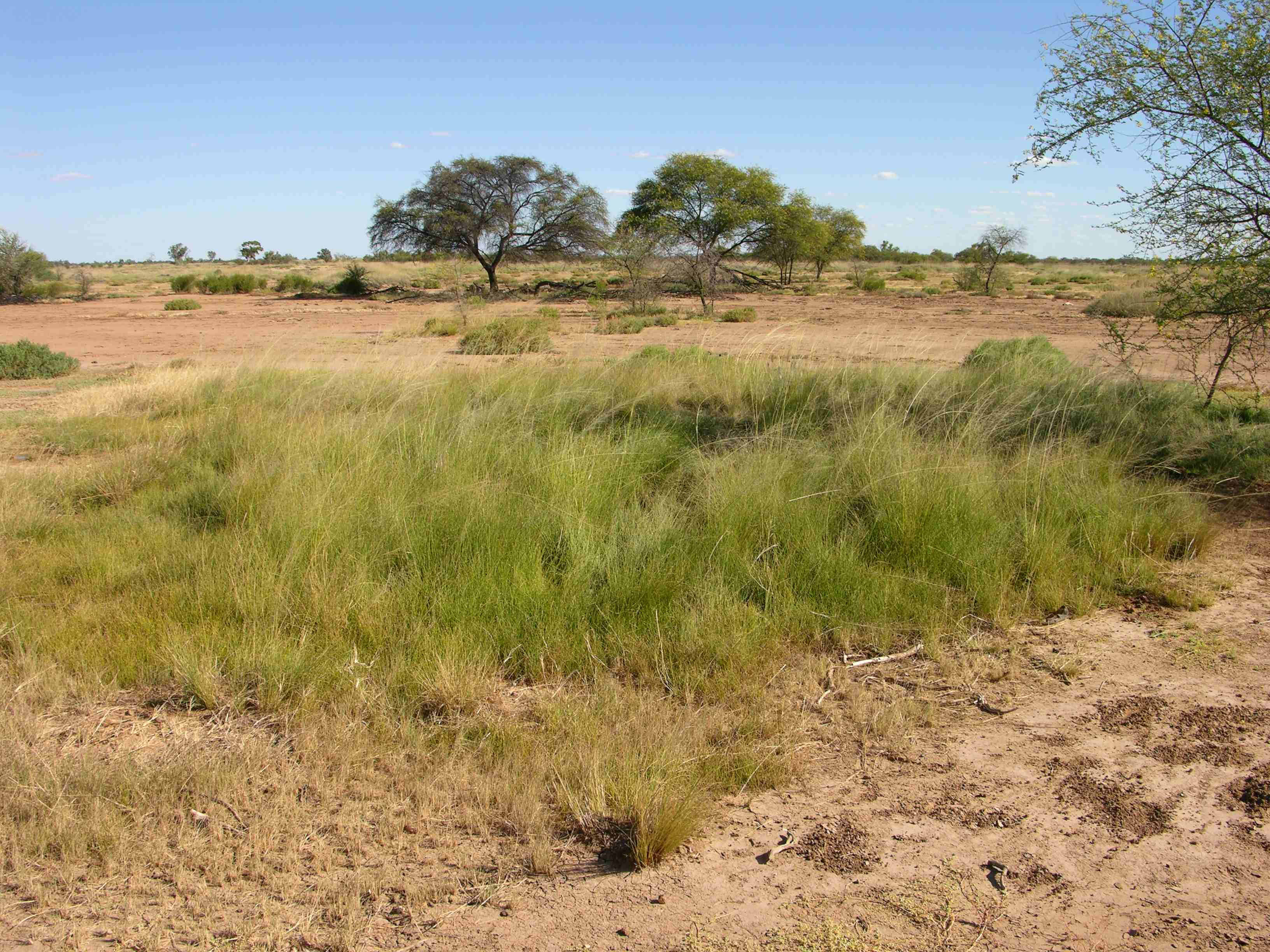
Site footer

 — Department of Environment, Science and Innovation