Walking the landscape—catchment stories—Pine Catchment
To effectively manage a catchment it is important to have a collective understanding of how the catchment works. Catchment stories, using map journals, integrate spatial information, photographs and animations with an informative narrative to demonstrate the features of catchments.
This story describes the location, extent and values of the Pine Catchment. It demonstrates the key features which influence water flow, including geology, topography, rainfall and run-off, natural features, human modifications and land uses.
The information was complied using the walking the landscape process, where experts systematically worked through a catchment in a facilitated workshop, to incorporate diverse knowledge on the landscape and to develop catchment stories. Others stories are under development, so watch this space!
Queensland groundwater dependent ecosystem (GDE) mapping version 1.5 includes Queensland groundwater dependent ecosystem mapping from version 1.4 (surface GDE points, lines, and terrestrial and surface GDE areas) with revised mapping for the eastern Murray-Darling Basin. It includes Queensland groundwater dependent ecosystem (subterranean GDE areas) mapping from version 1.4.
Potential GDE aquifer mapping v1.5—Eastern Murray Darling Basin
Updated Potential GDE aquifer mapping v1.5—Eastern Murray Darling Basin layer includes potential GDE aquifer mapping from version 1.4 with additional mapping for the eastern Murray-Darling Basin.
Wetland projects search tool
The wetland projects search tool, has been updated to include projects from NQ Dry Tropics and Moreton Bay Regional Council.
Intertidal and Subtidal Habitat Mapping and Conservation Values Assessment for Central Queensland State Waters
The WetlandUpdate is a regular bulletin sent to subscribers to provide them with the latest WetlandInfo resources and tools, as well as case studies, video information and new project fact sheets.
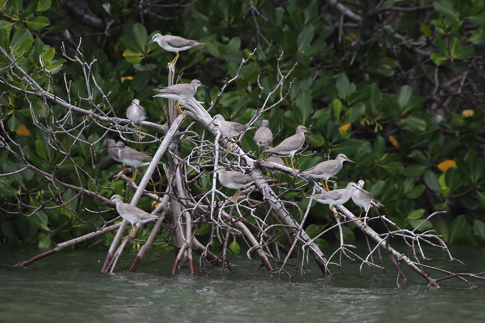
Our WetlandInfo feature bird is Tringa brevipes, commonly known as the grey-tailed tattler. These breed in Siberia and migrate along the East Asian-Australasian Flyway when not breeding. Grey-tailed tattlers live in sheltered areas of coastline on intertidal mudflats and rock platforms where they feed on small invertebrates.
WetlandInfo updates this section regularly, so stay tuned for more!
Department of Environment, Science and Innovation, Queensland (2017) WetlandUpdate April 2017, WetlandInfo website, accessed 18 March 2024. Available at: https://wetlandinfo.des.qld.gov.au/wetlands/resources/publications/latest-news/2017-04-12.html


 — Department of Environment, Science and Innovation