

|
|
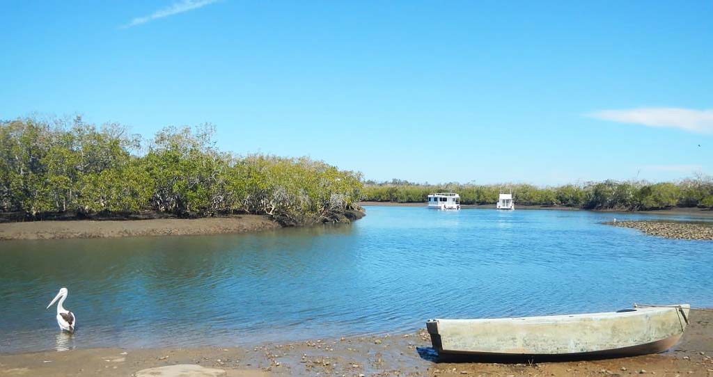
Queensland Intertidal and Subtidal Ecosystem Classification SchemeThe 'Queensland Intertidal and Subtidal Ecosystem Classification Scheme' uses the biological, physical and chemical characteristics of the water column and sea floor to classify intertidal and subtidal ecosystems, which includes estuarine and marine environments. The scheme develops a common understanding and language of classification to improve communication and lead to better management outcomes. It provides a structured framework and understanding available for mapping. 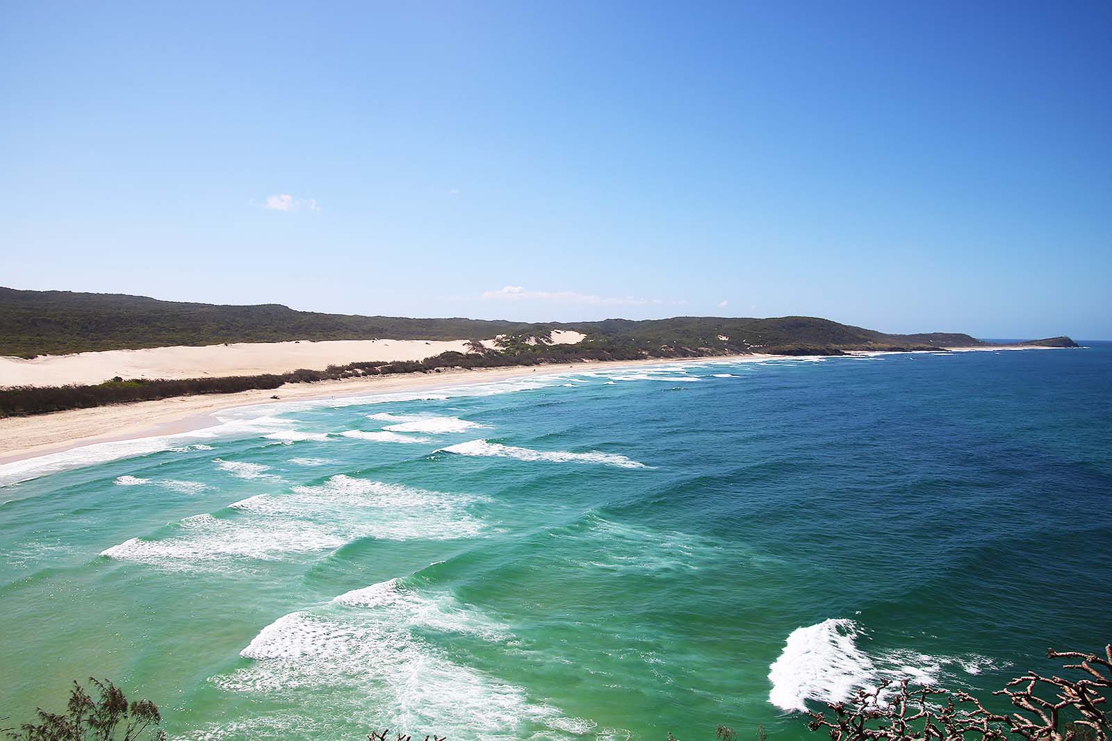 Quick links
Purpose
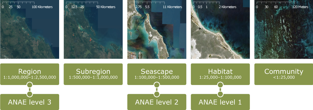
The purpose of the 'Queensland Intertidal and Subtidal Classification Scheme' (the scheme) is to develop a common understanding and language of classification that will improve communication and lead to better management outcomes for intertidal and subtidal ecosystems. The classification scheme provides a structured framework for classifying intertidal and subtidal ecosystems, which can be used to describe and identify ecosystem types (typology) and to map ecosystem types and biophysical attributes. The scheme provides a transparent, scientifically robust and logical approach to developing foundational ecological information upon which management, decision making and research can be built. It is flexible to ensure that the attributes are relevant to a broad range of purposes, allowing for the production of different typologies to address specific needs, such as a management question or research topic. The scheme integrates with and complements other relevant state and national mapping, datasets and classification schemes. For example, it adapts and extends the Australian National Aquatic Ecosystem framework and Queensland’s attribute-based classification and typology for freshwater ecosystems. The scheme will be particularly relevant to those who have a role in managing or mapping intertidal and subtidal ecosystems in Queensland. ScaleThe scheme has been designed for intertidal and subtidal ecosystems in Queensland and can be applied at five levels (scales)—regional, subregion, seascape, habitat and community. While intended for Queensland conditions, the scheme can be applied to any Australian or international systems. For each spatial scale there is a set of attributes across the themes of terrain, substrate, biota and hydrology (chemical and physical). A detailed list of attributes is available to accommodate a wide range of uses. Depending on the purpose, not all of these attributes may be necessary for a specific classification scheme. Attributes of the scheme are outlined in Module 1 (Appendix, s6.1). Application of the classification scheme at a particular level will depend on the availability of the underlying attribute data.
Development and application of attributes
Biological, physical and chemical factors (attributes) influence the nature and extent of ecosystems. Attribute-based classification separates the classification of attributes (e.g. depth, sediment size) from the designation of types (typology i.e. combinations of attributes) for a particular purpose (e.g. ecosystems). The scheme uses an attribute-based approach to describe and define ecosystem types by classifying intertidal and subtidal ecosystems based upon their biological, physical and chemical attributes. The scheme allows for classification of the water column (the vertical water mass between the water surface and the sea floor) or benthic (sea floor) environments while acknowledging their interactions. Spatial attributes provide information on the relative position, size and location of features. Attribute qualifiers provide further information on attributes such as naturalness, variability over time and cover. Habitat condition is not dealt with in the scheme, but some attributes and qualifiers may be useful as an input to condition assessments. Development of the methodThe three stages of the scheme are attribute classification, typology and mapping. Outputs are produced from each of these steps. 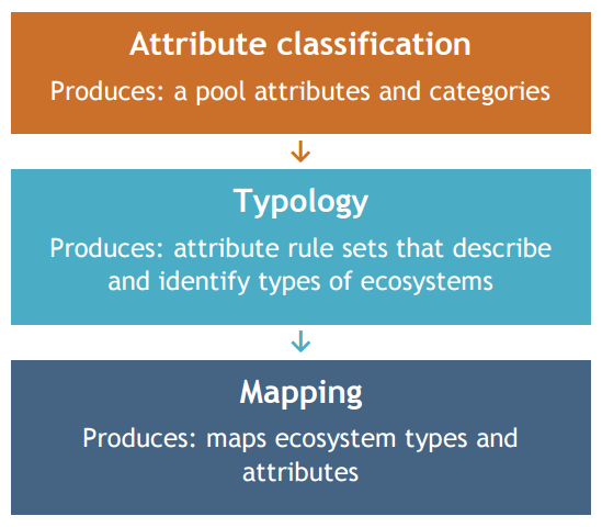
Additional information
Last updated: 24 September 2020 This page should be cited as: Department of Environment, Science and Innovation, Queensland (2020) Queensland Intertidal and Subtidal Ecosystem Classification Scheme, WetlandInfo website, accessed 18 March 2024. Available at: https://wetlandinfo.des.qld.gov.au/wetlands/what-are-wetlands/definitions-classification/classification-systems-background/intertidal-subtidal/ |

Site footer

 — Department of Environment, Science and Innovation