The Interim Queensland River Classification Scheme (the QRCS) has been developed using an attribute-based classification approach. The attributes fall into 8 themes including climate, terrain, geology, substrate (physical and chemical), hydrology (physical and chemical), and biota.
Attribute qualifiers provide extra information on the category of an attribute and are similar to modifiers in other classification schemes[1].
The QRCS features eight levels or scales at which attributes can be determined. This is to ensure that the scheme can be applied by a wide variety of scientists and practitioners at different scales. The regional, landscape and habitat levels are compatible with the ANAE (national) classification.
The collapsible list below lists all of the QRCS attributes, nested within the relevant themes. Clicking on each attribute or using the search function expands each attribute to provide a description and rationale for use. Select attributes also contain references and links, and relevant categories.
Some of the QRCS attributes can be measured in a number of ways, applying statistical or spatial measures. Possible examples inlcude:
Statistical measures
Spatial measures
Average
Width
Minimum
Density
Maximum
Fragmentation
Variability
Continuity
Instantaneous
Patchiness
Enter text below to search river classification attributes:
Displaying * of * attributes
Biota
Bare ground
Theme
Biota
Attribute
Bare ground
Description
The amount of bare ground in a given area. This does not include areas of biofilms and dead vegetation.
Rationale for use
The amount of bare ground can be an indicator of the surface properties of an area such as the resistance to erosion. This is often determined as a percentage.
References and links
-
Categories
-
Bioregion
Theme
Biota
Attribute
Bioregion
Description
Bioregions delineate regions with a similar set of major environmental influences (climate, geomorphology, landforms and lithology) that shape the occurrence of flora and fauna and their interaction with the physical environment.
Rationale for use
There are 13 bioregions in Queensland which describe the primary level of biodiversity. The bioregion is the first level of classification under the Regional Ecosystem framework.
Crown cover, frequently referred to as canopy cover, is the percentage of the ground surface covered by the vertical projection of the periphery of plant crowns.
Rationale for use
Crown cover influences rain splash erosion as the canopy intercepts the rain and also provides shading. The canopy can be indicative of evapotranspiration, and the ground area of roots. This may be determined spatially as fragmentation or density.
References and links
-
Categories
-
Flora composition of dominant macro- and benthic algae
Theme
Biota
Attribute
Flora composition of dominant macro- and benthic algae
Description
The dominant type of macro- and benthic algae that contributes most to the overall above-substrate biomass of the ecosystem.
Rationale for use
This can be used to describe the habitat and primary productivity in a specified area.
References and links
-
Categories
diatoms
cyanobacteria
filamentous algae
periphyton
macroalgae
Flora composition of dominant plants
Theme
Biota
Attribute
Flora composition of dominant plants
Description
Flora composition refers to the genus of dominant or predominant flora, that is the species that contributes most to the overall above-ground biomass of the ecosystem.
Rationale for use
This attribute can be used to help describe the likely habitat that an area may provide.
Growth form refers to the growth form of vegetation in the ecologically dominant stratum.
Rationale for use
The morphological characteristics of vegetation can indicate the likely processes they influence. Different growth forms have varying resistance to flow and to wind which in turn alters their influence on sediment transport.
Growth height refers to the height of vegetation in the ecologically dominant stratum relative to their growth form.
Rationale for use
The height of trees relative to the bankfull width of a channel influences how the wood may be arranged in the channel if it falls. If the tree is longer than the bankfull width it can bridge the channel and is more likely to form jams.
The total amount of carbon that is fixed by primary producers during photosynthesis over a set time interval. This is usually evaluated over a 24 hour cycle.
Rationale for use
This attribute is one of a suite of measures of ecosystem metabolism and influences ecological processes at different scales.
Overall metabolism of the system based on balance between gross primary production and respiration. This is usually evaluated over a 24 hour cycle.
Rationale for use
This attribute is an overall measure of ecosystem metabolism and influences ecological processes at different scales.
References and links
-
Categories
autotrophic
heterotrophic
balanced
Presence of bioengineered substrate
Theme
Biota
Attribute
Presence of bioengineered substrate
Description
The presence of engineered substrate from fauna that modify substrate characteristics. Examples of fauna that modify substrate include atyid shrimp, crayfish, carp, platypus, bony bream and pigs.
Rationale for use
The action of the substrate being bioengineered can create habitat areas for other species and may also contribute to erosion issues.
References and links
-
Categories
presence
absence
Presence of in-channel non-wetland indicator species
Theme
Biota
Attribute
Presence of in-channel non-wetland indicator species
Description
The presence of non-wetland indicator species growing in the channel. These plants are not specifically adapted to be wetland species.
Rationale for use
The presence of these species can be an indicator of past disturbances or changes. They may indicate a completely disconnected channel or an ephemeral system going through a major drying period. Their presence may be measured as a count, density or fragmentation. A list of flora wetland indicator species is available.
Vegetation communities in a bioregion that are consistently associated with a particular combination of geology, landform and soil.
Rationale for use
Understanding broadscale ecosystems provides an indication of the ecosystem functions that an area may perform. The Regional Ecosystem Description Database (REDD) is maintained by the Queensland Herbarium.
The density of roots provides an indication of the strength that plants may provide to a soil or sediment. This is often measured as an average or maximum, or may separately be calculated for sub-aerial roots.
References and links
-
Categories
-
Root depth
Theme
Biota
Attribute
Root depth
Description
The root depth that plants penetrate into the riverbed or riverbank.
Rationale for use
The rooting depth can influence the strength of a riverbank. Understanding the rooting depth relative to the height of the riverbank helps in predicting the influence of the roots on erosion processes. This is often measured as an average or maximum.
References and links
-
Categories
-
Timing of leaf drop
Theme
Biota
Attribute
Timing of leaf drop
Description
The dominant timing of leaf drop.
Rationale for use
This may alter the input of nutrients into the river.
References and links
-
Categories
none
constant
dry season
autumn
Vegetation cover
Theme
Biota
Attribute
Vegetation cover
Description
Vegetation cover is the percentage of the ground or water surface covered by vegetation and biological crusts in contact with the soil surface or the vertical projection of the periphery of plant crowns. It incorporates crown cover and the foliage projective cover of the ground layer.
Rationale for use
Vegetation cover is a more encompassing attribute than 'Crown cover' and includes all vegetation rather than just the predominant canopy layer. This can, for example, be used to look at the effects of raindrop impact and its implications on soil erosion.
References and links
-
Categories
-
Vegetation palatability
Theme
Biota
Attribute
Vegetation palatability
Description
The likelihood that the vegetation will be consumed by fauna.
Rationale for use
The palatability of vegetation indicates its likely residence time.
References and links
-
Categories
high
medium
low
unknown
Vegetation roughness
Theme
Biota
Attribute
Vegetation roughness
Description
The cumulative roughness that vegetation places on flow in an area.
Rationale for use
Vegetation roughness is often combined with substrate roughness and channel form to give a value of hydraulic resistance.
This is often measured as an average, maximum or minimum value. Measures such as the multi-decadal mean annual daily temperature are also used. The air temperature affects the ground surface and vegetation and may influence the type of vegetation present.
Aridity index refers to an indicator of the degree of dryness of the climate at a given location based on mean annual precipitation and mean evapotranspiration.
Rationale for use
The aridity index can be used to indicate areas suitable for different land uses, and may help identify channels with intermittent or ephemeral flows.
Climate classes represent six major groups at the regional scale considering the climatic limitations of native vegetation. Climate classes at the landscape scale refine these major groups into 27 groups considering the seasonal distribution of temperature and precipitation.
Rationale for use
These classes are an objective way to classify climate, based on the Köppen scheme. Classification incorporates mean monthly rainfall, annual rainfall, maximum temperatures, and minimum temperatures based on the standard 30-year period from 1961-1990.
Often the ecosystem is adapted to the dominant energy source.
References and links
-
Categories
water
air
heat
light
Effective precipitation
Theme
Climate
Attribute
Effective precipitation
Description
The average amount of precipitation that reaches a stream channel as direct runoff. This is usually calculated by subtracting the amount of evapotranspiration in an area from the total precipitation over the same area and duration.
Rationale for use
This is often measured as an average or variability. Knowledge of the amount of runoff from effective precipitation can be used to help estimate other sources of water in the channel.
References and links
-
Categories
-
Evaporation
Theme
Climate
Attribute
Evaporation
Description
A measure of the amount of surface liquid water transformed to water vapour.
Rationale for use
The amount of evaporation can alter the amount of precipitation that is available as runoff. This may be determined as a total, average, variability or maximum.
A measure of the combined loss of water by evaporation and transpiration.
Rationale for use
The amount of evapotranspiration can alter the amount of precipitation that is available as runoff. Evapotranspiration is more difficult to measure than evaporation as it requires measuring the amount of water being transpired by plants.
The average amount of heat emitted as surface terrestrial radiation.
Rationale for use
The amount of heat, for example, can influence the rate and volume of evaporation. This attribute is usually evaluated as an annual average.
References and links
-
Categories
-
Kinetic energy of raindrops
Theme
Climate
Attribute
Kinetic energy of raindrops
Description
As raindrops fall from the sky they gain kinetic energy due to gravity.
Rationale for use
The kinetic energy of raindrops can be used as an indicator of their potential to detach soil, often measured using a rainfall intensity relationship. The kinetic energy of rain, both volume-specific and time-specific, can affect the rain erosivity index and the detachment of soil particles.
References and links
Salles, C, Poesen, J & Sempere-Torres, D (February 2002), 'Kinetic energy of rain and its functional relationship with intensity', Journal of Hydrology. [online], vol. 257, no. 1-4, pp. 256-270. Available at: https://linkinghub.elsevier.com/retrieve/pii/S0022169401005558 [Accessed 5 October 2023].
Categories
-
Light/solar radiation
Theme
Climate
Attribute
Light/solar radiation
Description
The amount of light or solar radiation.
Rationale for use
This is usually evaluated as an annual average. Solar radiation can control other processes such as photosynthesis.
References and links
-
Categories
-
Phase-offset
Theme
Climate
Attribute
Phase-offset
Description
Phase-offset refers to the difference (in months) between the timing of maximum mean annual precipitation and mean potential evapotranspiration.
Rationale for use
This attribute displays the variability in the supply of water and energy, which ultimately drives the surface freshwater availability in Australia.
The transfer of water, as water vapour, to the atmosphere from vegetated and un-vegetated land surfaces.
Rationale for use
This may be determined as a total, average, variability or total maximum. Potential evapotranspiration is calculated as the amount of evapotranspiration that would occur assuming that a sufficient water source is available. This attribute can inform a water balance for an area.
The amount of precipitation that an area receives over a specified period of time.
Rationale for use
This is often reported as the annual average. The total precipitation that falls in an area can be indicative of the likely river discharges and sediment loads. High discharges often result in continuous river systems with higher sediment loads. Low discharges can mean lower sediment yields and may mean less well developed channels. There are also linkages with likely vegetation cover.
The month that receives the highest monthly rainfall, whereby the monthly average is calculated using 30 years of monthly gridded rainfall data between 1981 and 2010.
Rationale for use
This can be useful to understand seasonal patterns of precipitation.
The amount of moisture in the air as a percentage of the amount the air can hold.
Rationale for use
Humidity can, for example, be used to understand the likely conditions for plant growth. This may be measured and averaged over several time intervals (e.g. hourly) to give a daily average.
References and links
-
Categories
-
Wind direction
Theme
Climate
Attribute
Wind direction
Description
The dominant wind direction based on the direction the wind originates from.
Rationale for use
The dominant wind direction could be used to assess the dominant wave direction in a body of water. This has implications for sediment transport and erosion.
References and links
-
Categories
North
North East
East
South East
South
South West
West
North West
Unknown
Wind velocity
Theme
Climate
Attribute
Wind velocity
Description
The speed of the wind in an area.
Rationale for use
Wind speed influences the rate of aeolian transport. Areas with consistently high wind speeds can also restrict the type of vegetation that can grow. This attribute is usually evaluated as an annual average.
References and links
-
Categories
-
Geology
Geology
Theme
Geology
Attribute
Geology
Description
Physical characteristics of underlying rock.
Rationale for use
The underlying geology can control interactions with groundwater, the surface soil type and depth, and the slope.
A measure of the transparency of water, typically measured using a Secchi disc. The depth to which the black and white markings on a Secchi disc can be clearly seen from the surface of the water provides an indication of light penetration.
Rationale for use
Clarity provides information on light availability for algae, submerged plants and aquatic growth.
Colour is a measure of light 'quality' of water and results from light attenuation and scattering by dissolved matter and suspended particulates. True colour is colour of water with particulates (>0.45µm) removed.
Rationale for use
The colour of natural water is mainly derived from dissolved organic matter such as humic and fulvic acids from soils and decaying organic matter. Waste discharge, dissolution of metals, oxidisation and bacteria can also influence water colour. Water colour impacts the light availability for aquatic plants (i.e. macrophytes) to grow and survive. Water colour can also impact aquatic ecosystems by interfering with interactions of species and their food source. High humic waters can disturb prey detection and foraging ability of fish species to source their food.
A total measure of major cations in water, predominantly calcium and magnesium.
Rationale for use
Water hardness can alter the type of chemical reactions taking place in the water and may also be a habitat requirement for some species of biota.
References and links
-
Categories
-
Mixing state
Theme
Hydrology (chemical)
Attribute
Mixing state
Description
Characterises the homogeneity of the water column.
Rationale for use
Stratification and mixing states can have a huge influence on water quality and ecology. This attribute may need a period qualifier attached to it as the mixing state may change seasonally.
The portion of river sediment load carried suspended in the water column for a time. It may remain suspended or settle to the bed.
Rationale for use
The suspended load can influence the clarity of the water changing the habitat for biota. The suspended load is also part of the sediment budget for the river system.
References and links
-
Categories
-
Suspended sediment hysteresis
Theme
Hydrology (chemical)
Attribute
Suspended sediment hysteresis
Description
This describes the nonlinear relationship between discharge and suspended sediment concentration.
Rationale for use
This often reflects a lag time between peak discharge and suspended sediment concentration or sediment exhaustion before the peak. A clockwise hysteresis loop is when sediment concentrations are higher on the rising limb of the hydrograph compared to the falling limb.
References and links
-
Categories
none
clockwise
anticlockwise
Total dissolved load
Theme
Hydrology (chemical)
Attribute
Total dissolved load
Description
The portion of the river sediment load carried in solution. Solutes may be organic and inorganic and are usually <0.45µm in diameter.
Rationale for use
The dissolved load is a proportion of the sediment budget of the system. The concentration of ions in the dissolved load can create different habitat conditions.
References and links
-
Categories
-
Total Suspended Solids
Theme
Hydrology (chemical)
Attribute
Total Suspended Solids
Description
Small particles of insoluble material (sediment, plankton, organic matter) suspended in water.
Rationale for use
These particles affect the clarity of the water.
References and links
-
Categories
-
Trophic state
Theme
Hydrology (chemical)
Attribute
Trophic state
Description
A measure of the productivity of aquatic ecosystems, in terms of organic carbon produced per unit of time and surface. Waters with low productivity are termed oligotrophic and waters with high productivity eutrophic.
Rationale for use
This provides an understanding of the primary productivity in a body of water.
A measure of the 'cloudiness' of water, often measured as light scattering by suspended particles in the water column.
Rationale for use
It can provide an indirect indication of both light penetration and suspended solids but the relationships between turbidity and these other indicators vary in different waters.
The forms of nitrogen in water that directly support biological processes such as growth of phytoplankton. This includes dissolved and particulate inorganic nitrogen and mineralisable forms of organic nitrogen.
Rationale for use
Bioavailable nitrogen indicates the proportion of total nitrogen that is available to biota.
References and links
-
Categories
-
Water - bioavailable phosphorous
Theme
Hydrology (chemical)
Attribute
Water - bioavailable phosphorous
Description
The forms of phosphorus in water that directly support biological processes such as growth of phytoplankton. This includes filterable reactive phosphorus and mineralisable forms of organic phosphorus.
Rationale for use
Bioavailable phosphorous indicates the proportion of total phosphorus that is available to biota.
References and links
-
Categories
-
Water - dissolved inorganic nitrogen
Theme
Hydrology (chemical)
Attribute
Water - dissolved inorganic nitrogen
Description
A measure of the dissolved (<0.45µm) forms of inorganic nitrogen in water. Calculated by addition of oxidised nitrogen and ammonia nitrogen.
Rationale for use
Dissolved inorganic nitrogen is a measure of the nitrogen forms directly available for biotic uptake and biological processes.
A measure of the dissolved (<0.45µm) forms of organic carbon in the water.
Rationale for use
Dissolved organic carbon is used by heterotrophic microorganisms to fuel biological processes. Dissolved organic carbon can be detrimental to water quality in high concentration as decomposition can use up available dissolved oxygen.
References and links
-
Categories
-
Water - Dissolved organic nitrogen
Theme
Hydrology (chemical)
Attribute
Water - Dissolved organic nitrogen
Description
A measure of the dissolved (<0.45µm) forms of organic nitrogen in water. Calculated by subtracting dissolved inorganic nitrogen (DIN) from total dissolved nitrogen.
Rationale for use
Organic forms of nitrogen can be less favourable for biotic uptake as energy is required to metabolise organic forms for use in biological processes. Organic forms are often the major component of total nitrogen.
Dissolved oxygen in water is essential for life processes of most aquatic organisms, and is influenced by photosynthesis, respiration and atmospheric exchange processes.
Rationale for use
Stagnant water, small waterhole surface area and a long duration between flow events can cause low DO levels. Low DO levels can contribute significant stress to aquatic species and in extreme cases result in fish kills.
Dissolved oxygen saturation in water is a measure of dissolved oxygen relative to the maximum concentration at equilibrium given salinity, temperature and atmospheric pressure.
Rationale for use
Dissolved oxygen saturation provides an indication of oxygen availability, use and production.
References and links
-
Categories
-
Water - electrical conductivity
Theme
Hydrology (chemical)
Attribute
Water - electrical conductivity
Description
A measure of the amount of dissolved salts in the water, and therefore an indicator of salinity.
Rationale for use
Variability in conductivity may occur between water bodies due to different geological and soil conditions in a catchment. Low flows can induce high conductivity through evaporative concentration of dissolved salts. Fish or invertebrates may be adapted to certain ranges of conductivity, and shifts beyond natural ranges can reduce habitat suitability or become toxic at high concentration.
A measure of all forms of phosphorus in water that pass through an 0.45µm filter and react with molybdenum blue reagent. This fraction is largely comprised of orthophosphate.
Rationale for use
Filterable reactive phosphorus is a readily available form of phosphorus for biotic uptake and biological processes.
Describes the relative abundance of major anions and cations in the water.
Rationale for use
Ionic composition can be used to trace changes in chemical composition of the water, indicating mixing of water or contamination.
References and links
-
Categories
-
Water - oxidised nitrogen
Theme
Hydrology (chemical)
Attribute
Water - oxidised nitrogen
Description
A combined measure of the oxidised forms of nitrogen (nitrate and nitrite) in water.
Rationale for use
Oxidised nitrogen is a form of nitrogen directly available for biotic uptake. In well oxygenated conditions oxidised nitrogen is largely composed of nitrate, which is a highly mobile form and common contaminant of waters.
pH refers to the acidity or alkalinity of water on a scale of 0 to 14.
Rationale for use
pH has a major impact on both habitat conditions and biota found at a location. pH may be influenced by the surrounding landscape (geological setting, water balance, quality, type of soils, vegetation and land use) which in turn dictates habitat of the aquatic environment. Changes in pH can influence the survival of organisms if it is outside of their usual habitat range. The acidity or alkalinity can alter chemical processes in the water.
Salinity refers to the amount of dissolved salt in the water.
Rationale for use
The salinity has a major impact on both habitat conditions and biota found at a location. Salinity can also cause flocculation of cohesive particles such as silts and clays.
Aquifer confinement is the level of interaction of the source aquifer with ground surfaces conditions (e.g. rainfall). Aquifers can range in their degree of confinement.
Rationale for use
Understanding the confinement of an aquifer can indicate how susceptible it is to changes in surface conditions such as point source or diffuse pollution.
Aquifer Groundwater Flow Systems depict groundwater flow systems at a habitat scale based on their hydrogeological characteristics using a combination of geology, geomorphology and topographical information.
Rationale for use
Groundwater flow systems are characterised by their flow path lengths and corresponding ability to respond to hydrological change caused by alteration to the natural environment.
Commonly the name of the source aquifer refers to the geological formation in which it exists.
References and links
-
Categories
For full list refer to REDD database
Bankfull discharge
Theme
Hydrology (physical)
Attribute
Bankfull discharge
Description
Discharge at a point in the river that occurs at bankfull water height.
Rationale for use
This is a standardised measure of the volume of water that is being moved through the channel. This measurement is a way to compare different river systems.
References and links
-
Categories
-
Catchment channel flow yield
Theme
Hydrology (physical)
Attribute
Catchment channel flow yield
Description
The discharge for a time interval divided by the catchment area (volume/area). This is often calculated annually.
Rationale for use
This is a standardised approach to compare the volume discharged from a catchment so that different sized catchments can be compared. This may be determined as an average, minimum or variability.
References and links
-
Categories
-
Channel flood frequency
Theme
Hydrology (physical)
Attribute
Channel flood frequency
Description
The frequency of floods that a channel experiences. This is frequently described as either the annual exceedance probability (AEP) or the average recurrence interval (ARI).
Rationale for use
The AEP describes the probability of a certain discharge magnitude occurring in a single year and is measured as a percentage. If a flood has an AEP of 1%, it has a one in 100 likelihood of occurring in any given year. Alternatively, the ARI describes the average time period between discharges of a certain magnitude. An ARI of 100 years means a discharge is likely to occur once every 100 years. ARI is often used for planning purposes, however the AEP is a more intuitive measure.
References and links
-
Categories
-
Channel flow discharge
Theme
Hydrology (physical)
Attribute
Channel flow discharge
Description
The volume of water that flows through a point in the river in a specified period of time. It is often quantified annually as ML/year. It is also frequently calculated at the end catchment outlet.
Rationale for use
This is a comparative measure of how much water is being transferred through the river channels. This may be determined as an average, variability, minimum or maximum. Sometimes the relative timing of peaks in the hydrograph are considered.
References and links
-
Categories
-
Degree of hyporheic connectivity
Theme
Hydrology (physical)
Attribute
Degree of hyporheic connectivity
Description
Describes the degree of connection between the water column and the hyporheic zone.
Rationale for use
The connection of the hyporheic zone with the channel can change the water chemistry and temperature.
References and links
-
Categories
-
Degree of parafluvial connectivity
Theme
Hydrology (physical)
Attribute
Degree of parafluvial connectivity
Description
Describes the degree of connection between the water column and the parafluvial zone.
Rationale for use
The connection of the parafluvial zone with the channel can change the water chemistry and temperature.
References and links
-
Categories
-
Energy
Theme
Hydrology (physical)
Attribute
Energy
Description
The energy that a body of water exerts on its boundary. One way this can be quantified is by stream power.
Rationale for use
The range in stream power provides information about how the energy in the channel changes. Is it consistently high or does it have a high point and then decline, or is it consistently low?
References and links
-
Categories
-
Floodplain flood velocity
Theme
Hydrology (physical)
Attribute
Floodplain flood velocity
Description
The velocity of water on the floodplain.
Rationale for use
The speed of water on the floodplain can help determine its ability to erode and deposit sediment. This can be determined at specified heights/stages during the flood.
References and links
-
Categories
-
Flow response (lag) time
Theme
Hydrology (physical)
Attribute
Flow response (lag) time
Description
This is the elapsed time between peak precipitation in an event and peak discharge. Lag time can be influenced by a range of factors including catchment size, slope, vegetation coverage and surface permeability.
Rationale for use
Short lag times are indicative of a flashy river system and long lag times can indicate dampening of the flood by the floodplain and slower moving pulses.
References and links
-
Categories
-
Groundwater - surface water connectivity
Theme
Hydrology (physical)
Attribute
Groundwater - surface water connectivity
Description
Describes the connection and direction of flow between channel and groundwater.
Rationale for use
The connectivity with the groundwater indicates whether the system is losing water into the groundwater or is gaining from the groundwater.
The degree of energy loss in fluid flow as a result of roughness. The roughness may be at differing scales including sediment grains, bedforms and channel form such as meander bends as well as vegetation.
Rationale for use
The roughness of the channel reduces the flow velocity, especially near the boundary. This can change the energy that is exerted on the boundary. Manning's n is a common co-efficient used to approximate hydraulic resistance in a channel.
References and links
-
Categories
-
Length of time water is at bankfull
Theme
Hydrology (physical)
Attribute
Length of time water is at bankfull
Description
The average period of flows at or above bankfull. This could be the annual average.
Rationale for use
The length of time at bankfull or higher increases the time that water can infiltrate into the channel banks resulting in increased bank storage.
References and links
-
Categories
-
Period of no flow
Theme
Hydrology (physical)
Attribute
Period of no flow
Description
The length of time that there is no surface flow in the channel during a set time interval. There may still be standing water that is not flowing.
Rationale for use
This attribute describes the likelihood that the river will cease to flow or be dry for a period during a year. This can result in disconnection where parts of the river may dry out.
References and links
-
Categories
-
Permanence of water in channel
Theme
Hydrology (physical)
Attribute
Permanence of water in channel
Description
Permanence of water refers to the length of time and how regularly a channel has water in it.
Rationale for use
The length of time and frequency of water in a channel can impact biota that may live in the wetland.
Describes the length of time and frequency that water is present in the larger landform unit of the floodplain.
Rationale for use
Refugia can depend on the presence of water.
References and links
-
Categories
permanent
near permanent
intermittent
ephemeral
unknown
Photosynthetically active radiation (PAR)
Theme
Hydrology (physical)
Attribute
Photosynthetically active radiation (PAR)
Description
A measure of the solar radiation available for photosynthesis.
Rationale for use
Plants have optimal photosynthesis in the PAR wavelengths of 400-700 nm. The PAR received in an area is a controlling factor in the efficacy of plant production through photosynthesis. The PAR is further influenced by canopy shading of the channel and the turbidity.
The ratio of groundwater volume to the total volume of channel discharge.
Rationale for use
The chemistry, temperature and sediment of the groundwater flow can be very different to the stream flow coming from runoff into the channel.
References and links
-
Categories
-
Rate of recession
Theme
Hydrology (physical)
Attribute
Rate of recession
Description
The rate of water surface elevation (stage) change over time as flows are decreasing after an event peak.
Rationale for use
The maximum rate of recession indicates the likely drainage of the riverbank compared to the water surface levels. Fast recession in a slowly draining riverbank can lead to the bank being heavy and unsupported resulting in mass failures.
References and links
-
Categories
-
Rate of rise
Theme
Hydrology (physical)
Attribute
Rate of rise
Description
The rate of water surface elevation (stage) change over time as flows are increasing before an event peak. This is also referred to as the rising limb.
Rationale for use
The speed at which the water rises in the channel can influence the slaking of sediment and how quickly sub-aerially prepared sediment is entrained.
References and links
-
Categories
-
Relative dominance of water source
Theme
Hydrology (physical)
Attribute
Relative dominance of water source
Description
The water source is the broad part of the environment that water is generated from, such as ground or surface waters. Dominance is defined as being the primary source of water for more than 70% of the time (based on Wetland Classification Scheme attribute).
Rationale for use
The water source controls the water chemistry including the temperature.
The force of water moving against the channel boundaries and/or broader landscape. This is calculated as force per unit area. It can be applied in the channel or floodplain, or can be applied as a bankfull shear stress.
Rationale for use
This may be determined as an average, variability or maximum. Shear stress is an indicator of the forces of water movement acting on the channel boundary. Shear stress is a determinant of sediment entrainment and transport, and also a determinant of habitat suitability for many aquatic biota. The boundary shear stress provides quantification of the lift forces being applied at the channel boundary that can influence erosion.
References and links
-
Categories
-
Time to sink
Theme
Hydrology (physical)
Attribute
Time to sink
Description
The length of time it takes for water to travel from the most distal point in the upper catchment to the catchment outlet or sink. This is commonly referred to as the time of concentration.
Rationale for use
This is a theoretical relationship and describes a property of the catchment that can influence, for example, how fast solutes may travel through the system.
References and links
-
Categories
-
Topographic drainage (landscape)
Theme
Hydrology (physical)
Attribute
Topographic drainage (landscape)
Description
Topographic drainage refers to where water flows and drains across the land surface based on drainage-enforced elevation models. At the landscape scale these equate to the drainage basins dataset.
Rationale for use
The categories show the landscape scale divisions of water flow directions across land surfaces. They indicate which areas are likely to supply water to river systems.
For full list refer to Drainage Basin Sub Areas - Queensland
Topographic drainage (region)
Theme
Hydrology (physical)
Attribute
Topographic drainage (region)
Description
Topographic drainage refers to where water flows and drains across the land surface based on drainage-enforced elevation models. At the regional scale these equate to the drainage divisions determined by the Australian Water Resources Management Committee (WRMC).
Rationale for use
The categories show the broad division of water flow directions across land surfaces. They indicate which areas are likely to supply water to the coast and which supply water inland.
The depth of water. This may be determined spatially such as over a reach or temporally over a year.
Rationale for use
The water depth can inform the likely conditions for appropriate habitats of some species. It is often referred to as the stage at gauging stations where it is measured against elevation. This may be quantified as maximum, instantaneous, average or variability.
References and links
-
Categories
-
Water source distance
Theme
Hydrology (physical)
Attribute
Water source distance
Description
Describes the maximum travel distance that the water source (e.g. groundwater, surface water, both groundwater and surface water) takes to deliver water to a point of interest.
Rationale for use
This describes the distance between two specific features, for example a groundwater aquifer and a waterhole. This information can inform on maximum distance or area that needs to be managed for water supply.
References and links
-
Categories
-
Water turbulence
Theme
Hydrology (physical)
Attribute
Water turbulence
Description
A measure of the mixing of the water. Turbulence produces a three-dimensional flow field with eddies occurring due to morphology, grain roughness and vegetation.
Rationale for use
An understanding of the three-dimensional flow velocities can aid in determining the mixing of water, which can relate to the dissipation of zones of velocity and temperature.
References and links
-
Categories
-
Water velocity
Theme
Hydrology (physical)
Attribute
Water velocity
Description
The variability in water velocities at an instant in time measured across an area of interest. This may be quantified using the coefficient of variation.
Rationale for use
This may be determined as an instantaneous variation or temporal variation. This attribute provides information on the likely velocities that may influence habitat or sediment flux across an area of interest.
References and links
-
Categories
-
Water velocity at bankfull
Theme
Hydrology (physical)
Attribute
Water velocity at bankfull
Description
A measure of the channel cross-section velocities at bankfull discharge.
Rationale for use
This is often determined as an average, and the bankfull channel is used as a standard for comparisons. The average can be calculated spatially in a cross-section by averaging the velocities across the channel to account for the variability in boundary roughness.
References and links
-
Categories
-
Substrate (chemical)
Substrate - acid sulfate
Theme
Substrate (chemical)
Attribute
Substrate - acid sulfate
Description
The presence of potential or actual acid sulfate in the substrate.
Rationale for use
The presence of potential or actual acid sulfate in substrate will affect site management and suitable activities. Disturbance of acid sulfate in substrates can have significant detrimental impacts on water quality and habitat.
References and links
-
Categories
Nil
Potential Acid Sulfate
Actual Acid Sulfate
Unknown
Substrate - ammonia nitrogen
Theme
Substrate (chemical)
Attribute
Substrate - ammonia nitrogen
Description
A measure of ammonia nitrogen in the substrate which includes both ionised (NH4+) and unionised (NH3) forms of ammonia.
Rationale for use
The positive charge of ionised ammonia means that it adsorbs to negatively charged sites on substrate (particularly clay) and organic particles. Its tendency to adsorb means it is not mobile within substrate, but can also be transported with eroded sediments.
The forms of nitrogen in the substrate that directly support biological processes such as growth of phytoplankton. This includes dissolved and particulate inorganic nitrogen and mineralisable forms of organic nitrogen.
Rationale for use
Bioavailable nitrogen indicates what proportion of the total is available to biota.
References and links
-
Categories
-
Substrate - bioavailable phosphorous
Theme
Substrate (chemical)
Attribute
Substrate - bioavailable phosphorous
Description
The forms of phosphorus in the substrate that directly support biological processes such as growth of phytoplankton. This includes filterable reactive phosphorus and mineralisable forms of organic phosphorus.
Rationale for use
The bioavailable phosphorous load indicates what proportion of the total load is directly available for biota.
References and links
-
Categories
-
Substrate - cation exchange capacity
Theme
Substrate (chemical)
Attribute
Substrate - cation exchange capacity
Description
A measure of the substrates capacity to hold positively charged ions, including important nutrients calcium, magnesium and potassium.
Rationale for use
Cation exchange capacity is an important measure of the substrates ability to hold and release nutrients and an indicator of substrate fertility.
References and links
-
Categories
-
Substrate - electrical conductivity
Theme
Substrate (chemical)
Attribute
Substrate - electrical conductivity
Description
A measure of the ability of the substrate (measured as a water-saturated extract) to conduct an electric current. It is often used as a metric of salinity.
Rationale for use
Differences in conductivity may occur from differences in geology and soil condition.
A measure of all forms of phosphorus in the substrate that pass through an 0.45µm filter and react with molybdenum blue reagent, this fraction is largely comprised of orthophosphate.
Rationale for use
Filterable reactive phosphorus is a readily available form of phosphorus for biotic uptake and biological processes.
Describes the relative abundance of major anions and cations in the substrate.
Rationale for use
Ionic composition can be used to trace changes in chemical composition of substrate, indicating mixing of substrate or contamination.
References and links
-
Categories
-
Substrate - organic nitrogen
Theme
Substrate (chemical)
Attribute
Substrate - organic nitrogen
Description
A measure of the organic nitrogen in the substrate. Calculated by subtracting inorganic nitrogen from total dissolved nitrogen.
Rationale for use
Organic forms of nitrogen can be less favourable for biotic uptake as energy is required to metabolise organic forms for use in biological processes. Organic forms are often the major component of total nitrogen.
A measure of the acidity or alkalinity of the substrate.
Rationale for use
pH has a major impact on both habitat conditions and biota found at a location. pH may be influenced by the surrounding landscape (geological setting, water balance, quality, type of soils, vegetation and land use). Changes in pH can influence the survival of organisms if it is outside of their usual habitat range. The acidity or alkalinity can alter chemical processes in the substrate.
A measure of all forms of phosphorus in the substrate.
Rationale for use
Total phosphorus indicates the amount of phosphorus that is both bioavailable and non- bioavailable.
References and links
-
Categories
-
Substrate (physical)
Large wood jams
Theme
Substrate (physical)
Attribute
Large wood jams
Description
A large wood jam is defined as 2 or more pieces of large wood touching each other whereby large wood is defined as pieces > 1m in length and 0.1 m in diameter.
Rationale for use
Accumulations of large wood into jams provide a source of roughness or blockages in the channel. This may be calculated as the count, average or variability.
References and links
-
Categories
-
Large wood pieces
Theme
Substrate (physical)
Attribute
Large wood pieces
Description
Large wood is defined as pieces > 1m in length and 0.1 m in diameter.
Rationale for use
Large wood provides a roughness element in the channel. This may be calculated as the count, average or variability.
References and links
-
Categories
-
Large wood volume
Theme
Substrate (physical)
Attribute
Large wood volume
Description
The volume of large wood (kg/m3) in a given area.
Rationale for use
The volume of large wood can indicate the degree of roughness it provides in a channel as well as the habitat available for biota to shelter.
References and links
-
Categories
-
Material on substrate
Theme
Substrate (physical)
Attribute
Material on substrate
Description
The material sitting on top of the substrate, for example leaf litter.
Rationale for use
Knowing the grainsize of the substrate may not adequately describe the surface that the channel flow interacts with. Material on the substrate may change the roughness or strength of the riverbed.
References and links
-
Categories
-
Soil texture
Theme
Substrate (physical)
Attribute
Soil texture
Description
Soil texture refers to the relative proportion of clay, sand, and silt in the soil.
Rationale for use
Knowledge of the soil texture can help understand the degree of energy required to erode the soil and can also indicate the likely permeability.
Cohesion refers to the bonding of fine grain particles via electrochemical forces. The proportion of silts and clays in the substrate can be used to indicate its cohesive properties.
Rationale for use
The cohesive sediment makes the banks more resistant to erosion and can alter the morphology of the riverbank with cohesive banks tending to the steeper and higher.
References and links
Chen, D, Zheng, J, Zhang, C, Guan, D, Li, Y & Huang, H (15 September 2022), 'Threshold of surface erosion of cohesive sediments', Frontiers in Marine Science. [online], vol. 9, p. 847985. Available at: https://www.frontiersin.org/articles/10.3389/fmars.2022.847985/full [Accessed 5 October 2023].
Categories
-
Substrate composition
Theme
Substrate (physical)
Attribute
Substrate composition
Description
Categorises the composition of land surface.
Rationale for use
The benthic substrate can influence ecology as it can limit or increase nutrient availability, and affect pH and water quality. In a riverine waterhole, the benthic substrate composition can restrict groundwater. This attribute may be calculated at a section or as a longitudinal variability.
Consolidated substrates are those which are not friable and have become hardened into substrates such as rock. Consolidated substrates are enduring, whereas unconsolidated or mixed substrates are less enduring. Consolidated substrates provide attachment sites for a diversity of biota including coral reefs and other important bioconstructors.
Rationale for use
Consolidated substrates have higher resistance than unconsolidated ones.
The depth of the substrate. This may be the depth of mobile sediment in a riverbed.
Rationale for use
The depth of the substrate can suggest the sediment budget of the riverbed sediment. The water flow through the sediment can be influenced by the sediment depth.
References and links
-
Categories
-
Substrate dispersion
Theme
Substrate (physical)
Attribute
Substrate dispersion
Description
The potential for the substrate to disaggregate when wet. This is often quantified using an Emerson test.
Rationale for use
Dispersive clays can result in substrates (including riverbanks) rapidly disintegrating into suspension when in contact with water, irrespective of the hydraulic force on the banks.
References and links
-
Categories
-
Substrate hydraulic conductivity
Theme
Substrate (physical)
Attribute
Substrate hydraulic conductivity
Description
A measure the of ease of the substrate to transmit fluid based on both properties of the substrate and the properties of the fluid.
Rationale for use
Substrate hydraulic conductivity is a more realistic measure than substrate permeability as it considers both the substrate and fluid properties. The temperature of the fluid entering the substrate influences how it is transmitted. The interconnectedness of gaps in the substrate also affects movement of fluid.
References and links
-
Categories
-
Substrate inorganic grain particle size
Theme
Substrate (physical)
Attribute
Substrate inorganic grain particle size
Description
A categorisation of the particle size of inorganic material.
Rationale for use
This is sometimes determined using the Folk classification. Fine clays to silts are cohesive, whereas larger particles are non-cohesive - the Hjulström curve can inform on the mobilisation of sediment.
A description of the different physical characteristics that can be used to separate out layers of substrate. These descriptors can include colour, texture and grain size.
Rationale for use
Different lithological units may erode at different rates. They can also be indicative of processes of rock and unconsolidated substrate formation, such as via flood events.
References and links
-
Categories
-
Substrate organic grain particle size
Theme
Substrate (physical)
Attribute
Substrate organic grain particle size
Description
A categorisation of the particle size of organic material.
Rationale for use
The coverage of organic particles can provide nutrients into the water, provide a source of food for animals, and can clog interstitial spaces in the riverbed.
References and links
-
Categories
coarse (>1mm)
fine (1mm or less)
Substrate permeability
Theme
Substrate (physical)
Attribute
Substrate permeability
Description
A measure of the ease of rock to transmit fluid based on the properties of the substrate.
Rationale for use
The interconnectedness of gaps in the substrate influences the rate of drainage of the riverbank as floods recede. This can be a controlling factor in the process of channel bank failures. This can be measured as an average or variability.
References and links
The Encyclopedic dictionary of physical geography (1994), p. 611, Blackwell, Oxford, UK ; Cambridge, Mass., USA, ed. A Goudie.
Categories
-
Substrate resistance
Theme
Substrate (physical)
Attribute
Substrate resistance
Description
The ability of the substrate to resist forces acting on it.
Rationale for use
In a river the resistance to the flow velocity is importance and can change due to friction and cohesion.
References and links
-
Categories
-
Substrate roughness
Theme
Substrate (physical)
Attribute
Substrate roughness
Description
This describes the roughness produced by the substrate which is characterised by the variability or irregularity in elevation within a spatial unit.
Rationale for use
It may be quantified at different spatial levels such as grain roughness at a micro-patch level or channel roughness at a reach level. Substrate roughness contributes to overall hydraulic roughness.
References and links
-
Categories
-
Substrate slaking potential
Theme
Substrate (physical)
Attribute
Substrate slaking potential
Description
The potential for a material to disintegrate when inundated by water or exposed to the atmosphere. It can be caused by the swelling of clays forcing out interstitial air.
Rationale for use
Understanding the slaking potential allows to predict the likely timing and susceptibility of sediment supply from channel boundary erosion.
References and links
-
Categories
-
Terrain
Abandoned channels
Theme
Terrain
Attribute
Abandoned channels
Description
Channels that do not take bedload under typical flow conditions. This may be categorised by the number of abandoned channels on the floodplain or the length, surface area or relative volume that they cover.
Rationale for use
During high flow events abandoned channels may connect before it floods. The presence of abandoned channels can provide a roughness element on the floodplain as well as areas for habitat.
References and links
-
Categories
-
Channel arrangement
Theme
Terrain
Attribute
Channel arrangement
Description
The way that channels are positioned relative to each other.
Rationale for use
The channel arrangement is the result of the hydrology, boundary materials and sediment transported.
References and links
-
Categories
single channel
channel within channel (multiple)
channel within channel (single)
multiple channels in floodplain
Channel bed width
Theme
Terrain
Attribute
Channel bed width
Description
A measurement of the channel bed width, measured perpendicular to the centreline.
Rationale for use
The bed width provides information on the area with riverbed sediment. This can be calculated as an average or variability. The variability in bed width describes how the channel is changing over a reach. Bed width will narrow at bedrock constrictions and widen where they are absent.
References and links
-
Categories
-
Channel cross-sectional area
Theme
Terrain
Attribute
Channel cross-sectional area
Description
A measurement of the area of a channel cross-section. This is usually standardised by measuring the area of the bankfull channel perpendicular to the channel centreline.
Rationale for use
This is often measured as an average or variability. The cross-sectional area informs on the area of the channel, and this can suggest the influence of boundary roughness.
References and links
-
Categories
-
Channel depth
Theme
Terrain
Attribute
Channel depth
Description
A measure of the channel depth. This is often standardised by using the elevation difference between the deepest point in the channel (thalweg) and the elevation of the top of the bankfull channel.
Rationale for use
This is often measured as an average or variability. The bankfull depth provides information on the flow depth at bankfull. It can also be used alongside the bankfull width to describe the width:depth. This is often used to describe shallow wide streams vs deep and narrow ones.
References and links
-
Categories
<2m
2 - <10m
10 - <20m
≥ 20m
Channel direction
Theme
Terrain
Attribute
Channel direction
Description
The cardinal direction that the channel flows in from upstream to downstream.
Rationale for use
This informs on the channel network pattern and can reveal any geological controls.
References and links
-
Categories
North
North East
East
South East
South
South West
West
North West
Unknown
Channel levee elevation
Theme
Terrain
Attribute
Channel levee elevation
Description
The elevation difference between the top of the channel levee and the adjacent floodplain surface.
Rationale for use
This informs on the elevation at which flooding will occur.
References and links
-
Categories
-
Channel levee extent
Theme
Terrain
Attribute
Channel levee extent
Description
The longitudinal extent of a channel levee compared to the length of the channel.
Rationale for use
This informs on the degree of connection that the river has with the floodplain over a set distance at different elevations, stages or discharges. This may be determined as a proportion of the channel length.
References and links
-
Categories
-
Channel levee presence
Theme
Terrain
Attribute
Channel levee presence
Description
The presence or absence of ridge on the floodplain that is parallel and adjacent the banktop.
Rationale for use
The presence of levees indicates the hydrological and sedimentological connection with the floodplain. They can also be instrumental in the process of avulsion.
References and links
-
Categories
presence
absence
Channel migration rate
Theme
Terrain
Attribute
Channel migration rate
Description
The distance moved by a laterally migrating channel. It is often measured based on the change in channel centreline between two time periods perpendicular to the centreline, and can be quantified annually.
Rationale for use
The rate of lateral migration is the interplay of boundary resistance and the energy in the river. It describes the mobility of the channel and the rate at which the floodplain is eroded and constructed.
References and links
-
Categories
-
Channel morphological sequences
Theme
Terrain
Attribute
Channel morphological sequences
Description
Channel morphological sequences are functional typologies that include a spatial attribute. These common sequences consider spatial location, the sequence of morphs and the sediment size in the channel.
Rationale for use
Their variability in hydraulics and sediment size can be used to predict different habitats. They are also indicators of sediment supply and transport capacity.
References and links
Montgomery, DR & Buffington, JM (May 1997), 'Channel-reach morphology in mountain drainage basins', Geological Society of America Bulletin. [online], vol. 109, no. 5, pp. 596-611. Available at: https://pubs.geoscienceworld.org/gsabulletin/article/109/5/596-611/183255 [Accessed 5 October 2023].
Categories
cascade
step-pool
plane-bed
pool-riffle
dune-ripple
Channel network pattern
Theme
Terrain
Attribute
Channel network pattern
Description
The way channels are orientated and connected with each other.
Rationale for use
The spatial arrangement of how channels connect with each other can control the concentration of discharge within the catchment.
A measure of the length of the channel boundary surface. This is usually measured in a cross-section perpendicular to the channel centreline and standardised using the extent of the bankfull channel.
Rationale for use
This can be used in conjunction with the wetted perimeter to understand the length of the cross section that is not under water. This part of the channel can provide a different habitat and could be dominated by subaerial processes.
References and links
-
Categories
-
Channel planform area
Theme
Terrain
Attribute
Channel planform area
Description
The total area of a channel over a specified distance, measured looking down on the channel (planform) and standardised by using the extent of the bankfull channel.
Rationale for use
This can be used in conjunction with canopy cover to determine the relative area of channel shading.
References and links
-
Categories
-
Channel sediment accumulation/deposition features
Theme
Terrain
Attribute
Channel sediment accumulation/deposition features
Description
A functional typology of the morphs of sediment accumulation in the channel that also considers spatial location. Commonly used categories include bars, benches and islands - further determination of these features by a typology process is still required.
Rationale for use
These features are formed by and can be indicative of the hydraulic variability in the channel and are influenced by the sediment budget. Where present they can be indicative of the rate and size of sediment that is being accumulated.
References and links
-
Categories
-
Channel sediment removal/erosion features
Theme
Terrain
Attribute
Channel sediment removal/erosion features
Description
A functional typology of the morphs of sediment erosion in the channel that also considers spatial location. Commonly used categories include headcuts, scour holes, undercuts and mass failure scars - further determination of these features by a typology process is still required.
Rationale for use
These features are formed by and can be indicative of the hydraulic variability in the channel and are influenced by the sediment budget. Where present they can be indicative of the rate and size of sediment that is being eroded.
References and links
-
Categories
-
Channel sinuosity
Theme
Terrain
Attribute
Channel sinuosity
Description
The length of the channel over a set distance divided by the length of the valley over the same distance.
Rationale for use
The sinuosity considers the channel length over the downstream distance. Shorter stream lengths create steeper slopes and vice versa. A meandering stream often has a pool riffle sequence.
The channel width, measured perpendicular to the centreline. This is often standardised by using the bankfull width.
Rationale for use
This is often measured as an average or variability. Bankfull width is a standardised measure of channel widths, and assumes that the channel is adjusted to the magnitude and frequency of discharges and sediment loads. The variability in bankfull width describes how the channel is changing over a reach. Wider channel widths could be expected on meander bends compared to shorter widths on straight sections.
References and links
-
Categories
<10m
10 - <20m
20 - <30m
30 - <100m
≥100m
Confinement source
Theme
Terrain
Attribute
Confinement source
Description
A functional typology that indicates the material or landform that generates the confinement in the surrounding landscape.
Rationale for use
The type of confining material can indicate the likely sediment inputs during high flows and the trajectory of the channel.
References and links
Fryirs, KA, Wheaton, JM & Brierley, GJ (April 2016), 'An approach for measuring confinement and assessing the influence of valley setting on river forms and processes: Measuring Confinement along Fluvial Corridors', Earth Surface Processes and Landforms. [online], vol. 41, no. 5, pp. 701-710. Available at: https://onlinelibrary.wiley.com/doi/10.1002/esp.3893 [Accessed 5 October 2023].
Categories
hillslope
terrace
bedrock
anthropogenic
Contiguity
Theme
Terrain
Attribute
Contiguity
Description
The degree of disconnection. Indicates how much of the channel or network flows down a channel rather than overland or in wetlands, lakes or reservoirs.
Rationale for use
This gives an indication of how well connected flows of water, sediment and biota might be in the channel. A non-continuous channel has greater losses of both water and sediment compared to a continuous channel.
References and links
-
Categories
Continuous
Non-continuous
Difference in slope of opposing riverbanks
Theme
Terrain
Attribute
Difference in slope of opposing riverbanks
Description
The difference in slope of opposing riverbanks. Each side is measured from the top of bank to the bottom of the bank, perpendicular to the channel, and then compared.
Rationale for use
The difference in slope of the opposing riverbanks can inform on the processes occurring in the channel and its hydraulic roughness.
References and links
-
Categories
-
Dominant sediment source
Theme
Terrain
Attribute
Dominant sediment source
Description
The dominant source of sediment for a site. This considers a typology of landscape locations that can supply sediment.
Rationale for use
Understanding the dominant sediment source has management implications, such as prioritising sites for rehabilitation.
References and links
-
Categories
hillslope erosion
gullying
riverbank erosion
riverbed erosion
erosional/depositional features
Dominant sediment source relative position
Theme
Terrain
Attribute
Dominant sediment source relative position
Description
The relative position in the catchment from which the dominant source of sediment is derived.
Rationale for use
Understanding the relative position of the dominant sediment source has management implications, such as prioritising sites for rehabilitation.
References and links
-
Categories
Upstream
Within reach
Downstream
Drainage density
Theme
Terrain
Attribute
Drainage density
Description
The ratio between the total length of all streams within the river catchment determined at a defined spatial resolution (e.g. 1:50,000) and the total area of the catchment.
Rationale for use
The drainage density can indicate the concentration of flow. A high drainage density means that flows rapidly converge and concentrate.
The difference in elevations between two planar surfaces. This is often applied to different heights on the floodplain.
Rationale for use
Floodplains are often perceived as flat surfaces. Natural variability in elevation can come from paleochannels and channel migration. This variability can increase floodplain roughness and can result in greater water storage on the floodplain surface.
References and links
-
Categories
-
Elevation/Altitude
Theme
Terrain
Attribute
Elevation/Altitude
Description
Elevation/Altitude refers to the vertical distance between a feature and Australian Height Datum.
Rationale for use
This is often recorded as an average or variability. For example, the average elevation of a reach can indicate where in the catchment the river may be and the climatic conditions.
The slope along the surface of a floodplain. This is often reported perpendicular to the channel.
Rationale for use
This is often measured as an average or variability. The floodplain slope can differ from the channel bed slope. The slope of the floodplain can influence overbank flow velocities and sediment dynamics.
References and links
-
Categories
-
Floodplain vertical accretion rate
Theme
Terrain
Attribute
Floodplain vertical accretion rate
Description
The rate of vertical accretion is the rate at which sediment is deposited on the floodplain from overbank flows.
Rationale for use
This is usually determined as an annual average. The rate of vertical accretion describes the connection with the floodplain hydrologically and sedimentologically. The relative rates of lateral migration and vertical accretion can be used to understand the channel pattern/arrangement, such as whether the stream will likely avulse.
References and links
-
Categories
-
Floodplain width
Theme
Terrain
Attribute
Floodplain width
Description
The average width of the floodplain.
Rationale for use
The width of the floodplain controls the area that the channel can migrate across. It also controls the depth of flood flows and the relative roughness of the floodplain.
References and links
-
Categories
-
Land zone (landscape)
Theme
Terrain
Attribute
Land zone (landscape)
Description
Land zones represent major differences in geology and in the associated landforms, soils, and physical processes that give rise to distinctive landforms or continue to shape them.
Rationale for use
Landzones are a functional typology that can integrate environmental control across the landscape scale. These controls influence types and rates of physical processes as well as controlling the biota present.
05 Tertiary-early Quaternary loamy and sandy plains and plateaus
06 Quaternary inland dunefields
07 Cainozoic duricrusts
08 Cainozoic igneous rocks
09 Fine grained sedimentary rocks
10 Coarse grained sedimentary rocks
11 Metamorphic rocks
12 Mesozoic to Proterozoic igneous rocks
Unknown
Land zone (regional)
Theme
Terrain
Attribute
Land zone (regional)
Description
Land zones represent major differences in geology and in the associated landforms, soils, and physical processes that give rise to distinctive landforms or continue to shape them.
Rationale for use
Landzones are a functional typology that can integrate environmental control across the regional scale. These controls influence types and rates of physical processes as well as controlling the biota present.
The degree to which topographic features (e.g. hillslopes) limit the lateral extent of an active riverine system.
Rationale for use
This can be used to help determine the trajectory the channel might take. For example, a channel that is laterally confined is often insensitive to planform change.
References and links
Fryirs, KA, Wheaton, JM & Brierley, GJ (April 2016), 'An approach for measuring confinement and assessing the influence of valley setting on river forms and processes: Measuring Confinement along Fluvial Corridors', Earth Surface Processes and Landforms. [online], vol. 41, no. 5, pp. 701-710. Available at: https://onlinelibrary.wiley.com/doi/10.1002/esp.3893 [Accessed 5 October 2023].
Categories
Confined
Unconfined
Partly confined
Longitudinal slope morphology
Theme
Terrain
Attribute
Longitudinal slope morphology
Description
A categorical description of the shape based on slopes in a long profile. This is often measured parallel to the channel centreline.
Rationale for use
This is commonly applied to the riverbed where the slope morphology at different spatial levels can indicate broad energy conditions associated with sediment transport in a reach, at the site or patch level. At the patch level it may indicate the slope morphology of a riffle.
References and links
-
Categories
concave
convex
planar
Meander belt width
Theme
Terrain
Attribute
Meander belt width
Description
The width that the channel occupies in the floodplain when it has fully developed meanders. This is the amplitude of the fully developed meanders.
Rationale for use
This informs on the area of the floodplain that is currently being reworked (e.g. eroded, deposited) by meander migration.
References and links
-
Categories
-
Number of channels
Theme
Terrain
Attribute
Number of channels
Description
A count of the number of channels that are taking flow and bedload. This is applicable at the superreach scale.
Rationale for use
Discharge and sediment can be divided in multichannel systems. The number of channels indicates variability in the discharge and sediment being carried by each individual channel.
References and links
-
Categories
1
2
3-5
6-10
>10
Physiographic province
Theme
Terrain
Attribute
Physiographic province
Description
Physiographic provinces distinguish major physiographic changes based on similarities in landform characteristics and/or processes. Each province is described in terms of geology, structure, and broad regolith types.
Rationale for use
Physiographic provinces can be used to interpret broad landscape processes providing biogeographic and evolutionary context for ecosystems and habitats.
The presence of a morphological shape in the channel formed by sediment accumulation/deposition.
Rationale for use
The presence of morphs of sediment accumulation indicate a depositional environment.
References and links
-
Categories
presence
absence
Presence of morphs of sediment removal
Theme
Terrain
Attribute
Presence of morphs of sediment removal
Description
The presence of a morphological shape formed by sediment removal/erosion.
Rationale for use
The presence of morphs of sediment removal indicate an erosional environment.
References and links
-
Categories
presence
absence
River terrace continuity
Theme
Terrain
Attribute
River terrace continuity
Description
Describes how continuous the terrace is longitudinally over a specified length and direction.
Rationale for use
This informs on the level of confinement of the current channel.
References and links
-
Categories
-
River terrace formation process
Theme
Terrain
Attribute
River terrace formation process
Description
The process through which the river terrace is formed. The terrace is planar and stands above the present level of the floodplain.
Rationale for use
This helps in understanding the geological history and climatic evolution of the region.
References and links
-
Categories
accretional
incisional
combined
River terrace width
Theme
Terrain
Attribute
River terrace width
Description
The width of the terrace perpendicular to the stream.
Rationale for use
This is often measured as an average width. This helps in understanding the geological history and climatic evolution of the region.
References and links
-
Categories
-
Riverbank erosion process
Theme
Terrain
Attribute
Riverbank erosion process
Description
The process of bank erosion that produces that greatest volume of sediment.
Rationale for use
The dominant process controls the timing and volume of sediment supply. The type of riverbank erosion may be predicted by the channel geometry, hydrology, and sediment composition.
References and links
-
Categories
sub-aerial
fluvial entrainment
mass failure
Riverbank slope
Theme
Terrain
Attribute
Riverbank slope
Description
The slope of a riverbank, from the top of bank to the bottom of the bank, perpendicular to the channel.
Rationale for use
This is often measured as an average. The slope is indicative of grainsize and processes. A vertical slope on both banks suggests channel incision.
References and links
-
Categories
-
Sediment budget
Theme
Terrain
Attribute
Sediment budget
Description
The amount of sediment that is mobilised and deposited in a specified area over a set time interval. In channels this is often measured in the bankfull channel over a year and represented by the equation of net change equals volume of deposition less volume of erosion.
Rationale for use
The relative volumes of erosion and deposition in the channel reveal the amount of sediment that may be exported downstream. This can be applied to the channel, floodplain or broader catchment.
References and links
-
Categories
erosional
depositional
dynamic equilibrium
Sediment transport mode
Theme
Terrain
Attribute
Sediment transport mode
Description
The dominant process for sediment transport.
Rationale for use
The dominant sediment transport mode helps in understanding processes of channel formation. These categories are further described above in hydrology-chemical and hydrology-physical.
References and links
-
Categories
bed
suspended
wash
dissolved
Slope morphology in cross-section
Theme
Terrain
Attribute
Slope morphology in cross-section
Description
A categorical description of the shape based on the side slopes in a cross-section. This is often measured perpendicular to the channel centreline. Each side is assessed separately.
Rationale for use
The categories can inform on the processes and timing of sediment supply or removal alongside any base level changes.
References and links
-
Categories
concave
convex
planar
basal toe
basal undercut
Slope of surface water
Theme
Terrain
Attribute
Slope of surface water
Description
The angle of the water surface relative to the horizontal within a channel length from an upstream point to downstream point.
Rationale for use
The water surface slope can be used in the calculation of stream power as it indicates the energy present in a channel.
References and links
-
Categories
-
Slope of upstream area
Theme
Terrain
Attribute
Slope of upstream area
Description
The slope of the upstream catchment area.
Rationale for use
This is often measured as an average or variability. The topographic ruggedness or roughness of the landscape informs on hillslope runoff diffusion concentration in the contributing area.
References and links
-
Categories
-
Structural control
Theme
Terrain
Attribute
Structural control
Description
A structural control is a discontinuity (e.g. geological) that can alter channel form and processes.
Rationale for use
Either the geological type or the length of the structural control are worth considering depending on the scale. A meandering channel can hit the structural control of a fault line and straighten out.
References and links
-
Categories
-
Subaerial area
Theme
Terrain
Attribute
Subaerial area
Description
This is the area that is not occupied by water in the channel at a specified water level.
Rationale for use
This can indicate the abundance of potential oviposition sites or it can be used to indicate the area available for sub-aerial erosion.
References and links
-
Categories
-
Terrain morphology
Theme
Terrain
Attribute
Terrain morphology
Description
Terrain morphology describes basic shapes that constitute the landform surface as described in Bolongaro-Crevenna et al. (2005). These can be used at multiple spatial levels and can be used in combination to describe different features.
Rationale for use
Describing the basic building block shapes provides a standardised approach that can be used by practitioners. For example, a levee may be described as a ridge on a planar surface adjacent to a channel.
References and links
Bolongaro-Crevenna, A, Torres-Rodríguez, V, Sorani, V, Frame, D & Arturo Ortiz, M (2005), 'Geomorphometric analysis for characterizing landforms in Morelos State, Mexico', Geomorphology, vol. 67, no. 3, pp. 407-422, Elsevier.
Categories
peak
ridge
crest-undifferentiated
plane
pit
channel
depression-undifferentiated
Terrain slope
Theme
Terrain
Attribute
Terrain slope
Description
Indication of the general or dominant slope of a morphological feature.
Rationale for use
The terrain slope indicates the likely runoff from land surface and can also suggest whether hillslope erosion is likely to be significant or not. Slope is a driver and modifier of energy both above and below the water and influences biotic diversity, distribution and the functional traits of those biota.
The area upstream of a given point that the land surface drainage flows to topographically.
Rationale for use
At the reach or site scale this can quantify the extent of the catchment that drains to a given point. Understanding the catchment area allows for more effective management.
References and links
-
Categories
-
Upstream network confinement (proportion)
Theme
Terrain
Attribute
Upstream network confinement (proportion)
Description
Proportion of upstream channel network length with a laterally confining margin.
Rationale for use
The amount of hillslope confinement can control the rate of hillslope runoff into the stream. It indicates where there are floodplains that the river can hydrologically and sedimentologically connect with.
References and links
-
Categories
-
Vertical confinement
Theme
Terrain
Attribute
Vertical confinement
Description
This refers to the degree to which the substrate (e.g. bedrock) limits the vertical migration of an active riverine system.
Rationale for use
This can be used to help determine the trajectory the channel might take. For example, a channel that is highly vertically confined is more likely to widen than incise when the stream power increases.
References and links
-
Categories
Confined
Unconfined
Wetted area
Theme
Terrain
Attribute
Wetted area
Description
The total area of a channel that is occupied by water at a defined water level over a specified distance. This can be calculated in a cross-section to show the area of water in relation to the channel cross-sectional area. It may also be calculated in planform (looking down the channel) to show the proportion of a channel over a reach that has water.
Rationale for use
This can indicate the area available for aquatic processes.
References and links
-
Categories
-
Wetted perimeter
Theme
Terrain
Attribute
Wetted perimeter
Description
The perimeter of a river channel in a cross section that is covered by water at a specific water level.
Rationale for use
This can be used in conjunction with the channel perimeter to understand the length of the cross section that is under water. This part of the channel can provide a different habitat and could be dominated by fluvial processes.
References and links
-
Categories
-
References
^ Cowardin, LM, Carter, FC & LaRoe, ET (1979), 'Classification of wetlands and deepwater habitats of the United States.', Fish an dWildlif Service, vol. FWS/OBS-79131, Fish and Wildlife Services, Washington, DC.
Last updated: 9 October 2023
This page should be cited as:
Department of Environment, Science and Innovation, Queensland (2023) River classification attributes (Module 3), WetlandInfo website, accessed 18 March 2024. Available at: https://wetlandinfo.des.qld.gov.au/wetlands/what-are-wetlands/definitions-classification/classification-systems-background/queensland-river-classification/riverine-attributes/


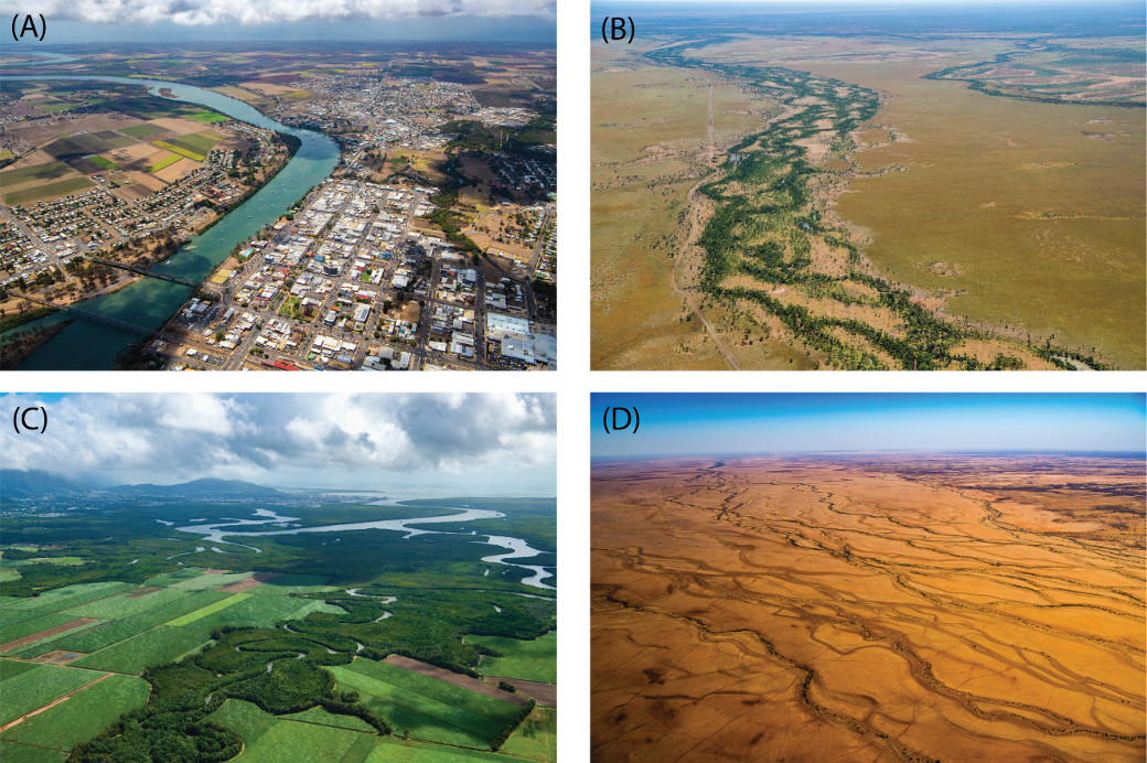

 — Department of Environment, Science and Innovation