

|
|
Recharge zonesRecharge zones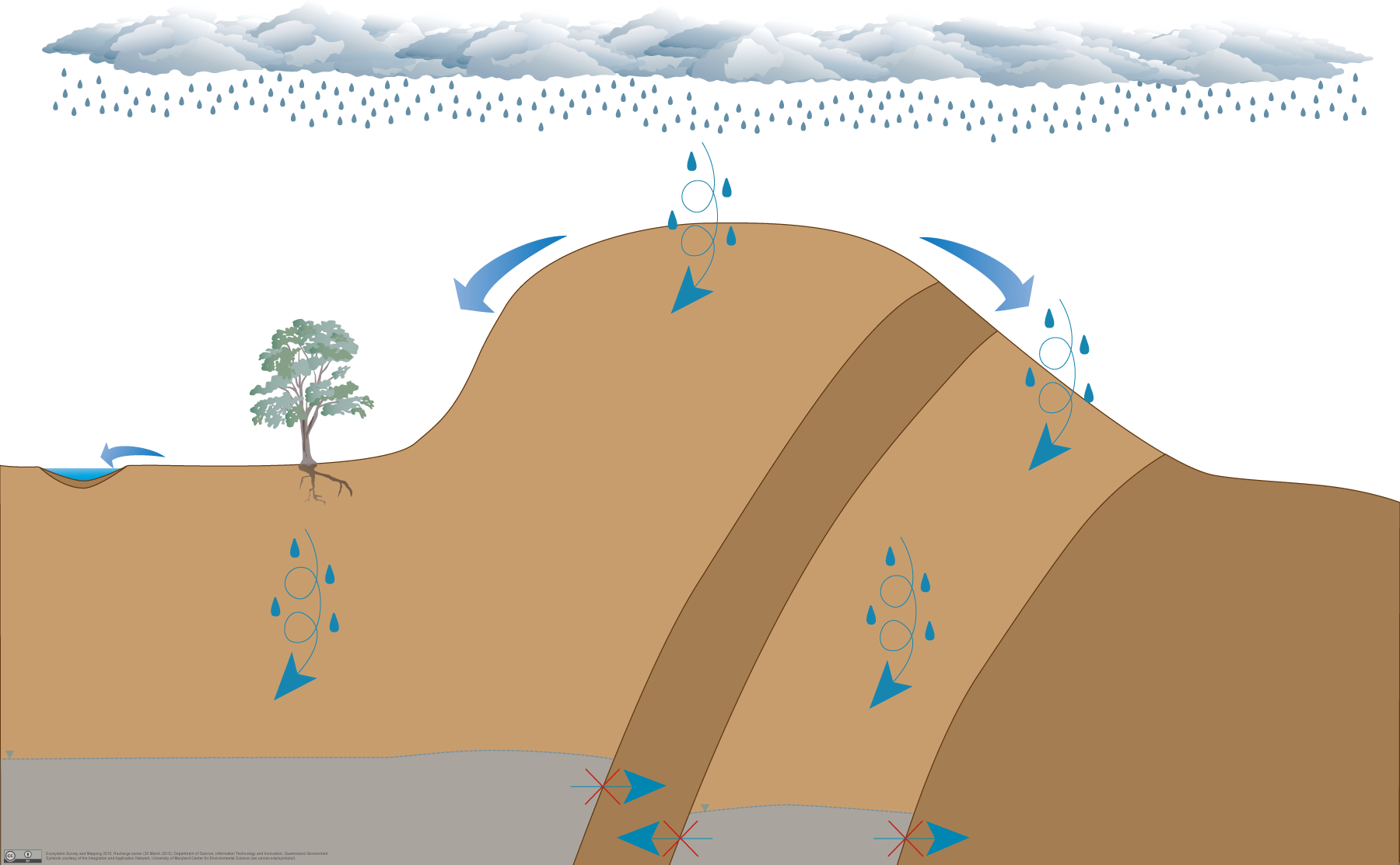
Click on elements of the model or select from the tabs below When water infiltrates a permeable land surface it percolates downwards through the unsaturated zone of permeable rock and/or sediment until it reaches the saturated zone, the top of which is called the groundwater table. Recharge zones refer to those areas where water infiltrates through the permeable rock and sediment but the saturated zone is at a depth where surface ecosystems (e.g. palustrine, lacustrine and riverine wetlands, riverine water bodies and terrestrial vegetation) are unable to access the groundwater. However, subterranean ecosystems (e.g. aquifer and cave ecosystems) underlying recharge areas may be groundwater dependent. Pictorial conceptual model PDF Additional links
Last updated: 12 April 2017 This page should be cited as: Queensland Government, Queensland (2017) Recharge zones, WetlandInfo website, accessed 18 March 2024. Available at: https://wetlandinfo.des.qld.gov.au/wetlands/ecology/aquatic-ecosystems-natural/groundwater-dependent/recharge-zones/ |
Site footer

 — Department of Environment, Science and Innovation