

|
|
Queensland Lake Eyre and Bulloo Freshwater Biogeographic ProvinceQueensland Lake Eyre and Bulloo Freshwater Biogeographic Province – Geology and topography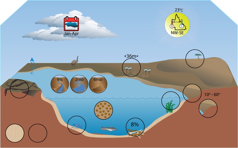 Click on elements of the model or select from the tabs below
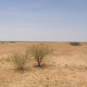
GeologySoil types in the Lake Eyre and Bullo FBP are predominantly clays and clay loams. The soil types in the FBP consist of Kandosols, Tenosols, Sodosols, Vertisols, and Rudosols, though there is some slight variation in composition between catchments. In general these soil types are susceptible to poor water retention, low fertility, low organic matter reserves and low water penetration. Furthermore they are prone to compaction, hardsetting, crusting, dispersiveness, and wind/water borne erosion. There are high natural stores of salt within the lower reaches of river basins with evapoconcentration leading to salt lakes, the only export mechanism being via wind transport[1]. The main surface soil type associated with floodplains and wetlands is self-mulching grey cracking clays, these grey sediments being a characteristic feature of floodplain deposition. Other landforms include dunefields and gibber[2]. The extremely fine clay soils contribute to turbidity observed in watercourses throughout the Lake Eyre and Bulloo FBP[2].
Fluctuations in temperature and intermittent flooding can cause the soil surface to heave upwards[3], resulting in the formation of depressions and small rises. Rainwater and floodwater ponds in these small depressions for a longer period of time than on the surrounding floodplain, and may result in a different vegetation community. Lignum (Muehlenbeckia florulenta) grows on cracking clay soils that typically have uneven surfaces such as depressions[3]. The presence of such micro-habitats may result in a region with higher biodiversity than surrounding regions which do not contain depressions.
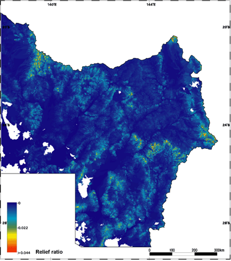
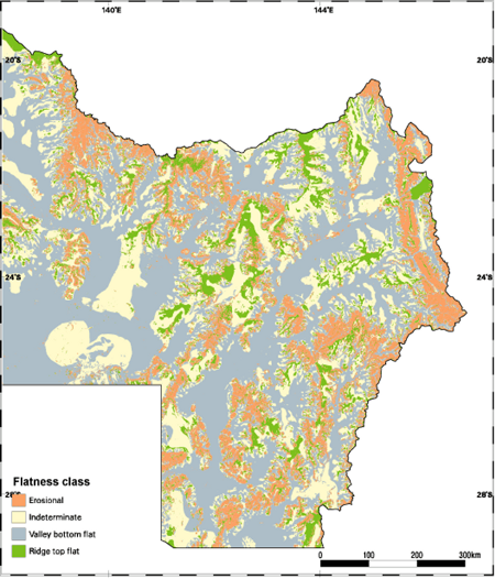
TerrainMost of the Lake Eyre and Bulloo FBP terrain has a very low relief ratio, with a mean for the FBP of 0.006. Relatively high relief ratio values are confined to the upper catchment areas within the FBP, particularly the upper areas of the Georgina River drainage basin, around the Selwyn Range near Mt Isa, the headwaters of the Thomson and Barcoo Rivers in the Cooper Creek drainage, especially south-east of Longreach and the headwaters of the Bulloo River drainage. The headwaters of the Diamantina River and margins of basin drainages show some low to moderate relief. The FBP has variable proportions of flatness index classes. Small proportions of the FBP contain ridge top flat areas or erosional classes that correspond with high and moderate relief ratios of the upper catchments in the FBP and the margins of drainage basins. The majority of the FBP falls into either indeterminate or valley bottom flat categories. The valley bottom flat classes are the most common, reflecting the extensive floodplains of anastomosing rivers and some extremely low relief areas in the central west.
References
Last updated: 22 March 2013 This page should be cited as: Department of Environment, Science and Innovation, Queensland (2013) Queensland Lake Eyre and Bulloo Freshwater Biogeographic Province – Geology and topography, WetlandInfo website, accessed 18 March 2024. Available at: https://wetlandinfo.des.qld.gov.au/wetlands/ecology/aquatic-ecosystems-natural/riverine/freshwater-biogeo/lake-eyre-and-bulloo/geology-topography.html |
Site footer

 — Department of Environment, Science and Innovation