

|
|
Central Freshwater Biogeographic ProvinceCentral Freshwater Biogeographic Province – Water quality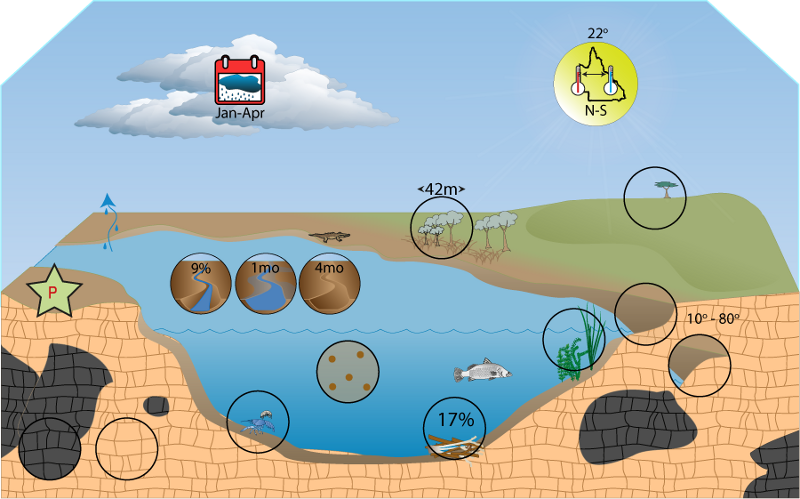 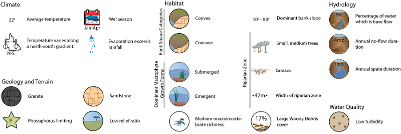 Click on elements of the model or select from the tabs below TurbidityTurbidity within the FBP is generally low (mean 12, median 4). The range of turbidity values is comparable to the Wet Tropics, a FBP with extremely low turbidity. Information about primary productivity and light climate
Last updated: 22 March 2013 This page should be cited as: Department of Environment, Science and Innovation, Queensland (2013) Central Freshwater Biogeographic Province – Water quality, WetlandInfo website, accessed 18 March 2024. Available at: https://wetlandinfo.des.qld.gov.au/wetlands/ecology/aquatic-ecosystems-natural/riverine/freshwater-biogeo/central/water-quality.html |
Site navigation
Site footer
© The State of Queensland (Department of Environment, Science and Innovation) 2024

 — Department of Environment, Science and Innovation
You are here:
Ecology
Plants, animals, soils, water and more (components)
How wetlands function (processes)