Skip links and keyboard navigation

Wallum Freshwater Biogeographic Province

Wallum Freshwater Biogeographic Province – Geology and topography

Perennial streams

Wet season (Jan-Mar) Average temperature (20°) Temperature varies along a NE-SW gradient Evaporation exceeds rainfall Humic stained water Phosphorus limiting water Nitrogen limiting water Undercut banks present Low turbidity Acidic water Low water temperature High ratio of sodium and chloride Low relief ratio Acidic soils Nitrogen limiting soils Phosphorus limiting soils Large woody debris cover (low) Infiltration exceeds rainfall Groundwater fed system Emergent macrophyte growth forms dominant Sand Cemented "coffee rock" Perched aquifer Regional aquifer Trees, Shrubs, Grasses, Sedges and reeds Trees, Shrubs, Grasses, Sedges and reeds

Chain-of-pond streams

Wet season (Jan-Mar) Average temperature (20°) Temperature varies along a NE-SW gradient Low relief ratio Evaporation exceeds rainfall Humic stained water Hydrologically connected Hydrologically connected Hydrologically disconnected Hydrologically disconnected Phosphorus limiting water Nitrogen limiting water Acidic water High ratio of sodium and chloride Low water temperature Emergent macrophyte growth forms dominant Low turbidity Below ground flow Large woody debris cover (low) Infiltration exceeds rainfall Acidic soils Nitrogen limiting soils Phosphorus limiting soils Sand Grasses Trees, Shrubs, Grasses, Sedges and reeds

Click on elements of the model or select from the tabs below

Geology

Main Beach, Stradbroke Island, Photo by Water Planning Ecology Group, DSITIA

Yellow Patch, Moreton Island, Photo by Water Planning Ecology Group, DSITIA

Flinders Beach, Stradbroke Island, Photo by Water Planning Ecology Group, DSITIA

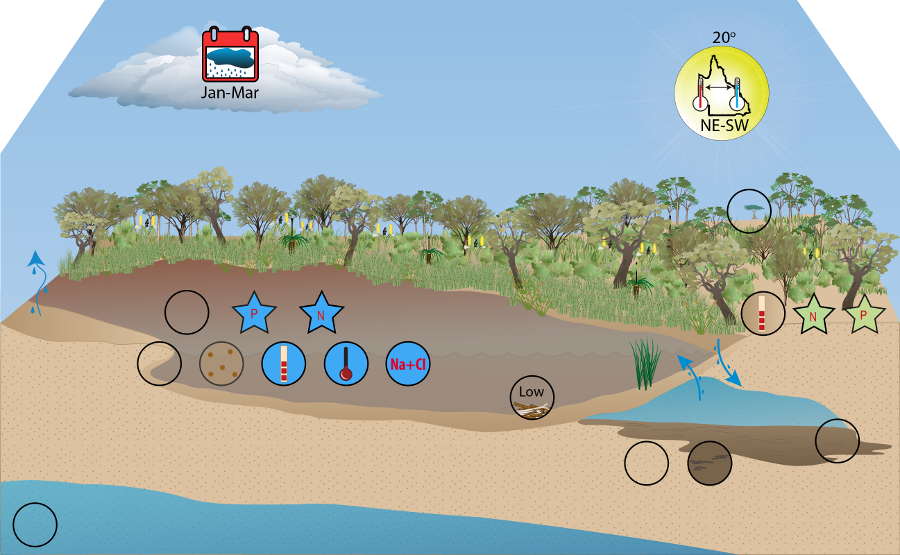
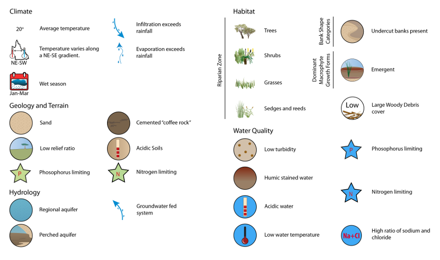
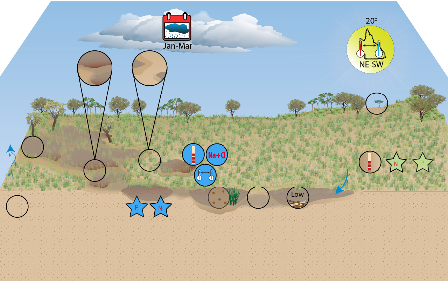
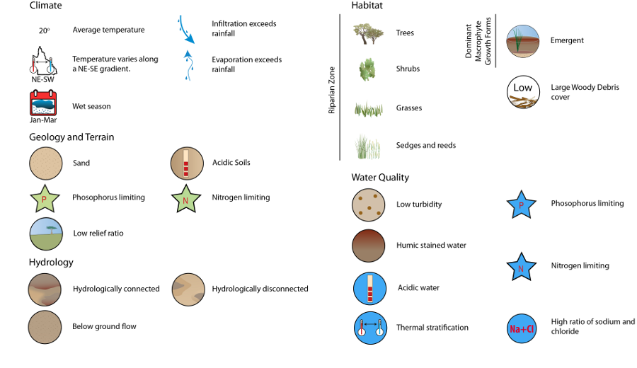
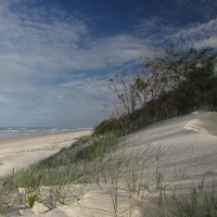
The surface geology of Wallum is dominated by unconsolidated sediments, evident in the multiple large dune systems comprising the FBP[13][14][18][22][7]. The complexes of parabolic dunes on coastal islands, such as those on North Stradbroke, Fraser and Moreton Islands are globally unique[12].

Episodic dune building occurred during the Quaternary glacial and interglacial cycles, in which oscillations in the global climate resulted in periodic sea level change[17]. The occurrence of Wallum dune sands below present-day sea level on North Stradbroke and Fraser Islands suggests that dune development occurred during times of lower sea level[14]. Sea level recession, associated with the cooler glacial cycles, exposed the sea bed to strong south-easterly winds characteristic of these arid cycles[11][17][23][2][13]. Wind transported sediment accumulated around the areas of higher ground in the landscape, such as emerged rocks and hills, forming the core of present-day dune systems[20][22][23][2]. As sea levels rose during the warmer interglacial cycles, those areas of higher sand became partially submerged, forming the present-day islands of Wallum FBP. The aeolian origin of these dune systems is seen in their composition of well-graded sands, deposited in north-westerly directed ridges[11][12][13][14][15][2]. The Quaternary rise and fall in sea levels led to periods of submergence and emergence in the coastal lowlands landscape, creating a history of episodic dune building when the sea bed became exposed[3][2].

Large, transgressive parabolic dunes overlay older aeolian sands[18]. The episodic nature of dune building resulted in multiple overlaying dune systems of varying Quaternary ages, typically becoming younger from west to east[12]. The oldest dune in Wallum is dated at more than 700,000 years in age[19][20][22][18]. Those dune systems located on beaches along the eastern shorelines are considered active systems, while those further inland are older paleodune systems[6]. Bedrock underlying dune systems is located at depths up to 40 m below sea level; and while origins vary throughout the FBP, Mesozoic sedimentary and volcanic rocks, and Palaeozoic metamorphic rocks are common compositions[12][20][6].

Dune age and subsequent exposure to weathering influences the soil composition and profile development in the dune systems[22][20].

Sand composition is dominated by quartz with the occasional presence of feldspar and heavy minerals in younger dunes[22]. The sesquioxide coating on quartz grains results in yellow to yellow-brown colouring[22], while leaching creates a red-orange hue in deeper profiles[6]. A hardening of lateral zones within the soil profile of Quaternary sand deposits is common, often referred to as 'coffee rock'[6][5]. These cemented layers occur in the soil B horizon by a process of dissolution, leaching precipitation[20][5].

Fine complexes of clay minerals and humic material coat and fill the spaces between sand grains, then harden, resulting in a layer of material characterised by low porosity and permeability

[5][6][20][4].

This cementation process occurs above the watertable, creating a partially confining layer of varying thickness and permeability[6][20][21][5].

These indurated layers influence groundwater systems by affecting flow patterns and creating perched aquifers where infiltrating water is prevented from reaching the watertable (see Hydrology)[5][20][21][4].

Soils

Flinders Beach, Stradbroke  Island, Photo by Water Planning Ecology Group, DSITIA

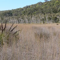
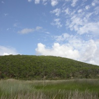
Soils that develop on these highly quartoze Quaternary sands are categorised as podzols[20][1]. Sand is dominant in all layers of the soil horizon, with the depth of the soil A2 horizon increasing with dune age[20][1].

Due to their sandy composition, these soils are characteristically well aerated, with well-drained surface horizons[1]. Analogous to the freshwater streams of the FBP, these soils are typically acidic and nutrient deficient, notably in nitrogen and phosphorous[10][16][1].

Nutrient deficiency is largely a result of leaching and drainage on the dunes with fewer nutrients found in older dunes, as they migrate down the profile[22][20]. Sea water derived nutrients are available to soils, owing to the coastal position of the FBP[9].

Terrain

The FBP largely shows subdued relief, with the exception of some elevation in the south-west where the Glass House Mountain range exists[3].

Amity Swamp, Stradbroke  Island, Photo by Water Planning Ecology Group, DSITIA

Eighteen Mile Swamp, Stradbroke  Island, Photo by Water Planning Ecology Group, DSITIA

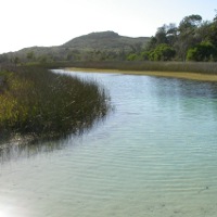
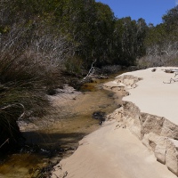
There is little true coastal plain and most elevation occurs in the dune systems, the highest of which reaches a peak height of 280 m. Wallum topography is dominated by the erosional flatness index class associated with hill slopes, which may be attributed to the elevated dune systems. Due to the sandy substrate of the FBP however, this is unlikely to represent true erosion in the region. The valley bottom flat class typically represents flood plains; however, in the case of Wallum FBP, this value likely indicates areas of lower relief, such as coastal wetlands (e.g. Eighteen Mile Swamp, North Stradbroke Island). These areas often affect water run-off behaviour by acting as hydrological buffers[8]. Both the relief ratio (0.02) and stream segment slope (1.32%) show very little change in gradient across the entire length of the river, nor per unit distance. The gradual slope of the waterways suggests that water flow is likely to be slow, with less erosive power.


Flatness Index class

Percentage

Erosional

67

Indeterminate

9

Valley bottom flat

21

Ridge top flat

3


Mean

SE

Minimum

Maximum

Relief ratio

0.02

0.00

0.00

0.12

Stream segment slope (%)

1.3

0.07

0.0

12.7


References

  1. ^ a b c d ANRA (2009), 'Soils: Overview', Australian Natural Resources Atlas (ANRA). [online], Australian Government. Available at: https://data.gov.au/data/dataset/australian-natural-resources-atlas-anra.
  2. ^ a b c d Benussi, G (1975), 'Genesis of North Stradbroke Island', Proceedings of the Royal Society of Queensland, vol. 86, no. 2, pp. 3-8, Royal Society of Queensland.
  3. ^ a b Coaldrake, JE (1961), 'The ecosystem of the Coastal Lowlands ("Wallum") of Southern Queensland', CSIRO Bulletin, vol. 283, CSIRO.
  4. ^ a b Cox, M, Harbison, J, Ezzy, T, Preda, M, Brooke, B, Lee, R, Lester, J, Oberhardt, M & Laycock, J (2000), 'Coffee rock: an overview of its character and occurrence in the Pumicestone region', PASSCON 2000. Science informing catchment management : 22 and 23 November, 2000, Queensland University of Technology : extended abstracts / Pumicestone Passage and Deception Bay Catchment Conference, pp. 23-24, QUT, ed. Malcolm E. Cox.
  5. ^ a b c d e Cox, M, Preda, M & Harbison, J (2002), Importance of indurated sand layers to groundwater flow in Quaternary coastal settings, Moreton Bay. [online], Groundwater Systems Research, QUT Institute of Sustainable Resources. Available at: http://www.isr.qut.edu.au/downloads/2002_iah_cox_preda_harb.pdf.
  6. ^ a b c d e f Cox, M & Labadz, M (2008), 'Quaternary sandy aquifers bounding Moreton Bay, SE Queensland, Australia: complex coastal hydrological systems', Proceedings of the 36th IAH Congress. Integrating Groundwater Science and Human Well-being, Toyama, Japan. [online], QUT. Available at: https://coastalresearch.csiro.au/?q=node/287.
  7. ^ Donders, TH, Wagner, F & Visscher, H (2006), 'Late Pleistocene and Holocene subtropical vegetation dynamics recorded in perched lake deposits on Fraser Island, Queensland, Australia', Palaeogeography, Palaeoclimatology, Palaeoecology, vol. 241, pp. 417-439, Elsevier.
  8. ^ Gallant, JC & Dowling, TI (2003), 'A multiresolution index of valley bottom flatness for mapping depositional areas', Water Resources Research. [online], vol. 39, no. 12. Available at: https://agupubs.onlinelibrary.wiley.com/doi/10.1029/2002WR001426.
  9. ^ Griffith, SJ, Bale, C, Adam, P & Wilson, R (2003), 'Wallum and related vegetation on the NSW north coast: Description and phytosociological analysis', Cunninghamia, vol. 8, no. 2, pp. 205-252, National Herbarium of New South Wales, Royal Botanic Gardens & Domain Trust, Sydney.
  10. ^ Griffith, SJ, Bale, C & Adam, P (2008), 'Environmental correlates of coastal heathland and allied vegetation', Australian Journal of Botany, vol. 56, pp. 512-526, CSIRO.
  11. ^ a b Johnson, D (2004), The geology of Australia, Cambridge University Press, Cambridge UK.
  12. ^ a b c d Kelly, R & Baker, J (1984), 'Geological development of north and south Stradbroke islands', Focus on Stradbroke: New information on North Stradbroke Island and surrounding areas 1974-1985; Royal Society of Queensland Symposium, North Stadbroke Island, 11-12 August 1984, Boolarong Publications and Stradbroke Island Management Organisation, Brisbane, eds. R.J. Coleman, J. Covacevich & P. Davie.
  13. ^ a b c Laycock, JW (1975), 'Hydrogeology of North Stradbroke Island', Proceedings of the Royal Society of Queensland, vol. 86, no. 4, pp. 15-19, Royal Society of Queensland.
  14. ^ a b c Laycock, JW (1975), 'North Stradbroke Island hydrogeological report', GSQ Report, vol. 88, Geological Survey of Queensland.
  15. ^ Laycock, JW (1978), 'North Stradbroke Island', Papers, Department of Geology, University of Queensland. [online], vol. 8, no. 2, pp. 89-96, eds. G R Orme & R W Day. Available at: http://espace.library.uq.edu.au/view/UQ:10883.
  16. ^ Lieper, G, Glazebrook, J, Cox, D & Rathie, K (2008), Mangroves to mountains: A field guide to the native plants of south-east Queensland, Society for Growing Australian Plants (Queensland Region) Inc., Browns Plains, Queensland.
  17. ^ a b Longmore, ME (1997), 'Quaternary Palynological Records from Perched Lake Sediments, Fraser Island, Queensland, Australia: Rainforest, Forest History and Climatic Control', Australian Journal of Botany, vol. 45, pp. 507-526, CSIRO.
  18. ^ a b c Tejan-Kella, MS, Chittleborough, DJ, Fitzpatrick, RM, Thompson, CH, Prescott, JR & Hutton, JT (1990), 'Thermoluminescence dating of coastal sand dunes at Cooloola and North Stradbroke Island, Australia', Australian Journal of Soil Research, vol. 28, pp. 465-481, CSIRO.
  19. ^ Thompson, CH & Ward, WT (1975), 'Soil landscapes of North Stradbroke Island', Proceedings of the Royal Society of Queensland, vol. 86, no. 3, pp. 9-14, Royal Society of Queensland.
  20. ^ a b c d e f g h i j k Thompson, CH (1992), 'Genesis of podzols on coastal dunes in southern Queensland: I. Field relationships and profile morphology', Australian Journal of Soil Research, vol. 30, pp. 593-613, CSIRO.
  21. ^ a b Thompson, CH, Bridges, EM & Jenkins, DA (1996), 'Pans in humus podzols (Humods and Aquods) in coastal southern Queensland', Australian Journal of Soil Research, vol. 34, pp. 161-182, CSIRO.
  22. ^ a b c d e f g Walker, J, Thompson, CH, Fergus, IF & Tunstall, BR (1981), 'Plant succession and soil development in coastal sand dunes of subtropical eastern Australia', Forest succession: concepts and applications, Springer-Verlag New York, Inc., USA, eds. D.C. West, H.H. Shugart & D.B. Botkin.
  23. ^ a b Ward, TC (1978), 'Notes on the origin of Stradbroke Island', in G R Orme & R W Day (eds), Papers, Department of Geology University of Queensland, vol. 8, Department of Geology, University of Queensland, Brisbane, pp. 97-104.

Last updated: 22 March 2013

This page should be cited as:

Department of Environment, Science and Innovation, Queensland (2013) Wallum Freshwater Biogeographic Province – Geology and topography, WetlandInfo website, accessed 18 March 2024. Available at: https://wetlandinfo.des.qld.gov.au/wetlands/ecology/aquatic-ecosystems-natural/riverine/freshwater-biogeo/wallum/geology-topography.html

Queensland Government
WetlandInfo   —   Department of Environment, Science and Innovation